37 rail trails in the collection
Best Wisconsin rail trails
Compare 40 routes by distance, surface, trailheads, and season before you choose the walk or ride.
- Guides
- 40
- Rail trails
- 37
- With paved miles
- 10
Route directory
All Wisconsin trail guides
Mileage is listed one way for point-to-point trails. Open a guide for trailheads, access notes, current official information, and what to bring.
Browse all Wisconsin park guidesRail trail
400 State Trail
A 22-mile crushed-limestone rail-trail following the Baraboo River valley between Reedsburg and Elroy, forming the eastern anchor of the famous Elroy-Sparta trail system and passing through classic Driftless Area scenery.
22 milesCrushed stonePoint to pointRail trail
Ahnapee State Trail
A 48-mile crushed-limestone rail-trail winding through Door and Kewaunee counties from Sturgeon Bay south along the Ahnapee and Kewaunee rivers to the lakeside city of Kewaunee, passing farms, prairies, and river corridors.
48 milesCrushed stonePoint to pointRail trail
Badger State Trail
40 miles of rail-trail between Madison and the Illinois border, traversing farms, glacial topography, and small Green County communities, and home to the historic Stewart Tunnel currently undergoing repair.
40 milesPavedPoint to pointRail trail
Bearskin State Trail
A 21.5-mile former railroad corridor through Northwoods forest and lakes between Minocqua and the Tomahawk area, on a smooth crushed-granite surface that makes it one of Wisconsin's classic family rail-trails.
21.5 milesCrushed stonePoint to pointRail trail
Buffalo River State Trail
A 36-mile former railroad corridor through the scenic Buffalo River valley in west-central Wisconsin, passing farmlands, woods, wetlands, and the river towns of Eleva, Strum, and Osseo between Mondovi and Fairchild.
36 milesCrushed stonePoint to pointState trail
Capital City State Trail
A 17-mile paved trail connecting Madison's Capitol Square to the Military Ridge and Glacial Drumlin trails, forming the city's main off-road corridor through neighborhoods, parks, and the isthmus.
17 milesPavedPoint to pointRail trail
Cattail State Trail
A 20-mile crushed-limestone rail-trail through the lake country and wetlands of Polk and Barron counties in northwestern Wisconsin, linking Amery to Almena on a quiet former-railroad corridor popular for fall color and wildlife.
20 milesCrushed stonePoint to pointRail trail
Chippewa River State Trail
A 23-mile crushed-limestone rail-trail through the Chippewa River valley between Eau Claire and Durand, following a former Chicago and North Western corridor through bluff country and river bottomlands.
23 milesCrushed stonePoint to pointRail trail
Devil's River State Trail
A 15-mile crushed-stone rail-trail through Brown and Manitowoc counties in eastern Wisconsin, highlighted by two dramatic railroad trestles spanning the Devil's River and passing farmlands, prairies, rivers, and wetlands.
15 milesCrushed stonePoint to pointRail trail
Eisenbahn State Trail
A 25-mile county-operated rail-trail from West Bend through the Kettle Moraine countryside to Eden, whose German name recalls its railroad heritage in a region shaped by German immigrant settlement.
25 milesCrushed stonePoint to pointRail trail
Elroy-Sparta State Trail
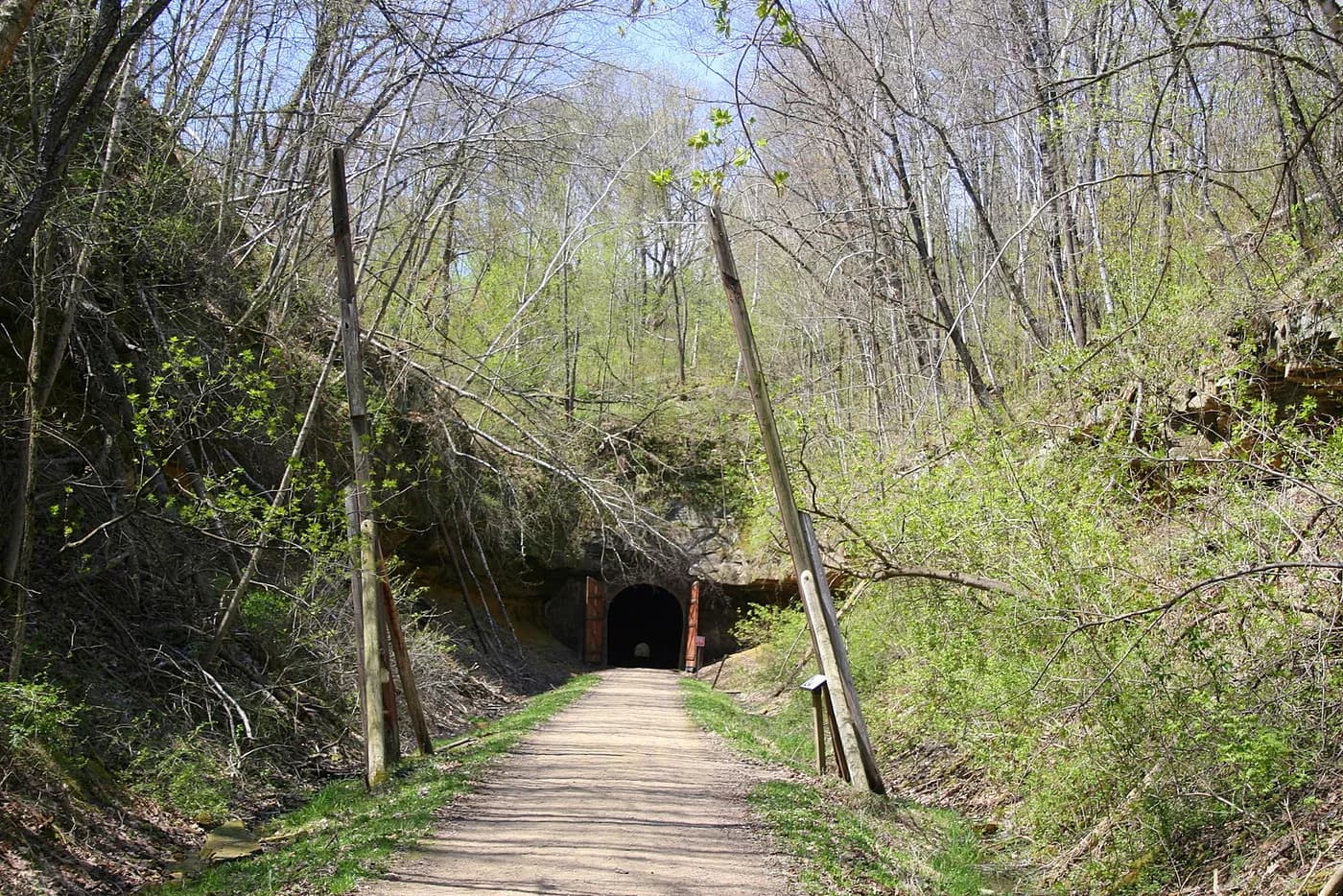
Widely credited as the nation's first rail-trail: 32.5 miles of crushed limestone through three hand-dug railroad tunnels and the rolling Driftless Area between Elroy and Sparta.
32.5 milesCrushed stonePoint to pointRail trail
Fox River State Trail
A 25-mile trail from downtown Green Bay south along the Fox River on a mix of asphalt and crushed stone, following one of Wisconsin's most historically significant river corridors through Brown and Calumet counties.
25 milesPavedPoint to pointRail trail
Friendship State Trail
A 56-mile rail-trail on a crushed-limestone surface through the central Wisconsin sand counties, connecting Friendship and several small towns on a quiet former-railroad grade.
56 milesCrushed stonePoint to pointRail trail
Glacial Drumlin State Trail
A 52-mile former-railroad rail-trail crossing the glaciated drumlin fields and farm country of southern Wisconsin between Waukesha and Cottage Grove, one of the state's marquee long-distance biking and walking corridors.
52 milesCrushed stonePoint to pointRail trail
Great River State Trail
A 24-mile rail-trail through the Mississippi River bottomlands between Onalaska and Marshland, hugging the bluffs and backwater sloughs of the Upper Mississippi River National Wildlife and Fish Refuge.
24 milesCrushed stonePoint to pointRail trail
Great Sauk State Trail
A 10.5-mile paved rail-trail paralleling the Wisconsin River through the twin historic towns of Prairie du Sac and Sauk City, running through the heart of Sauk Prairie State Recreation Area in south-central Wisconsin.
10.5 milesPavedPoint to pointState trail
Green Circle State Trail
A 31-mile loop encircling Stevens Point along the Wisconsin and Plover rivers, connecting city parks, Schmeeckle Reserve, wetlands, prairies, and boardwalks in a rare urban circular trail.
31 milesPavedLoopState trail
Hank Aaron State Trail
A 12-mile urban trail connecting American Family Field, home of the Milwaukee Brewers, to the Lake Michigan lakefront through the heart of Milwaukee, named in honor of baseball legend Hank Aaron.
12 milesPavedPoint to pointRail trail
Hillsboro State Trail
A short 4-mile crushed-limestone connector in the Driftless Area linking Hillsboro to the 400 State Trail system, passing through rolling Kickapoo Valley terrain.
4 milesCrushed stonePoint to pointRail trail
La Crosse River State Trail
A 22-mile crushed-limestone rail-trail following the La Crosse River through the glaciated coulees of western Wisconsin, linking Sparta to the Mississippi River bluff town of La Crosse and forming the central link in a three-trail corridor with the Elroy-Sparta and Great River trails.
22 milesCrushed stonePoint to pointRail trail
Mascoutin Valley State Trail
A 30-mile rail-trail through the Fox River valley of east-central Wisconsin between Berlin and Ripon, crossing pastoral farmland, river bottomlands, and the scenic Green Lake County countryside.
30 milesCrushed stonePoint to pointRail trail
Military Ridge State Trail
A 40-mile rail-trail connecting Madison to Dodgeville through the rolling Driftless Area of southwest Wisconsin, running along an 1855 military route past Governor Dodge and Blue Mound state parks on a mix of asphalt and crushed stone.
40 milesPavedPoint to pointRail trail
Mound View State Trail
A 7-mile paved rail-trail in southwest Wisconsin between Platteville and Belmont, named for the two prominent mounds that rise above the open farm fields alongside the route.
7 milesPavedPoint to pointRail trail
Mountain-Bay State Trail
One of Wisconsin's longest rail-trails at 83 miles, stretching from Weston near Wausau east to Green Bay through the communities of Kronenwetter, Hatley, Eland, and Shawano in central Wisconsin.
83 milesCrushed stonePoint to pointRail trail
Newton Blackmour State Trail
A 9-mile crushed-limestone rail-trail in Manitowoc County threading through rural northeastern Wisconsin farmland and small communities near the Lake Michigan coast.
9 milesCrushed stonePoint to pointRail trail
Nicolet State Trail
A 40-mile crushed-stone rail-trail through the pines, lakes, and logging history of Wisconsin's Northwoods between Eagle River and Rhinelander, passing through the Nicolet National Forest corridor and deep boreal forest.
40 milesCrushed stonePoint to pointRail trail
Oconto River State Trail
A 75-mile rail-trail through the Oconto River watershed of northeastern Wisconsin, from Stiles near Oconto Falls north to the edge of Chequamegon-Nicolet National Forest, passing through timber country and river corridors.
75 milesCrushed stonePoint to pointRail trail
Old Abe State Trail
A 20-mile paved rail-trail in Chippewa County connecting Lake Wissota and Brunet Island state parks along the scenic Chippewa River shoreline, named for the famous Civil War eagle mascot of Wisconsin.
20 milesPavedPoint to pointRail trail
Pecatonica State Trail
A 10-mile rail-trail following the old Milwaukee Road corridor through the Bonner Branch valley in Lafayette County, linking Belmont to the Cheese Country Trail at Calamine in Wisconsin's historic lead-mining country.
10 milesCrushed stonePoint to pointRail trail
Red Cedar State Trail
A 14.5-mile rail-trail shadowing the steep walls of the Red Cedar Valley from Menomonie south to its junction with the Chippewa River State Trail, passing sandstone bluffs, prairies, and the Dunnville State Wildlife Area.
14.5 milesCrushed stonePoint to pointRail trail
Saunders State Trail
A 26-mile crushed-limestone rail-trail in Burnett County in northwestern Wisconsin, running through lake country and Northwoods forest from Danbury toward Grantsburg.
26 milesCrushed stonePoint to pointRail trail
Stower Seven Lakes State Trail
A 12-mile crushed-stone rail-trail looping through the lake-dotted Polk County landscape near Centuria in northwestern Wisconsin, skimming the shores of several small lakes and offering one of the prettier shorter rides in the Saint Croix region.
12 milesCrushed stoneLoopRail trail
Sugar River State Trail
A 23-mile rail-trail through the pastoral Sugar River valley of southwestern Wisconsin between New Glarus and Brodhead, featuring one of the longest covered wooden bridges in the state and classic Swiss-heritage dairy country scenery.
23 milesCrushed stonePoint to pointRail trail
Tomorrow River State Trail
A 29-mile crushed-stone rail-trail through scenic glacial farm country in central Wisconsin, running from Plover in Portage County northeast to Manawa in Waupaca County through quiet communities and open terrain.
29 milesCrushed stonePoint to pointRail trail
Tuscobia State Trail
At 74 miles, one of Wisconsin's longest rail-trails, running on a former rail corridor from Park Falls through the Flambeau River State Forest and the Blue Hills wilderness to the Wild Rivers Trail north of Rice Lake, on a rustic crushed-stone surface.
74 milesCrushed stonePoint to pointRail trail
White River State Trail
A 19-mile former railroad corridor through Walworth and Racine counties in southeastern Wisconsin, passing bridges, scenic vistas, quaint towns, and wetlands between Elkhorn and Dover, within five miles of Lake Geneva.
19 milesCrushed stonePoint to pointRail trail
Wild Goose State Trail
A 34-mile rail-trail through glacial lake country and Horicon Marsh in east-central Wisconsin, following the Kettle Moraine and one of the most important waterfowl staging areas in North America.
34 milesCrushed stonePoint to pointRail trail
Wild Rivers State Trail
A 98-mile crushed-stone rail-trail through the rivers, forests, and small towns of Polk and Burnett counties in far northwestern Wisconsin, one of the longest state trails in the system and a corridor for multi-day Northwoods touring.
98 milesCrushed stonePoint to pointRail trail
Wiouwash State Trail
A 20-mile rail-trail through the Wolf River watershed of northeastern Wisconsin between Oshkosh and Hortonville, traversing wetlands, farm fields, and hardwood forest in Winnebago and Outagamie counties.
20 milesCrushed stonePoint to pointRail trail
Wolf River State Trail
A 37-mile rail-trail on a former railroad grade through the forests of northern Wisconsin, skirting the Wolf River and Nicolet National Forest between White Lake and Crandon with a wild, undeveloped character.
37 milesCrushed stonePoint to point