Rail trail · Wisconsin
Great River State Trail
A 24-mile rail-trail through the Mississippi River bottomlands between Onalaska and Marshland, hugging the bluffs and backwater sloughs of the Upper Mississippi River National Wildlife and Fish Refuge.
Length
24 miles
Surface
Crushed stone
Route
Point to point
Endpoints
Onalaska to Marshland
Season
Best April through October; spring and fall migrations bring large concentrations of waterfowl and shorebirds; summer is warm and lush; a Wisconsin State Trail Pass is required for cyclists 16 and older
Plan your ride or walk
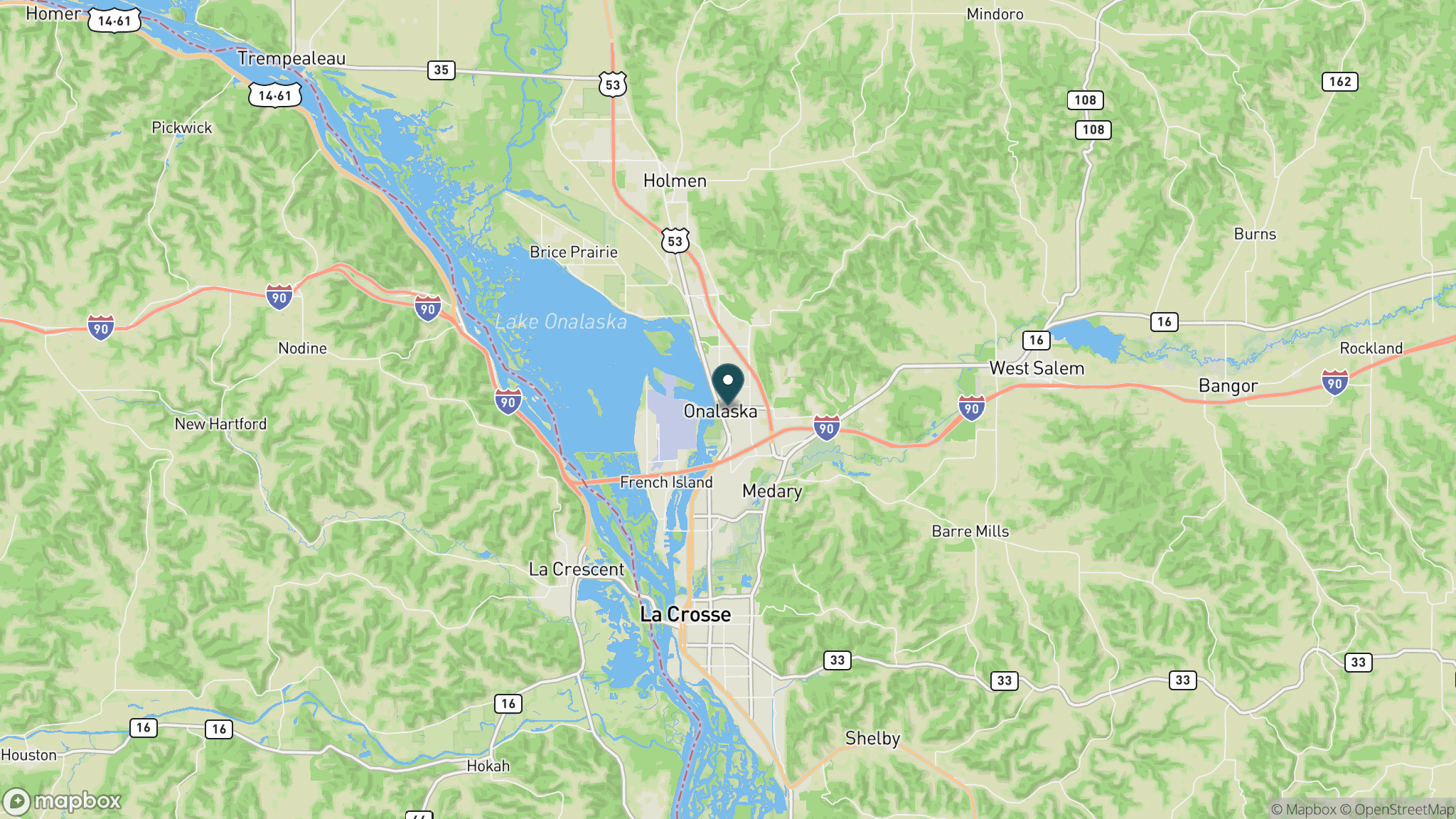
The Great River State Trail runs 24 miles along the Mississippi River bluffs and bottomlands from Onalaska north to Marshland, following a former Burlington Northern railroad corridor. The trail passes through the Upper Mississippi River National Wildlife and Fish Refuge, one of the most important migratory bird corridors in North America. Backwater sloughs, oxbow lakes, and towering cottonwood bottomlands line the route, and bald eagles are a near-certain sighting year-round. The trail connects at its southern end with the La Crosse River State Trail in Onalaska, extending the reach of the Driftless Area rail-trail network. Spring and fall migrations, when hundreds of thousands of waterfowl move through the Mississippi Flyway, are the most dramatic times to visit.
Getting there
The southern trailhead is in Onalaska, immediately north of La Crosse via US 53, about 3 hours northwest of Madison. Parking is available in Onalaska and at Trempealeau, roughly midway along the trail. The Trempealeau National Wildlife Refuge is adjacent to the trail and adds additional wildlife viewing options.
Official trail information
Confirm current conditions, closures, and any required trail pass on the managing agency’s page.
Wisconsin DNR: Great River State TrailWhat to bring
Gear keyed to a long, flat trail day: footwear, hydration, sun protection, and a pack sized for the distance.
Frequently asked questions
How long is the Great River State Trail?
The Great River State Trail is 24 miles, running point to point from Onalaska north along the Mississippi River to Marshland. At Onalaska it connects to the La Crosse River State Trail for extended multi-trail riding.
What wildlife can you see on the Great River State Trail?
The trail borders the Upper Mississippi River National Wildlife and Fish Refuge, making it one of the best wildlife-watching trails in Wisconsin. Bald eagles are present year-round; spring and fall bring massive migrations of waterfowl, pelicans, and shorebirds through the Mississippi Flyway.
Do you need a pass for the Great River State Trail?
Yes. Cyclists 16 and older need a Wisconsin State Trail Pass, available as a daily or annual pass. Walking and running are free.
Does the Great River State Trail connect to other trails?
Yes. The southern terminus in Onalaska links directly to the La Crosse River State Trail, which in turn connects east toward the Elroy-Sparta State Trail, creating a multi-day rail-trail network across the Driftless Area.
More Wisconsin trails
Looking for parks instead? Browse state parks by state.