Rail trail · Wisconsin
Wild Rivers State Trail
A 98-mile crushed-stone rail-trail through the rivers, forests, and small towns of Polk and Burnett counties in far northwestern Wisconsin, one of the longest state trails in the system and a corridor for multi-day Northwoods touring.
Length
98 miles
Surface
Crushed stone
Route
Point to point
Endpoints
Rice Lake to Superior (at the Minnesota border area)
Season
Best May through October; groomed for snowmobiling in winter; fall color on the river corridors peaks in early October
Plan your ride or walk
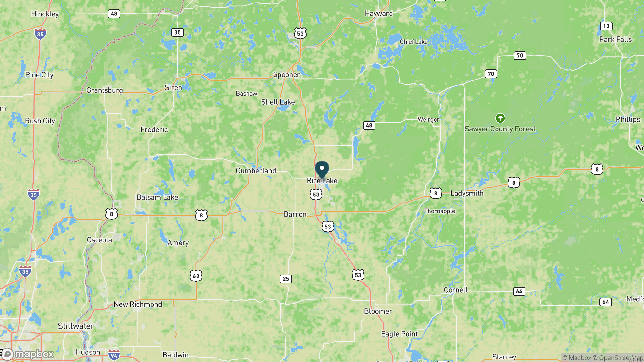
The Wild Rivers State Trail covers 98 miles through the river-laced forests and lake country of Polk and Burnett counties in far northwestern Wisconsin, making it one of the longest trails in the state system. The corridor follows former railroad right-of-way from Rice Lake north through Spooner, Trego, and Siren to the Danbury area near the Minnesota border, with the trail name reflecting the several wild rivers that cross or parallel the route, including the Namekagon and Yellow rivers. The crushed-stone surface is consistent and the grade is flat, making it suitable for long-distance biking and multi-day tours; the sheer length and the availability of lodging in trail towns like Spooner and Siren support overnights. Wildlife along the corridor includes black bears, bald eagles, sandhill cranes, and river otters. A Wisconsin State Trail Pass is required for cyclists 16 and older, and the trail doubles as a snowmobile corridor in winter.
Getting there
The southern trailhead in Rice Lake is about 90 miles southeast of Duluth, Minnesota, via US 53, and roughly 3.5 hours northwest of Madison. Parking and services are available in Rice Lake, Spooner, Trego, Siren, and Grantsburg. The northern end near Danbury is close to the Minnesota border and the Namekagon River.
Official trail information
Confirm current conditions, closures, and any required trail pass on the managing agency’s page.
Wisconsin DNR: Wild Rivers State TrailWhat to bring
Gear keyed to a long, flat trail day: footwear, hydration, sun protection, and a pack sized for the distance.
What to pack
Plan with our tools
Frequently asked questions
How long is the Wild Rivers State Trail?
The Wild Rivers State Trail is approximately 98 miles point to point from Rice Lake north to the Danbury area near the Minnesota border, making it one of the longest trails in the Wisconsin state trail system.
Which rivers does the Wild Rivers Trail cross or follow?
The trail passes through the watersheds of the Namekagon, Yellow, and Totogatic rivers, among others. The Namekagon River is part of the St. Croix National Scenic Riverway, a federally designated wild and scenic river.
Is the Wild Rivers Trail good for a multi-day trip?
Yes. The 98-mile length and the availability of lodging and camping in trail towns including Spooner, Trego, Siren, and Grantsburg make multi-day tours practical. Two to four days is typical for an end-to-end trip depending on pace and fitness.
Do you need a pass for the Wild Rivers State Trail?
Cyclists 16 and older need a Wisconsin State Trail Pass, daily or annual. Hikers use the trail for free. The same pass covers other Wisconsin state trails used on the same day, useful if you connect with nearby corridors.
More Wisconsin trails
Looking for parks instead? Browse state parks by state.