Rail trail · Wisconsin
Mound View State Trail
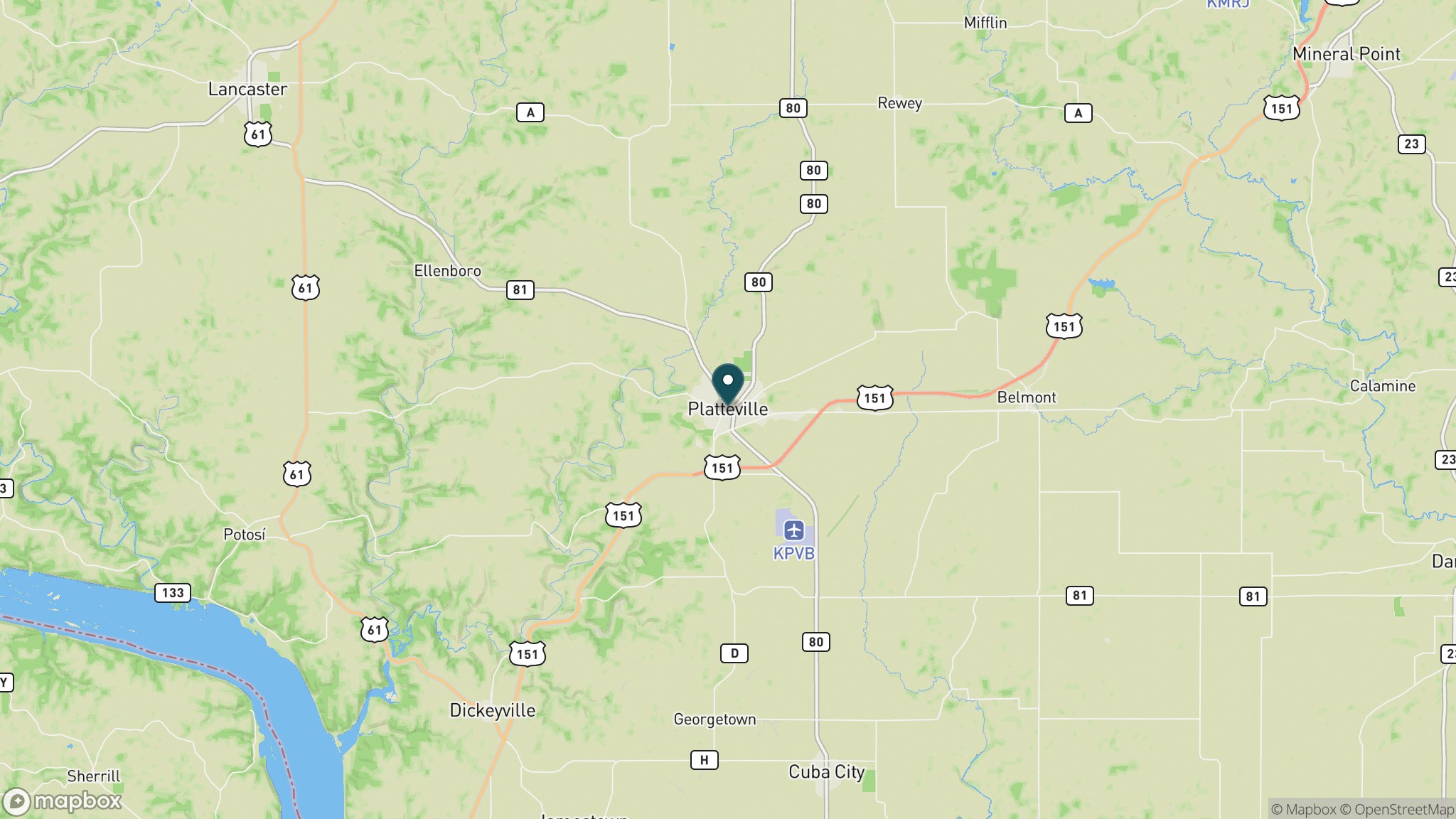
A 7-mile paved rail-trail in southwest Wisconsin between Platteville and Belmont, named for the two prominent mounds that rise above the open farm fields alongside the route.
Length
7 miles
Surface
Paved
Route
Point to point
Endpoints
Platteville to Belmont
Season
Year-round; paved surface accessible in all dry conditions; connects to unpaved Pecatonica State Trail at Belmont
Plan your ride or walk
The Mound View State Trail is a short but well-placed 7-mile paved trail connecting Platteville and Belmont in the rolling agricultural landscape of southwest Wisconsin. The trail takes its name from two large glacially formed mounds that rise prominently above the farm fields on the north side of the corridor; the nearer one, Platte Mound, sits about midway along the trail and is marked by the world's largest letter M, a landmark visible for miles. At the Platteville end, the trail connects to the city's Rountree Branch Trail near the intersection of Mineral Street and Valley Road. At the Belmont end, it links directly to the Pecatonica State Trail, which continues east 10 miles to Calamine and eventually to the 47-mile Cheese Country Trail, making Mound View a key connector in a larger southwest Wisconsin trail network. A Wisconsin State Trail Pass is required for cyclists and skaters 16 and older.
Getting there
Platteville is in southwest Wisconsin on US 151, about 75 miles southwest of Madison. Parking is available at the Mineral Street trailhead and at a city park on Valley Road in Platteville. In Belmont, park along Cushman Drive near Spring Street. Both ends connect to additional trails.
Official trail information
Confirm current conditions, closures, and any required trail pass on the managing agency’s page.
Wisconsin DNR: Mound View State TrailWhat to bring
Gear keyed to a long, flat trail day: footwear, hydration, sun protection, and a pack sized for the distance.
Frequently asked questions
How long is the Mound View State Trail?
The trail is 7 miles point to point between Platteville and Belmont on a paved surface.
What is the mound that the trail is named for?
The trail runs past two prominent mounds in the farm fields on its north side. Platte Mound, about midway along the route, is marked by the world's largest letter M and is a local landmark visible from a long distance.
What trails connect to the Mound View State Trail?
At the Platteville end, the trail connects to the Rountree Branch Trail. At the Belmont end, it links to the Pecatonica State Trail, which leads east to the Cheese Country Trail, forming a network of more than 50 miles of rail-trail across Lafayette and Grant counties.
Is a trail pass required?
Yes. A Wisconsin State Trail Pass is required for cyclists and in-line skaters age 16 and older. Walking and running are free.
More Wisconsin trails
Looking for parks instead? Browse state parks by state.