Destinations
Wisconsin outdoors
Lake Superior sea caves, quartzite bluffs over glacial lakes, and 60-plus state parks stitched together by the Ice Age Trail.
Top parks in Wisconsin
See all 108 parks
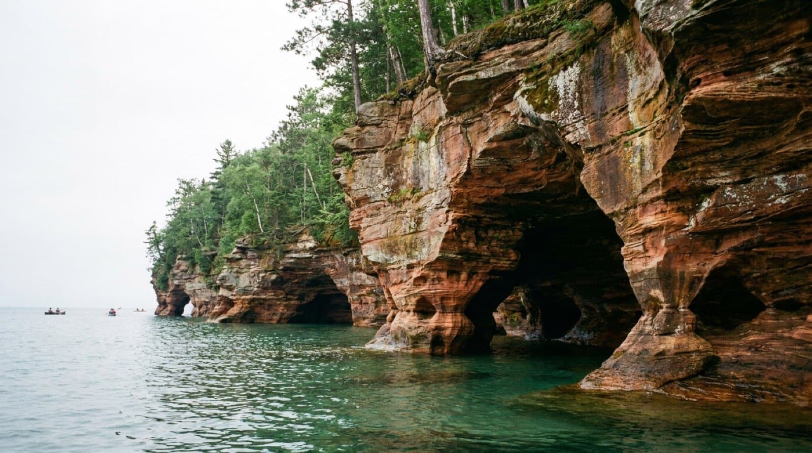
Apostle Islands National Lakeshore
Lake Superior's island archipelago: mainland sea caves, 21 islands reached by ferry or kayak, historic lighthouses, and permit-only backcountry camping.
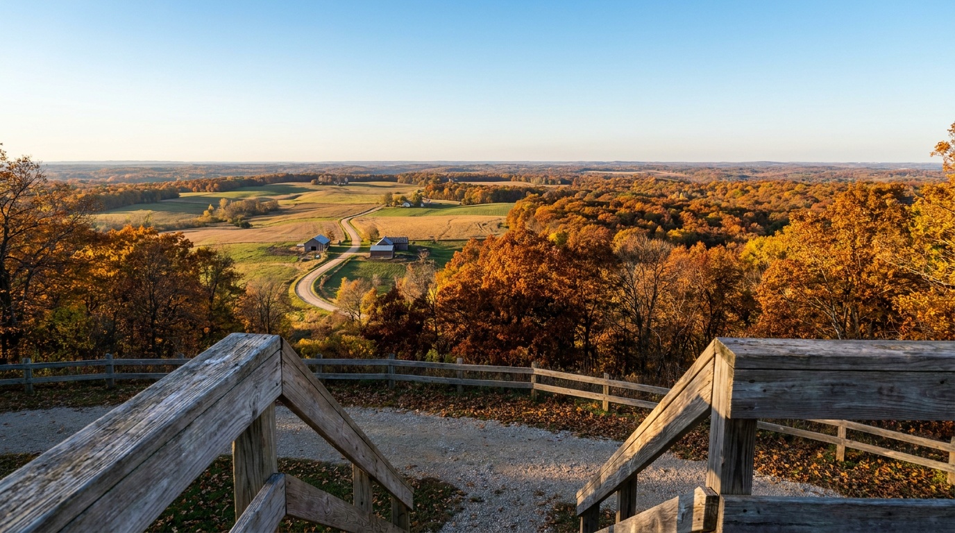
Blue Mound State Park
The highest point in southern Wisconsin: two observation towers over the Driftless Area, the only swimming pool in a Wisconsin state park, and miles of bike and ski trails.
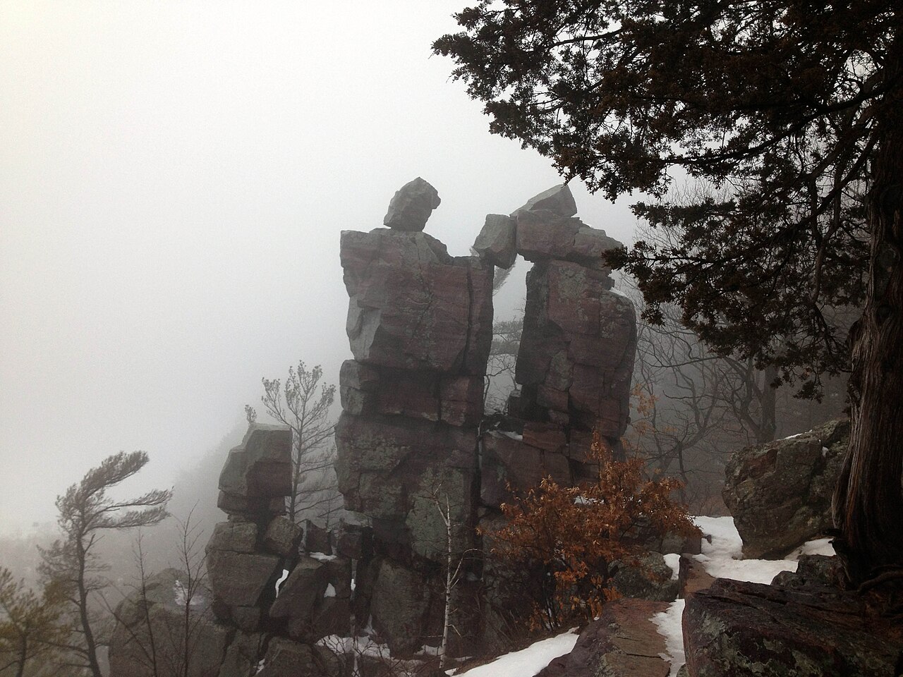
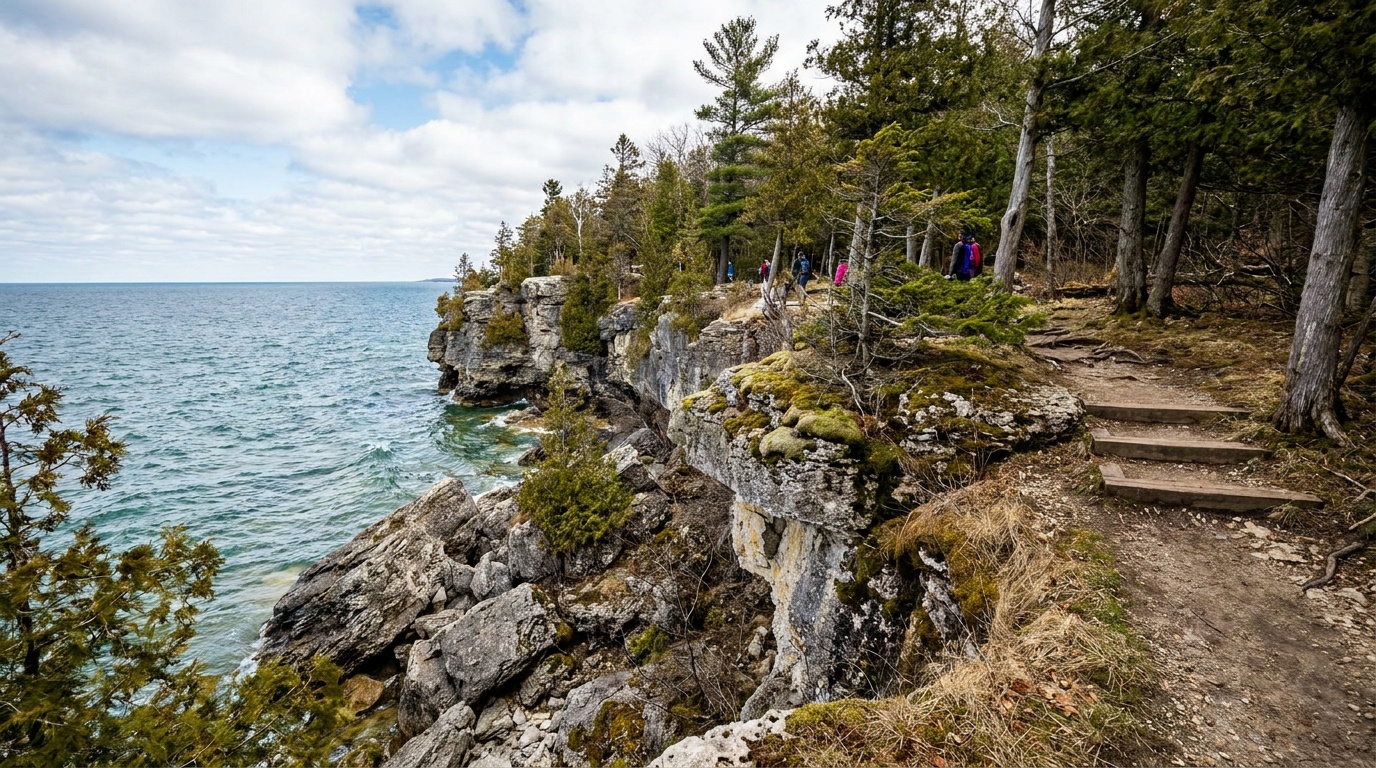
Devil's Lake State Park
Wisconsin's cliff-and-lake classic: quartzite bluffs, Ice Age Trail miles, swimming beaches, paddling, climbing, and reservable camping.
Governor Dodge State Park
Wisconsin's Driftless-country park: two lakes, Stephens Falls, bluff and prairie trails, 40-plus miles of multi-use trail, and two large campgrounds.
Peninsula State Park
Door County's crown jewel: eight miles of Green Bay shoreline, the cliff-edge Eagle Trail, the accessible Eagle Tower, a historic lighthouse, beaches, golf, and 460-plus campsites.

400 State Trail
The 22-mile 400 State Trail follows the Baraboo River valley from Elroy to Reedsburg, passing wetlands, wildlife, sandstone bluffs and rolling croplands.

Ahnapee State Trail
This 48-mile county-operated trail winds south from Sturgeon Bay along the Ahnapee and Kewaunee rivers through glades, farmland, prairies and wooded areas.

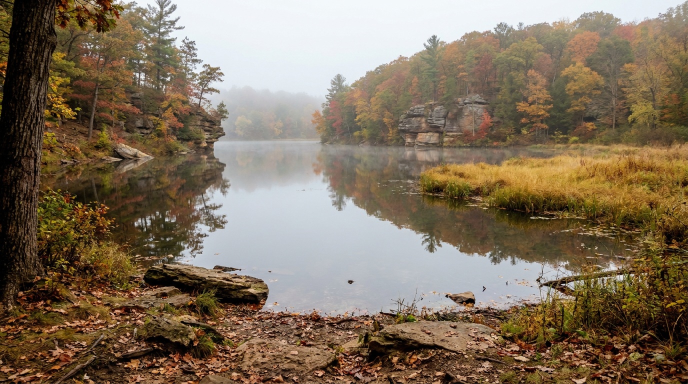
Amnicon Falls State Park
Amnicon Falls State Park features a series of waterfalls and rapids along the Amnicon River, viewable from a covered foot bridge or 2 miles of riverside trails.

Aztalan State Park
Aztalan State Park is a National Historic Landmark preserving an ancient Middle-Mississippian village with reconstructed flat-topped mounds and stockade.
Planning a Wisconsin trip
Wisconsin packs a lot of landscape between two Great Lakes. You get the dramatic stuff (500-foot quartzite bluffs, Lake Superior sea caves, glacier-carved kettles and moraines) alongside the gentle stuff (pine forests, sandy beaches, and quiet paddling lakes), and most of it sits within an easy weekend of the cities.
There is no national park here, but the Apostle Islands National Lakeshore on Lake Superior is the headline. It is 21 islands and 12 miles of mainland coast, with more lighthouses than any other site in the National Park System and the famous sandstone sea caves you paddle through in summer (and, in the rare year Lake Superior freezes solid, walk into as ice caves in February). Bayfield is the launch point for kayaks, ferries, and cruises.
For state parks, start with Devil's Lake near Baraboo, the busiest park in the state for good reason: a clear 360-acre lake ringed by towering bluffs, with climbs like the Balanced Rock and East Bluff trails that pay off in big views. Both Devil's Lake and a long ribbon of the state run along the Ice Age National Scenic Trail, which traces the edge of the last glacier across roughly a thousand miles. Door County, the peninsula reaching into Lake Michigan, adds shoreline parks, bluffs, and small-town harbors.
The sweet spot is late summer into early fall: mild days, thinner crowds, and fewer bugs, with fall color arriving up north first. Summer (highs in the 70s to low 80s F) is prime for swimming, paddling, and the sea-cave tours that run mid-June into early October. Winters are genuinely cold (single digits to 20s F up north) and turn the state into snowshoe and cross-country country.
Packing through-line: layers you can shed and add, because a sunny morning by the water can turn windy and cold fast on Lake Superior. Bring real footwear with grip for the rocky bluff trails, sun and bug protection for summer, and a warm waterproof shell any time you are near the big lakes.
Getting around Wisconsin
Most trips start at one of two airports. Milwaukee Mitchell International (MKE) is the largest, and Dane County Regional (MSN) in Madison sits closer to the central and southern parks. Both are easy interstate drives to Devil's Lake (Madison to Baraboo is roughly 45 minutes; Milwaukee about 2 hours).
The far north is the long haul. Bayfield and the Apostle Islands are about 5.5 hours from Madison and over 6 hours from Milwaukee. If the Apostle Islands are your main goal, it is often faster to fly into Duluth, Minnesota (DLH), which is under 2 hours from Bayfield with daily flights from Minneapolis and Chicago.
Once you are on the ground, a car is essential. The parks are spread out and not connected by transit. Rough drive times: Madison to Door County is about 3.5 hours; Devil's Lake to Door County is around 3 hours; and Door County to Bayfield is a long cross-state haul of roughly 5 hours, so most people pick a region (north woods and Lake Superior, or the central bluffs, or the Lake Michigan peninsula) rather than chaining them in one trip. Roads are good and well marked; the only seasonal catch is winter weather up north, where snow can slow the drive considerably.
Home-state outdoors
Think water, bluffs, forest, and shoulder-season weather.
Wisconsin is not a national park state, but it is a very real outdoor state. The best trips usually revolve around Lake Superior, the Driftless Area, Door County, the Ice Age Trail, or state-park camping weekends.
Best window
June to October, with September and October especially strong for hiking, paddling, and color.
Base logic
Bayfield for Apostle Islands, Baraboo for Devil's Lake, Door County for lakefront weekends.
Packing focus
Bug protection, rain shell, lake wind layers, camp insulation, and footwear for wet rock or sand.
Trip shape
Weekend clusters work best: one water anchor, one hiking anchor, and one weather backup.
Best first Wisconsin outdoor trip
Use Devil's Lake and the Baraboo range for big hiking payoff without leaving the southern half of the state.
Best northern trip
Base near Bayfield for Apostle Islands kayaking, shoreline hikes, waterfalls, and cooler Lake Superior weather.
All 5 Wisconsin park guides
State park directory
Every Wisconsin state park
A source-backed inventory layer for planning breadth. Full Kit Authority guides are marked when a park has camping detail, rules, and packing notes; the rest link straight to the official page. Looking for rail trails and state trails? They have their own Trail Guide.
68 parks
4 full guides · 61 with photos
Blue Mound State Park
State Park
Perched atop the highest point in southern Wisconsin, Blue Mound State Park offers spectacular views, a swimming pool and over 20 miles of trails.
- Camping
- Cabins
- Hiking
- Biking
Wisconsin DNR
Full guideDevil's Lake State Park
State Park
Along the Ice Age National Scenic Trail, Devil's Lake State Park offers views from 500-foot quartzite bluffs over a 360-acre lake with nearly 30 miles of trails.
- Camping
- Hiking
- Picnicking
- Swimming
Wisconsin DNR
Full guideGovernor Dodge State Park
State Park
One of the state's largest parks, Governor Dodge has over 5,000 acres of steep hills, bluffs, deep valleys, two lakes and a waterfall in the driftless area.
- Camping
- Picnicking
- Hiking
- Paddling
Wisconsin DNR
Full guidePeninsula State Park
State Park
Considered Wisconsin's most complete park, Peninsula State Park offers over 460 campsites, a summer theater, an 18-hole golf course, sand beach, bike trails, a lighthouse and eight miles of Door County shoreline.
- Camping
- Golf
- Beach
- Swimming
Wisconsin DNR
Full guideAmnicon Falls State Park
State Park
Amnicon Falls State Park features a series of waterfalls and rapids along the Amnicon River, viewable from a covered foot bridge or 2 miles of riverside trails.
- Camping
- Hiking
- Picnicking
Wisconsin DNR
Official pageAztalan State Park
State Park
Aztalan State Park is a National Historic Landmark preserving an ancient Middle-Mississippian village with reconstructed flat-topped mounds and stockade.
- Historic Site
Wisconsin DNR
Official pageBelmont Mound State Park
State Park
Belmont Mound rises 1,400 feet above sea level, offering fantastic views of the area, and sits a half mile east of Wisconsin's First Capitol historic site.
Wisconsin DNR
Official pageBig Bay State Park
State Park
On Madeline Island, Big Bay State Park features sandstone bluffs along 4 miles of Lake Superior shoreline, a boardwalk, sandy beach and hiking trails.
- Camping
- Hiking
- Swimming
- Beach
Wisconsin DNR
Official pageBig Foot Beach State Park
State Park
On the shores of Lake Geneva, Big Foot Beach State Park offers 5 miles of hiking trails, a family campground, a swimming beach, and picnic and playground areas.
- Camping
- Hiking
- Swimming
- Picnicking
Wisconsin DNR
Official pageBlack River State Forest
State Forest
Two forks of the Black River flow through this 68,000-acre forest of pine and oak woods under high sandstone abutments in central Wisconsin.
- Camping
- Paddling
- Hunting
- Hiking
Wisconsin DNR
Official pageBrule River State Forest
State Forest
The Brule River State Forest offers river paddling, world-class trout fishing, wildlife viewing, 23 miles of the North Country Trail and Lake Superior shoreline.
- Camping
- Paddling
- Fishing
- Wildlife Viewing
Wisconsin DNR
Official pageBrunet Island State Park
State Park
On the Chippewa and Fisher rivers, Brunet Island State Park offers over 1,300 acres with quiet lagoons and channels excellent for canoeing and wildlife watching.
- Camping
- Paddling
- Wildlife Viewing
- Picnicking
Wisconsin DNR
Official pageBuckhorn State Park
State Park
Buckhorn State Park covers a peninsula in the Castle Rock Flowage of the Wisconsin River, with family, group and cart-in camping, a canoe trail and fishing pier.
- Camping
- Cabins
- Hunting
- Hiking
Wisconsin DNR
Official pageCadiz Springs State Recreation Area
State Recreation Area
Cadiz Springs is a day use area in southwest Wisconsin's driftless region with rolling hills, valleys and spring-fed streams.
- Picnicking
- Hiking
- Hunting
- Fishing
Wisconsin DNR
Official pageCapital Springs State Recreation Area
State Recreation Area
Minutes from downtown Madison, Capital Springs State Recreation Area offers camping, hiking and skiing trails, picnicking, fishing and a Lake Waubesa boat launch.
- Camping
- Hiking
- Winter Sports
- Picnicking
Wisconsin DNR
Official pageChippewa Moraine State Recreation Area
State Recreation Area
Along the Ice Age National Scenic Trail, Chippewa Moraine State Recreation Area features kettle lakes and glacial features with an interpretive center.
- Hiking
- Winter Sports
- Backpacking
- Fishing
Wisconsin DNR
Official pageCopper Culture State Park
State Park
Copper Culture State Park was the site of a prehistoric cemetery of the Old Copper Complex people, with a museum of artifacts and exhibits along the Oconto River.
- Hiking
- Historic Site
Wisconsin DNR
Official pageCopper Falls State Park
State Park
Ancient lava flows, deep gorges and spectacular waterfalls make Copper Falls one of Wisconsin's most scenic parks, with log buildings built by the CCC.
- Camping
- Hiking
- Biking
- Picnicking
Wisconsin DNR
Official pageCoulee State Forest
State Forest
The 3,000-acre Coulee Experimental State Forest is used for forest watershed research and has many deep gulches and ravines.
- Hunting
- Winter Sports
- Hiking
- Horseback Riding
Wisconsin DNR
Official pageCouncil Grounds State Park
State Park
Along the Wisconsin River near former Native American encampment sites, Council Grounds State Park offers wooded trails, a beach area and an accessible fishing pier.
- Camping
- Hiking
- Beach
- Fishing
Wisconsin DNR
Official pageFischer Creek State Recreation Area
State Recreation Area
Fischer Creek has about a mile of Lake Michigan shoreline with scenic wooded bluffs rising up to 40 feet, grasslands and wetlands.
- Hiking
- Picnicking
- Wildlife Viewing
- Beach
Wisconsin DNR
Official pageFlambeau River State Forest
State Forest
The Flambeau River State Forest provides backcountry hiking, ATV and snowmobile trails, campgrounds and canoeing on the North and South forks of the river.
- Hiking
- Winter Sports
- Camping
- Hunting
Wisconsin DNR
Official pageGovernor Nelson State Park
State Park
On 10,000-acre Lake Mendota within sight of the State Capitol, Governor Nelson is a day use park with a sand beach, boat launch, prairies and over 8 miles of trails.
- Beach
- Boating
- Picnicking
- Playground
Wisconsin DNR
Official pageGovernor Thompson State Park
State Park
With over 2,800 acres of woods, Governor Thompson State Park offers a campground, beach on Woods Lake, trails and 6 miles of Caldron Falls Flowage shoreline.
- Camping
- Picnicking
- Beach
- Hiking
Wisconsin DNR
Official page


Inventory source: USGS PAD-US 4.1. Photos are public-domain or Creative Commons via Wikimedia Commons, credited per image. Official reservations and rules remain state-specific, so use the state booking links before committing to dates.
Frequently asked questions
What is the best national park in Wisconsin?
Wisconsin has no full national park, but Apostle Islands National Lakeshore on Lake Superior is the standout National Park Service site. It covers 21 islands and 12 miles of mainland coast, with sea caves you can kayak through in summer and more lighthouses than any other NPS unit. Use Bayfield as your base for ferries, cruises, and kayak rentals.
When is the best time to visit Wisconsin parks?
Late summer through early fall (roughly August into October) is the sweet spot: mild weather, fewer bugs, thinner crowds, and fall color that starts up north. Summer (highs in the 70s to low 80s F) is best for swimming, paddling, and the Apostle Islands sea-cave tours that run mid-June into early October. Winter brings snowshoeing and cross-country skiing, plus the rare chance at the Apostle Islands ice caves when Lake Superior freezes solid enough.
What is the most popular state park in Wisconsin?
Devil's Lake State Park near Baraboo is the busiest in the state. It centers on a clear 360-acre lake ringed by 500-foot quartzite bluffs, with hiking like the Balanced Rock and East Bluff trails plus swimming, paddling, and climbing. It sits along the Ice Age National Scenic Trail and is an easy drive from both Madison and Milwaukee.