Destinations
Illinois outdoors
Illinois trades elevation for variety: river-cut canyons up north, ancient sandstone cliffs down south, all on free-entry state land.
Top parks in Illinois
See all 135 parks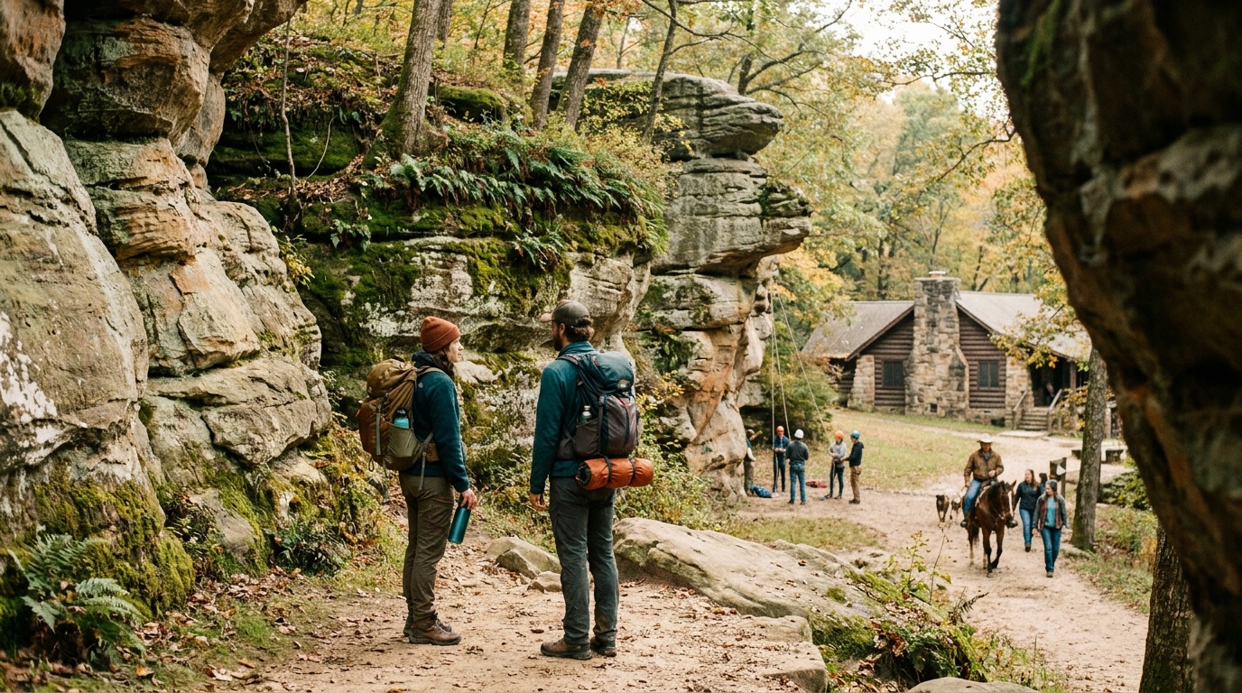
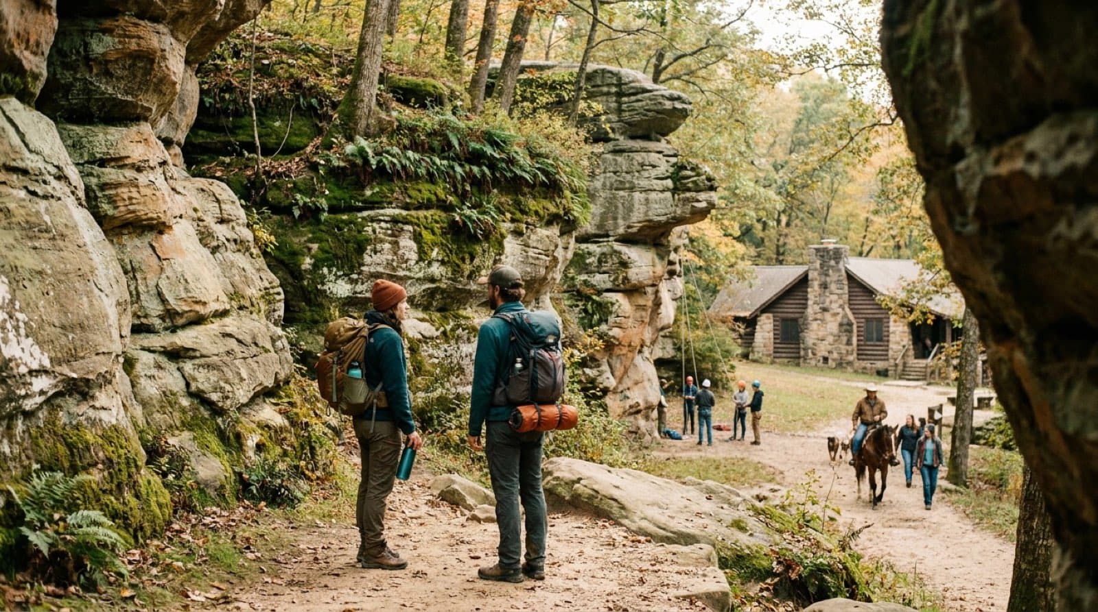
Giant City State Park
Southern Illinois' sandstone showpiece near Carbondale: massive bluff formations called Giant City Streets, a historic CCC-era lodge, rappelling, horseback riding, and 85 reservable campsites in the Shawnee National Forest.
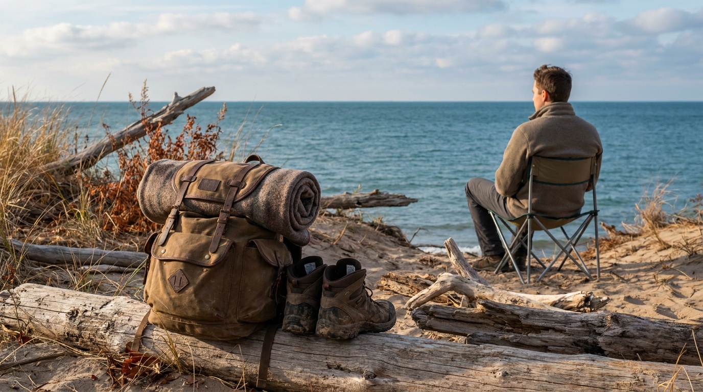
Illinois Beach State Park
Illinois' only remaining sand dune and beach habitat on Lake Michigan: 6.5 miles of shoreline, the Dead River wetland, and the only campground directly on Lake Michigan in the state.
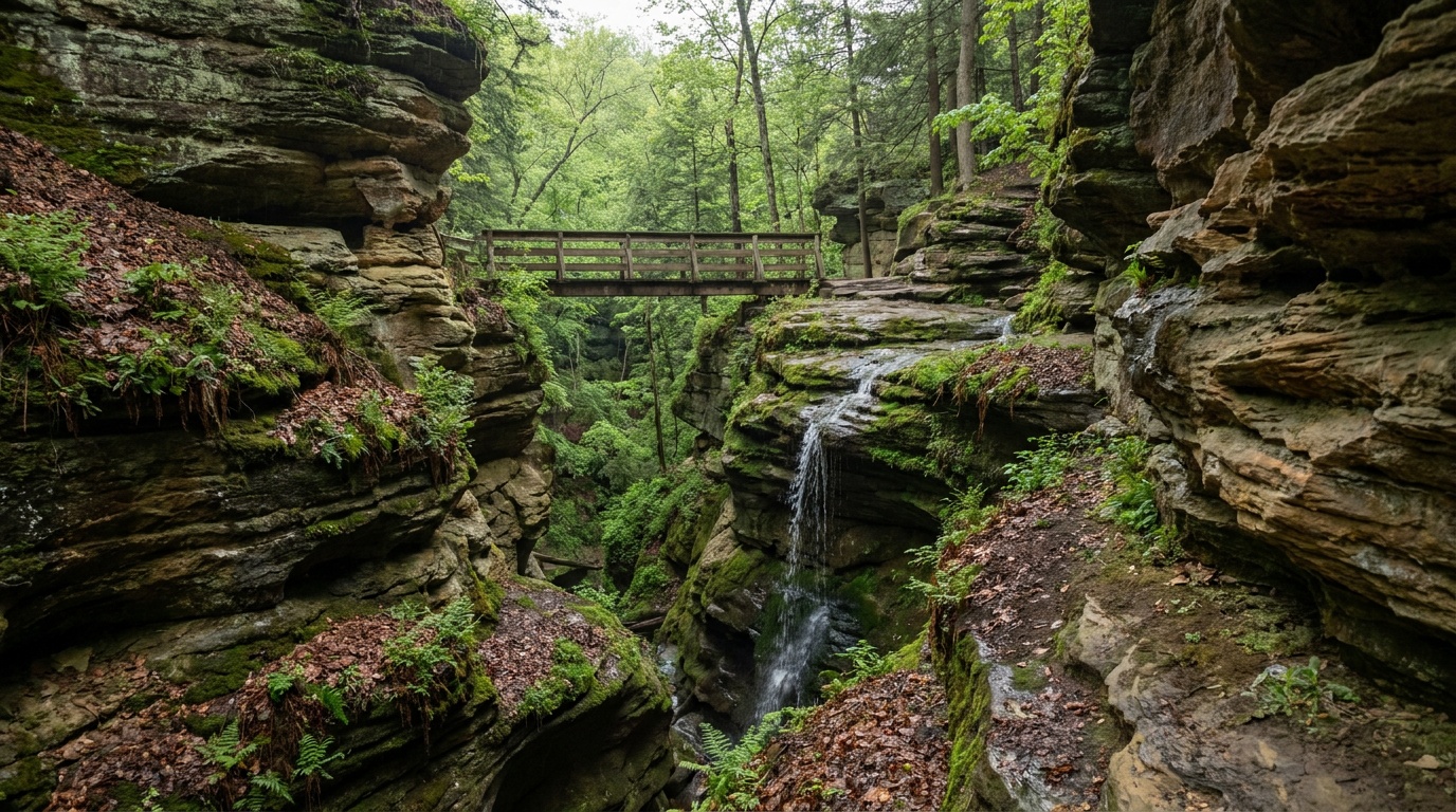
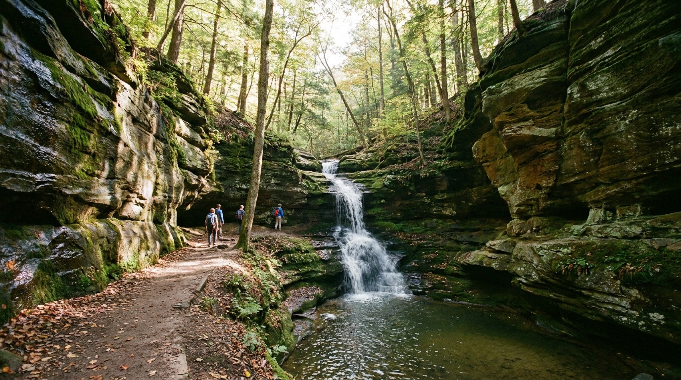
Matthiessen State Park
The quieter canyon park next to Starved Rock: dells, seasonal waterfalls, a streambed loop, and five miles of marked trails. Day-use only, no tent camping.
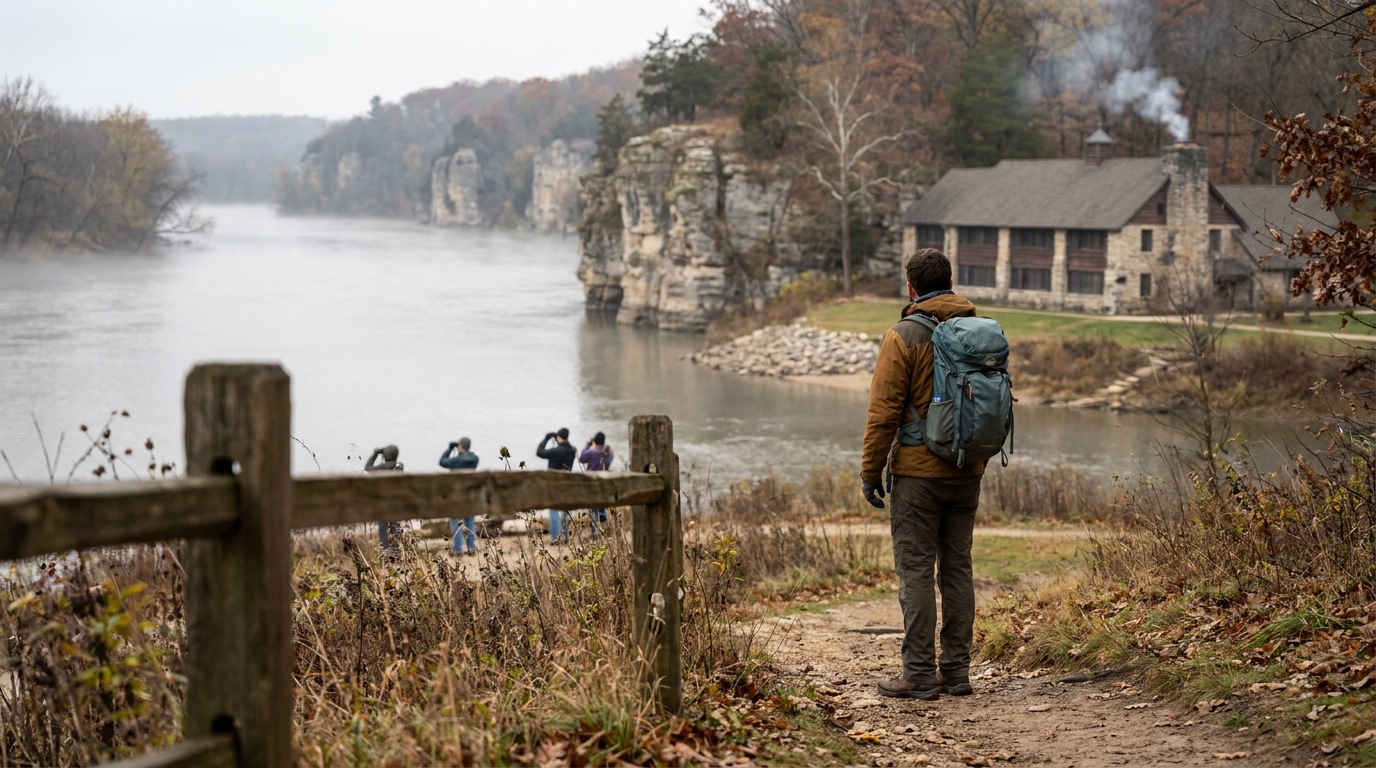
Pere Marquette State Park
Illinois' largest state park at the confluence of the Illinois and Mississippi Rivers: towering limestone bluffs, a historic CCC-built lodge with a 700-ton stone fireplace, winter bald eagle watching, and 12 miles of equestrian and hiking trails.
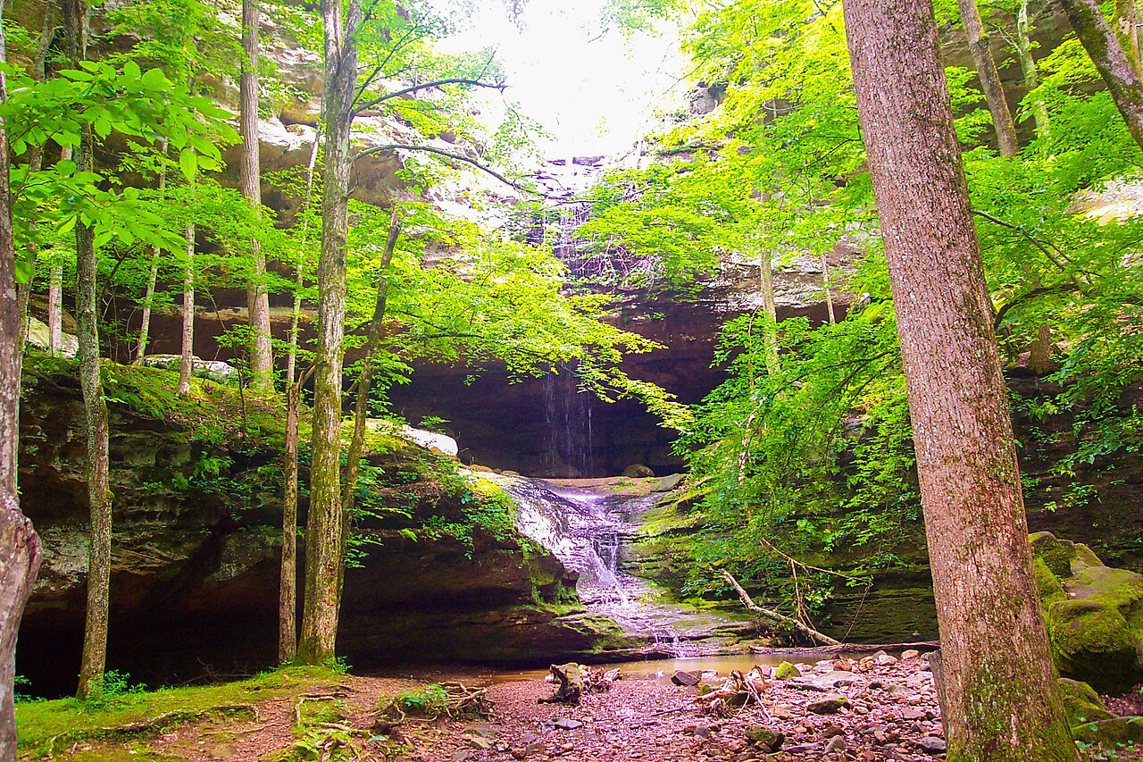
Starved Rock State Park
Illinois's canyon-and-waterfall flagship on the Illinois River: 18 sandstone canyons, a historic lodge, a reservation-required campground, and winter eagle watching.

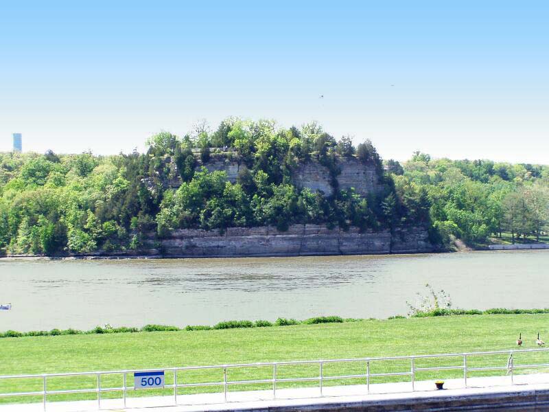
Mississippi Palisades State Park
Mississippi Palisades State Park is a 2,500-acre park near the confluence of the Mississippi and Apple rivers, rich in Native American history.
Ferne Clyffe State Park
Ferne Clyffe State Park is known for abundant ferns, rock formations, and trails through picturesque woods on a 2,470-acre site in Johnson County.

Cave-in-Rock State Park
Cave-in-Rock State Park sits atop bluffs above the Ohio River and is named for a 55-foot-wide cave carved from limestone by water.

Apple River Canyon State Park
Apple River Canyon State Park sits in the hilly northwest corner of Illinois, with limestone bluffs, deep ravines, springs, and streams formed by the Apple River.
Planning a Illinois trip
Illinois surprises people. There is no national park here, but the state quietly packs in some of the best canyon and cliff hiking in the Midwest, and almost all of it is free to enter.
Start with the two anchors. Up north, about 90 minutes southwest of Chicago, Starved Rock State Park carves 18 sandstone canyons along the Illinois River, with roughly 13 miles of trail that lead to seasonal waterfalls (best after spring rain or a winter thaw, when a few canyons freeze into ice columns). Far to the south, Shawnee National Forest spreads across 289,000 acres of oak-hickory hills between the Ohio and Mississippi rivers. Its crown jewel is Garden of the Gods, where 320-million-year-old sandstone has weathered into formations like Camel Rock and Devil's Smokestack. The quarter-mile Observation Trail there is one of the best effort-to-view ratios in the country: a short, mostly easy loop that opens onto miles of unbroken forest from the cliff edge.
There is more once you start looking. Giant City State Park near Makanda has shaded bluff trails and a historic lodge, Mississippi Palisades near Savanna stacks river overlooks on limestone cliffs, and quieter spots like Pomona Natural Bridge and the Little Grand Canyon reward a short detour.
For timing, spring (April to May) and fall (late September to October) are the sweet spots: temperatures in the 50s to 70s F, lower crowds in spring, and serious fall color across the Shawnee in October. Summer turns hot and humid (high 80s F and sticky), which makes the shaded canyon trails the smart play. Winter is cold but real hikers love the frozen Starved Rock waterfalls.
On packing: this is forgiving terrain with one catch, which is footing. Trails here are often wet sandstone, mud, and the occasional staircase, so the through-line is grippy waterproof shoes, layers you can shed as the day warms, and bug protection in summer. You are never far from a trailhead, so day-hiking light is the move.
Getting around Illinois
Most trips through outdoor Illinois start in Chicago, served by O'Hare (ORD) and Midway (MDW), the region's two big air hubs. From the Chicago area, Starved Rock is the easy win: roughly 95 miles and about 90 minutes to two hours southwest via I-80 and I-39 to Oglesby. Mississippi Palisades, up on the northwest border near Savanna, is about 140 miles (two and a half to three hours) from Chicago.
The Shawnee National Forest sits at the opposite end of the state and is a genuine road trip from Chicago: roughly 320 to 360 miles and about five to six hours south. If the Shawnee is your main target, fly into St. Louis (STL) instead, which puts you within about 130 to 150 miles (two to two and a half hours) of Garden of the Gods. Smaller regional options include Peoria (PIA) for central Illinois and Marion/Williamson County (MWA) deep in the south near the forest.
Distances between the headline areas are real, so plan north and south as separate trips rather than one loop: Starved Rock to the Shawnee is roughly five hours of driving. Within the Shawnee itself, the main sights (Garden of the Gods, Giant City, Pomona Natural Bridge) are spread across rolling backroads, so budget 30 to 60 minutes of driving between trailheads and keep a full tank, since gas and services thin out fast once you leave the towns.
All 5 Illinois park guides
State park directory
Every Illinois state park
A source-backed inventory layer for planning breadth. Full Kit Authority guides are marked when a park has camping detail, rules, and packing notes; the rest link straight to the official page. Looking for rail trails and state trails? They have their own Trail Guide.
132 parks
5 full guides · 61 with photos
Adeline Jay Geo-Karis Illinois Beach State Park
State Park
Illinois Beach State Park stretches 6.5 miles along the sandy shore of Lake Michigan, with dunes, swales, marshes, and oak forests across two units.
- Camping
- Hiking
- Fishing
- Boating
Illinois DNR
Full guideGiant City State Park
State Park
Giant City State Park near Carbondale is nestled in the Shawnee National Forest and named for massive sandstone structures formed 12,000 years ago.
- Camping
- Horseback Riding
- Fishing
- Hiking
Illinois DNR
Full guideMatthiessen State Park
State Park
Matthiessen State Park in LaSalle County combines canyons, streams, prairie, and forest with notable rock formations near Utica.
- Camping
- Winter Sports
- Horseback Riding
- Fishing
Illinois DNR
Full guidePere Marquette State Park
State Park
Pere Marquette State Park offers spectacular bluff-top views of the Illinois River and year-round recreation including horseback riding and camping.
- Horseback Riding
- Camping
- Hiking
- Fishing
Illinois DNR
Full guideStarved Rock State Park
State Park
Starved Rock State Park in northwestern Illinois is known for scenic canyons, waterfalls, and bluff-top views, with winter bald eagle viewing.
- Hiking
- Wildlife Viewing
- Camping
- Picnicking
Illinois DNR
Full guideApple River Canyon State Park
State Park
Apple River Canyon State Park sits in the hilly northwest corner of Illinois, with limestone bluffs, deep ravines, springs, and streams formed by the Apple River.
- Camping
- Fishing
- Hiking
- Hunting
Illinois DNR
Official pageArgyle Lake State Park
State Park
Argyle Lake State Park offers a 93-acre lake for boating and fishing plus 5 miles of foot trails through forest on a heavily wooded 1,700-acre site near Macomb.
- Camping
- Boating
- Fishing
- Hiking
Illinois DNR
Official pageBanner Marsh State Fish and Wildlife Area
State Fish and Wildlife Area
Banner Marsh is a fish and wildlife area southwest of Peoria, protected from the Illinois River by a major levee and teeming with fish and wildlife.
- Hunting
- Fishing
- Boating
- Picnicking
Illinois DNR
Official pageBeaver Dam State Park
State Park
Beaver Dam State Park sits in oak and hickory woodland near Carlinville and is named for a beaver dam that created its lake.
- Camping
- Fishing
- Hiking
- Picnicking
Illinois DNR
Official pageBig Bend
State park system area
Big Bend is mostly bottomlands along the Rock River interspersed with native grasslands, woods, oxbow lakes, wetlands, and marshes.
- Hunting
- Wildlife Viewing
Illinois DNR
Official pageBuffalo Rock State Park
State Park
Buffalo Rock State Park sits on a bluff above the Illinois River near Ottawa, offering sweeping river views on a 298-acre site.
- Hiking
- Hunting
- Biking
- Winter Sports
Illinois DNR
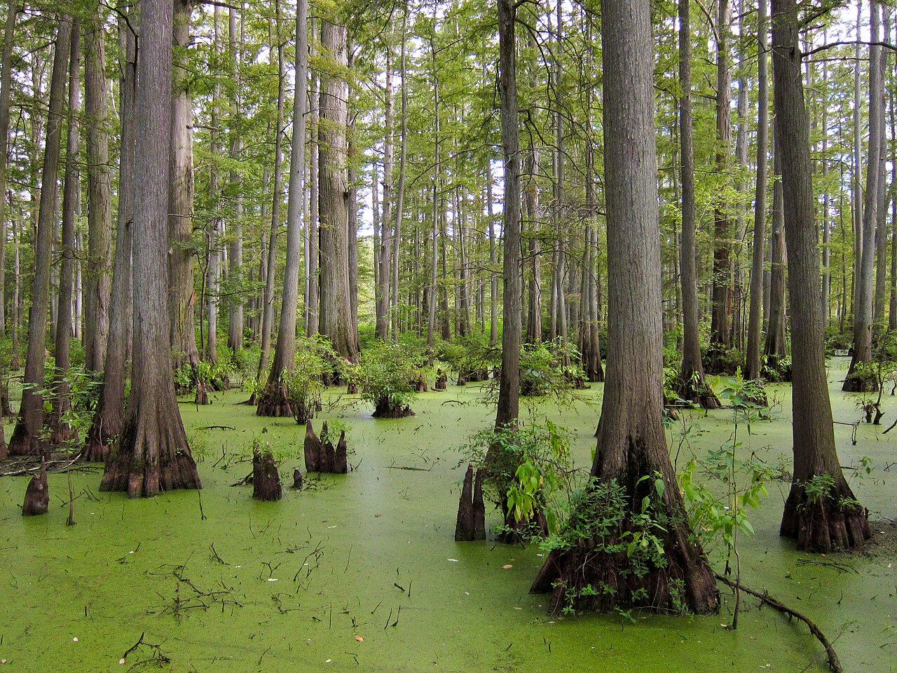
Official pageCache River State Natural Area
State Natural Area
Cache River State Natural Area in southernmost Illinois holds ancient bald cypress trees and wetlands designated of international importance.
- Boating
- Fishing
- Hiking
- Hunting
Illinois DNR
Official pageCastle Rock State Park
State Park
Castle Rock State Park lies along the west bank of the Rock River in Ogle County, with rock formations, ravines, and a sandstone bluff that names the park.
- Camping
- Boating
- Fishing
- Hiking
Illinois DNR
Official pageCave-in-Rock State Park
State Park
Cave-in-Rock State Park sits atop bluffs above the Ohio River and is named for a 55-foot-wide cave carved from limestone by water.
- Camping
- Fishing
- Hiking
- Boating
Illinois DNR
Official pageChannahon State Park
State Park
Channahon State Park is the official trailhead for the Illinois and Michigan Canal State Trail, preserving Locks 6 and 7 and an original locktender's house.
- Camping
- Fishing
- Picnicking
- Paddling
Illinois DNR
Official pageDes Plaines State Fish and Wildlife Area
State Fish and Wildlife Area
Des Plaines Fish and Wildlife Area spans more than 5,000 acres of farmland, woodland, prairie, swamp, and shoreline south of Joliet.
- Boating
- Camping
- Fishing
- Hunting
Illinois DNR
Official pageDixon Springs State Park
State Park
Dixon Springs State Park sits on a giant block of sandstone in the Shawnee Hills, with canyons and waterfalls along a fault line in Pope County.
- Camping
- Fishing
- Hiking
- Hunting
Illinois DNR
Official pageEagle Creek State Park
State Park
Eagle Creek State Park faces Wolf Creek across Lake Shelbyville in east central Illinois, with woodland and large tracts along the lake.
- Camping
- Boating
- Fishing
- Hiking
Illinois DNR
Official pageFerne Clyffe State Park
State Park
Ferne Clyffe State Park is known for abundant ferns, rock formations, and trails through picturesque woods on a 2,470-acre site in Johnson County.
- Camping
- Horseback Riding
- Fishing
- Hiking
Illinois DNR
Official pageFort Defiance State Park
State Park
Fort Defiance State Park sits on Cairo Point, the southernmost tip of Illinois, where the Ohio and Mississippi rivers meet at one of the world's largest confluences.
- Fishing
- Picnicking
Illinois DNR
Official pageFort Massac State Park
State Park
Fort Massac State Park overlooks the Ohio River at the southern tip of Illinois and was the state's first state park, established in 1908.
- Biking
- Boating
- Camping
- Fishing
Illinois DNR
Official pageFox Ridge State Park
State Park
Fox Ridge State Park near Charleston is known for steep wooded ridges, lush valleys, and rugged hiking trails along the bluffs of the Embarras River.
- Picnicking
- Camping
- Hiking
- Fishing
Illinois DNR
Official pageFranklin Creek State Natural Area
State Natural Area
Franklin Creek State Natural Area in Lee County features springs, hardwood forests, bedrock outcroppings, and a reconstructed 1847 grist mill.
- Fishing
- Hiking
- Hunting
- Horseback Riding
Illinois DNR
Official pageFults Hill Prairie State Natural Area
State Natural Area
Fults Hill Prairie State Natural Area holds the largest complex of high-quality loess hill prairies in Illinois, with woodland, prairie, and glade communities.
- Hiking
- Hunting
Illinois DNR
Official page


Inventory source: USGS PAD-US 4.1. Photos are public-domain or Creative Commons via Wikimedia Commons, credited per image. Official reservations and rules remain state-specific, so use the state booking links before committing to dates.
Frequently asked questions
What is the best outdoor area to visit in Illinois?
Illinois has no national park, so the two standouts are Starved Rock State Park near Oglesby (river canyons and waterfalls about 90 minutes from Chicago) and the Garden of the Gods area in Shawnee National Forest in the far south (ancient sandstone cliffs and panoramic overlooks). Starved Rock is the easy pick if you are near Chicago, while Garden of the Gods is worth the longer drive for its dramatic rock formations. Both are excellent for day hiking and cost nothing to enter.
When is the best time to visit Illinois state parks?
Spring (April to May) and fall (late September to October) are ideal, with comfortable temperatures in the 50s to 70s F. Spring brings flowing waterfalls at Starved Rock and thinner crowds, while October delivers strong fall color across the Shawnee. Summer is hot and humid (high 80s F), so stick to shaded canyon trails, and winter draws hikers who come specifically for Starved Rock's frozen waterfalls.
Do Illinois state parks charge an entrance fee?
No. Illinois state parks, including Starved Rock and Giant City, are free to enter, and Garden of the Gods Recreation Area in the federally managed Shawnee National Forest also has no entrance fee. You may pay small fees for camping (for example, around $10 per night at Pharaoh Campground near Garden of the Gods) or for guided activities like ziplining or horseback rides, but day hiking itself is free.