Rail trail · Wisconsin
Tuscobia State Trail
At 74 miles, one of Wisconsin's longest rail-trails, running on a former rail corridor from Park Falls through the Flambeau River State Forest and the Blue Hills wilderness to the Wild Rivers Trail north of Rice Lake, on a rustic crushed-stone surface.
Length
74 miles
Surface
Crushed stone
Route
Point to point
Endpoints
Park Falls to Wild Rivers State Trail junction north of Rice Lake
Season
Year-round; popular for snowmobiling and fat-tire biking in winter; summer and fall for hiking and biking; no trail pass required
Plan your ride or walk
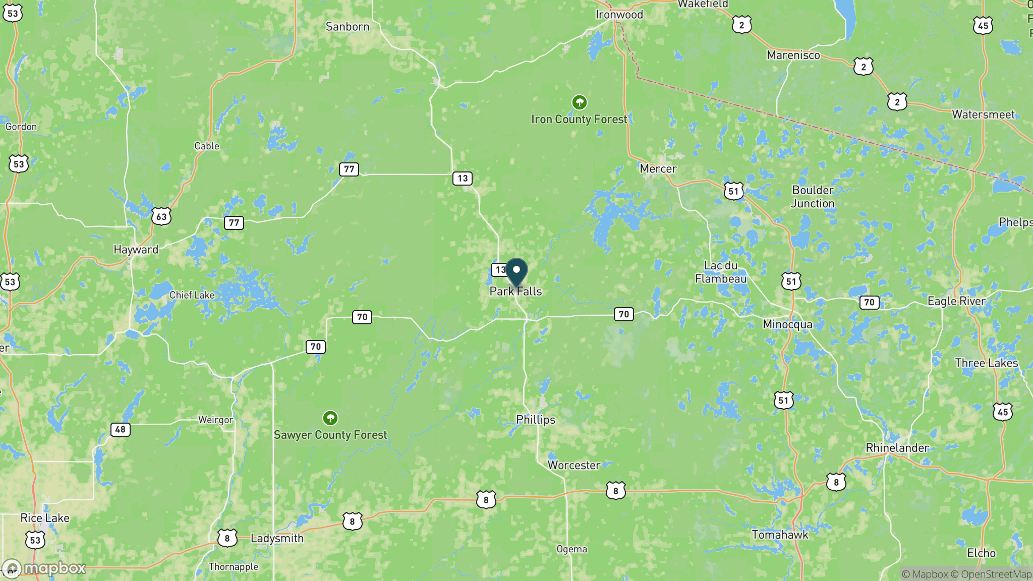
The Tuscobia State Trail is a 74-mile crushed-stone rail-trail through the deep Northwoods of northern Wisconsin, one of the longest rail-trails in the state and arguably its most remote. The trail runs from Park Falls in Price County west to the Wild Rivers State Trail junction north of Rice Lake in Barron County, passing through the Flambeau River State Forest and the rugged Blue Hills, threading seven small communities that provide year-round accommodations and services. State highways 27 and 70 parallel portions of the trail in Sawyer County, making it possible to do segments by shuttling between towns. The Tuscobia is widely used in winter for snowmobiling and increasingly for fat-tire biking, and the Friends of the Tuscobia State Trail actively maintain the corridor. No state trail pass is required, which is unusual among Wisconsin's longer trails. The western segment near Birchwood allows ATV use to the Red Cedar Lake Bridge for about 2.5 miles.
Getting there
The eastern terminus is in Park Falls on Price County, roughly 3.5 hours north of Madison via US 51 and SR 182. Trailhead parking is at Price County Park near 9th Avenue and 2nd Street in Park Falls. The western end is north of Rice Lake on Highway SS near SR 53, with Barron County parking and pit toilets. Intermediate communities including Winter, Radisson, and Couderay have parking and local services.
Official trail information
Confirm current conditions, closures, and any required trail pass on the managing agency’s page.
Wisconsin DNR: Tuscobia State TrailWhat to bring
Gear keyed to a long, flat trail day: footwear, hydration, sun protection, and a pack sized for the distance.
What to pack
Plan with our tools
Frequently asked questions
How long is the Tuscobia State Trail?
The Tuscobia is 74 miles point to point from Park Falls to the Wild Rivers State Trail junction north of Rice Lake, making it one of the longest rail-trails in Wisconsin. Most users choose a segment between two of the seven communities along the route.
Is a trail pass required for the Tuscobia State Trail?
No. Unlike many Wisconsin state trails, no state trail pass is required for the Tuscobia State Trail. It is free to use for cyclists, hikers, and snowmobilers.
What is the trail surface?
The entire Tuscobia is crushed stone, which suits hybrid bikes, gravel bikes, fat-tire bikes, and walking. The surface can be loose or soft in wet conditions, and the remoteness of some sections means pack accordingly.
Is the Tuscobia State Trail good for winter use?
Yes. The trail is a popular snowmobile corridor in winter and is increasingly used by fat-tire cyclists after snowfall. Seven communities along the route offer lodging and services year-round, including in the winter months.
More Wisconsin trails
Looking for parks instead? Browse state parks by state.