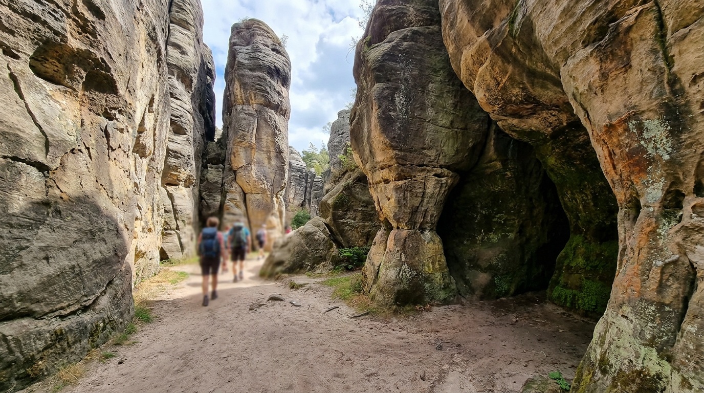
When to go
Weather, crowds, and what the season changes about the trip.
Spring
Mild and pleasant at the monument's higher elevation, with comfortable hiking.
Pack Layers, sun protection, and footwear for rocky trails.
Summer
Warm days with afternoon monsoon storms in July and August; cooler than the desert floor.
Pack Rain shell, early start, and water for exposed pinnacle trails.
Fall
Clear, dry, and comfortable, one of the best hiking windows.
Pack Layers for cool mornings and sun protection by midday.
Winter
Cold nights and occasional snow at elevation, with quiet trails and crisp air.
Pack Insulation, traction for icy shaded sections, and a warm layer.
Top things to do
Echo Canyon Loop
The signature hike, winding through grottoes and towering rock columns. The best introduction to the monument's pinnacle world.
Heart of Rocks Loop
A longer route to the densest cluster of balanced rocks and named formations, usually combined into a bigger day from Echo Canyon or the visitor center.
Massai Point and the scenic drive
The paved Bonita Canyon Drive climbs to Massai Point, with sweeping views over the pinnacles and the surrounding sky island.
Anchor the day around Echo Canyon Loop
Put the access rule first: shuttle, parking, timed-entry, or reservation windows should decide the order of the day. For one day in Chiricahua National Monument, make Echo Canyon Loop the non-negotiable, add Heart of Rocks Loop only if the first stop runs clean, and keep Massai Point and the scenic drive as the flexible finish.
- 1Start with Echo Canyon Loop: The signature hike, winding through grottoes and towering rock columns. The best introduction to the monument's pinnacle world.
- 2Add Heart of Rocks Loop: A longer route to the densest cluster of balanced rocks and named formations, usually combined into a bigger day from Echo Canyon or the visitor center.
- 3Use Massai Point and the scenic drive as the optional finish, not as a reason to rush the whole day.
Plan your trip
Turn Chiricahua's conditions into water, pack, and sleep-system decisions.
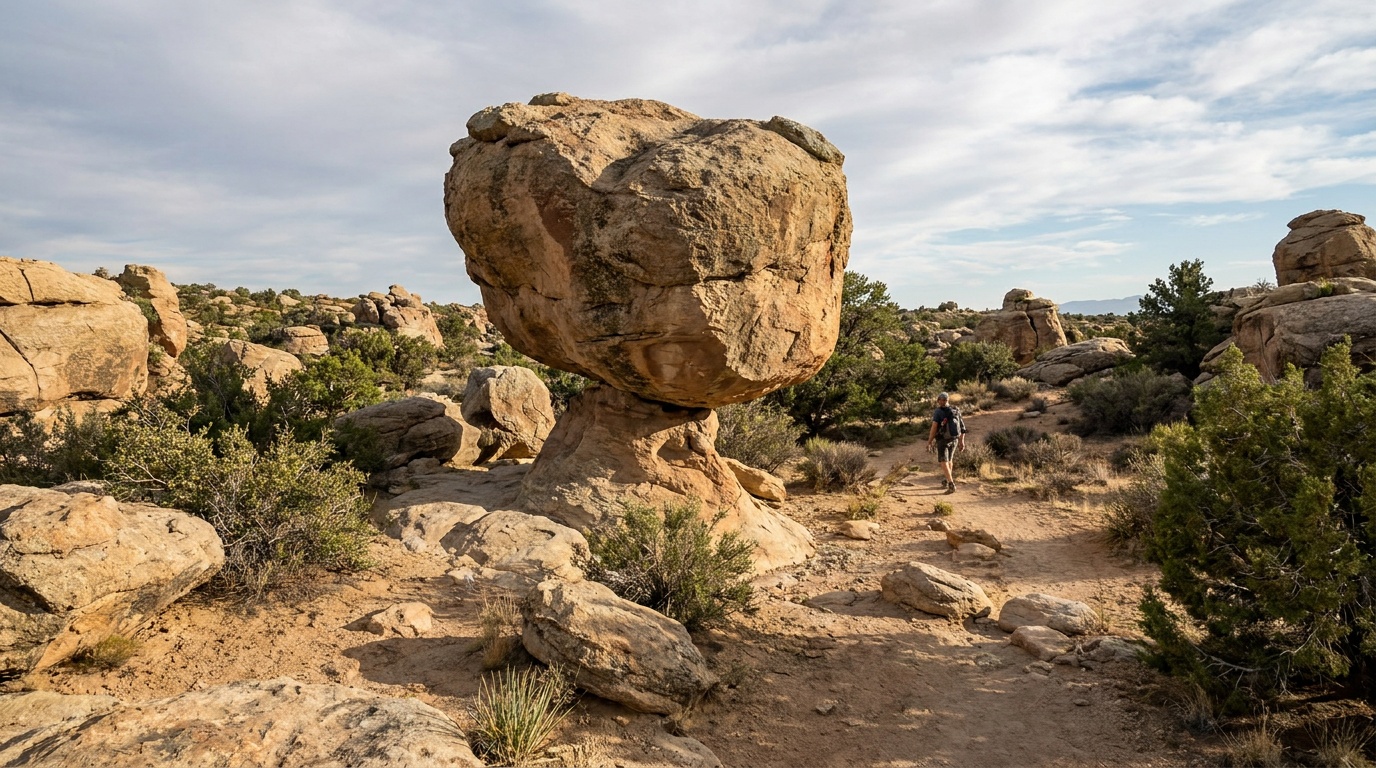
Build around conditions
Let season, elevation, and weather set the plan.
Plan your trip
4 quick tools, already seeded for Chiricahua National Monument. Tune the numbers around temperature swings, footing, layers, and how much margin the route needs.
What to pack
Start with the gear decisions this park changes: footing, weather, camping, and water.
Kit Authority
Chiricahua National Monument packing list
0 of 22 packed. Check items as you pack, then take this list to the store, trailhead, or campsite.
Pack planning
Decide what Chiricahua National Monument asks of your kit before you start checking boxes.
Use this as a constraint check while you are still shaping the trip. The active checklist becomes useful once your route, dates, and sleep plan are set.
- First constraintHydration and exposureWater, hat, sunscreen, sunglasses, Navigationmap, downloaded GPS, or a GPS watch, 3 more
- Route realityFooting and tractionHiking boots, Hiking socks, Trekking poles
- Load choicePack and carry systemDaypack
- If overnightSleep and shelterTent, Sleeping bag, Sleeping pad
Checklist mode
22 items, grouped for the trip you are actually taking.
- Dates and season are set.
- Primary route, campground, or lodge is chosen.
- Water, footwear, and overnight needs are sized.
One researched pick
The first gear decision for Chiricahua National Monument
A stable daypack is the one purchase that organizes water, layers, food, first aid, and the small safety margin.
We may earn a commission from links on this page, at no extra cost to you.
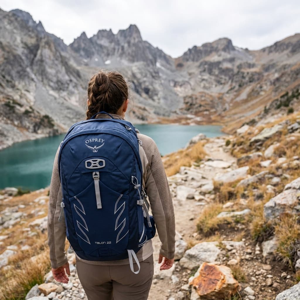
THE DAY-HIKE PICK
Osprey Talon 22
- Volume
- 22 L
- Weight
- 2 lb 1 oz (945 g)
- Back Panel
- AirScape foam with ventilation channels
- Hipbelt Pockets
- 2 zippered
- Hydration
- Compatible up to 3 L reservoir (sold separately)
- Warranty
- All Mighty Guarantee (lifetime repair or replace)
The Talon 22 is the daypack you see on the trail more than any other for good reason: it packs in a padded hipbelt, adjustable torso harness, and dual hipbelt pockets into a 22-liter package that handles loads up to 20 lb without complaint. Owners across hundreds of Amazon ratings consistently cite its adjustability and durability as standouts.
- Adjustable torso fit covers a wide range of body sizes
- Padded hipbelt and dual hipbelt pockets at this size are rare
- At 2 lb 1 oz it runs heavier than ultralight rivals for the same volume
Best for
Hikers who want a proven all-around daypack with solid load support, plenty of adjustment, and a warranty they can actually use.
Gear for Chiricahua
The buying guides that match what Chiricahua asks of your kit, with our current top picks across budget and use case.
Where to stay
Camp inside the monument at the small Bonita Canyon Campground, reserved on Recreation.gov. It is the only camping at the monument and fills quickly. If it is full, base in Willcox, about 35 to 40 minutes away, which has the nearest motels, food, and fuel.
Camping reservations
Camping reservations
Reserve the small Bonita Canyon Campground on Recreation.gov.
Chiricahua has one campground, the 25-site Bonita Canyon Campground. It now takes reservations on Recreation.gov and fills quickly, so book ahead rather than counting on a walk-up site.
Reviewed June 11, 2026
Booking window
Reserve Bonita Canyon on Recreation.gov, generally up to six months ahead. With only 25 sites, popular weekends go early.
- Bonita Canyon is the only campground at the monument, with about 25 sites and a roughly $12 nightly rate.
- The campground has a length limit; large RVs do not fit. Check site details before booking.
- There is no entrance fee for the monument, so camping is the main cost.
Where to book or verify
Official NPS page with campground details and rules.
Recreation.gov listing for the campground.
Check for federal campground, backcountry, tour, and permit inventory tied to this park.
Campgrounds to know
Bonita Canyon Campground
Details- Booking
- Reserve on Recreation.gov, up to six months ahead.
- Season
- Open year-round; check current conditions in winter.
- Sites
- About 25 sites for tents and smaller RVs, with a length limit.
- The only campground at the monument. Small and popular, about $12 per night, so book ahead.
Getting there and practical info
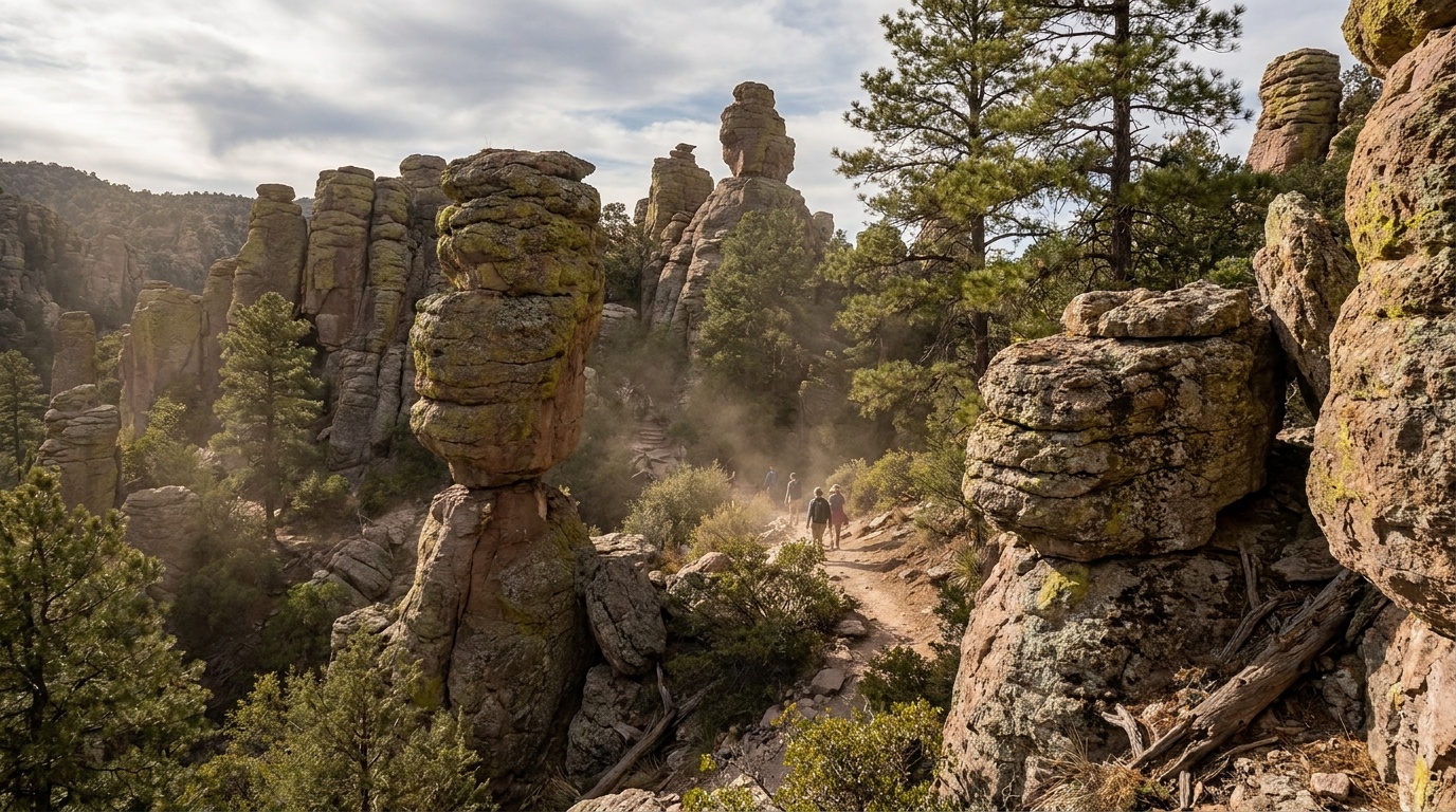
Build the arrival around the reservation.
Entry windows, permit pickups, and drive time should be checked before the itinerary gets crowded.
Getting there
Get to Chiricahua National Monument with the required window already protected.
- Nearest airport
- Tucson International (TUS) about 2 hours
- Access rhythm
- Car required
- Region
- Arizona
Arrival note
Chiricahua is remote: about two hours east of Tucson, reached via Interstate 10 to Willcox, then about 35 miles south on State Route 186.
Car strategy
A car is essential, and the drive in is part of the experience.
Local movement
Fuel up in Willcox, since services near the monument are minimal.
Pair this with lodging: choose the base that keeps the reservation or permit pickup from becoming the hardest part of the day.
Can you photograph here? Permit and drone rules
No single Arizona state permit: register with the state film office, pull free ADOT permits for highways, and apply separately for state parks.
- Permit
- Usually fine for personal shoots; commercial or large productions can need a permit
- Drones
- Commercial drone work requires FAA Part 107
- Land
- Yes: you can photograph what is visible from public space in the US
From our photography sister site, Aperture Authority. Verified 2026-07-01.
Frequently asked questions
Is there an entrance fee at Chiricahua National Monument?
No. Chiricahua charges no entrance fee and requires no entrance pass. The main cost is camping at the Bonita Canyon Campground.
Can you camp at Chiricahua National Monument?
Yes, at the small Bonita Canyon Campground, about 25 sites at roughly $12 per night. It now takes reservations on Recreation.gov and fills quickly, so book ahead. There is a length limit, so large RVs will not fit.
What is the best hike at Chiricahua?
Echo Canyon Loop, about 3.3 miles, is the classic introduction to the balanced rocks and pinnacles. For a bigger day, link it with the Heart of Rocks Loop to reach the densest cluster of named formations.
How far is Chiricahua from Tucson?
About two hours, driving east on Interstate 10 to Willcox and then roughly 35 miles south on State Route 186. The monument is remote, so plan fuel and supplies before you head in.