State trail · Oregon
Willamette River Greenway and Water Trail
A 187-mile paddling water trail along the Willamette River from Eugene to Portland, paired with a riverside greenway corridor of parks and natural areas protecting one of the Pacific Northwest's most important river ecosystems.
Length
187 miles
Surface
Natural
Route
Point to point
Endpoints
Eugene to Portland (Willamette River corridor)
Season
Best May through September; spring flows can be high and fast; summer low water reveals gravel bars for camping; fall is also good; winter paddling is for experienced paddlers only given cold temperatures and unpredictable flows
Plan your ride or walk
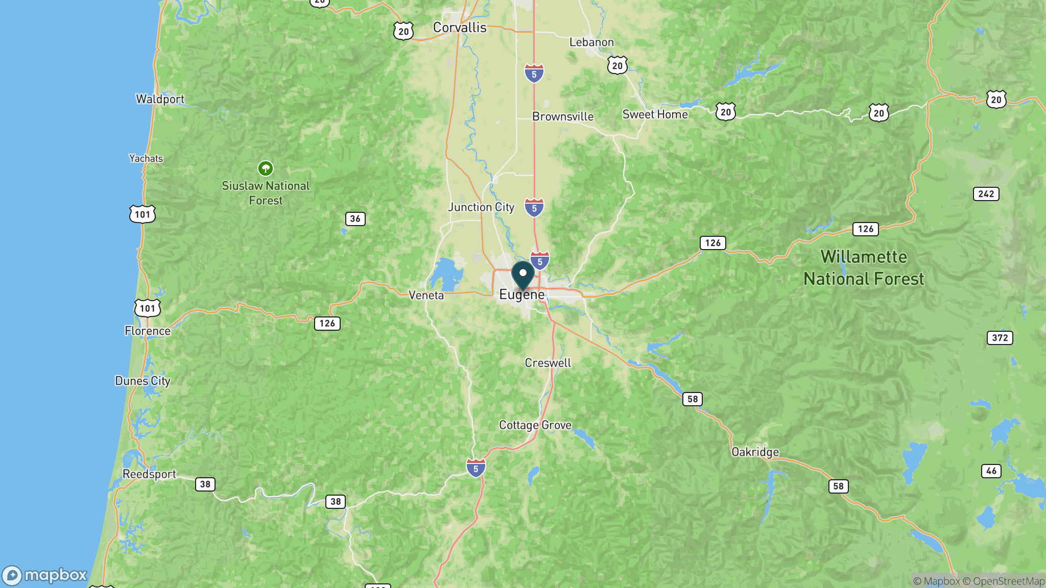
The Willamette River Greenway and Water Trail is Oregon's flagship river trail: 187 miles of designated paddling route down the Willamette from Eugene north to Portland, protected by the Oregon Scenic Waterways program and the state's Greenway land-use law. The water trail is the core experience, with canoe, kayak, and small boat access at put-ins and take-outs spaced along the entire corridor. Primitive campsites on gravel bars and greenway parks make multi-day trips possible from Eugene to Portland. The greenway itself is a network of state parks, natural areas, and protected riparian land along both banks, offering shore-based wildlife viewing throughout the corridor. Great blue herons, osprey, bald eagles, river otters, and beavers are common sightings. Oregon State Parks manages public access points and the campsite network along the water trail.
Getting there
The upstream put-in is near Eugene at Alton Baker Park, accessible from I-5 exit 194B. The downstream take-out is at Willamette Park in Portland. Numerous access points with boat ramps and parking exist at state parks and county parks along the 187-mile corridor, including sites near Corvallis, Salem, and Oregon City. Current USGS flow data is essential for trip planning.
Official trail information
Confirm current conditions, closures, and any required trail pass on the managing agency’s page.
Oregon State Parks: Willamette River GreenwayWhat to bring
Gear keyed to a long, flat trail day: footwear, hydration, sun protection, and a pack sized for the distance.
Plan with our tools
Frequently asked questions
Is the Willamette River Greenway a hiking trail or a water trail?
It is primarily a water trail: the 187-mile Willamette Water Trail is a designated paddling route from Eugene to Portland. The greenway refers to the protected corridor of parks and natural areas along the river banks, where shore access for wildlife viewing and day use is available, but there is no continuous land-based trail for the full distance.
How long does it take to paddle the Willamette Water Trail?
A full through-paddle from Eugene to Portland typically takes 7 to 12 days depending on river flow and how many miles paddlers cover each day. Shorter multi-day or day trips between any pair of access points are popular and require no special permits.
What can you see along the Willamette River Greenway?
The corridor is rich with wildlife: great blue herons, osprey, bald eagles, river otters, beavers, and migratory waterfowl are frequently seen. The greenway also passes working farmland, old-growth cottonwood bottomlands, and the river's historic mill sites.
Where can you camp along the Willamette Water Trail?
Oregon State Parks maintains a network of primitive river-access campsites on gravel bars and greenway parks along the full 187-mile corridor. Most are first-come, first-served and free. Gravel bars are only accessible at summer low-water levels.
More Oregon trails
Looking for parks instead? Browse state parks by state.