Rail trail · Massachusetts
Ashuwillticook Rail Trail
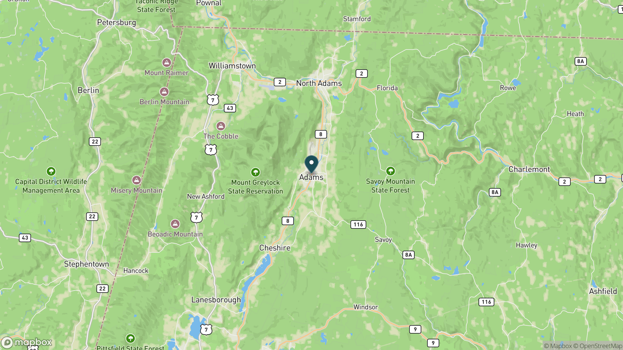
An 11-mile paved rail-trail through the Hoosic River valley in the Berkshires, connecting Adams and Lanesborough alongside Cheshire Reservoir and with views of Mount Greylock.
Length
11 miles
Surface
Paved
Route
Point to point
Endpoints
Adams to Lanesborough (Berkshire Mall area)
Season
Year-round; fall foliage in October is spectacular; winter brings snow and cold but the trail is popular with snowshoers when groomed; spring and summer are active with birders and cyclists
Plan your ride or walk
The Ashuwillticook Rail Trail (pronounced ah-shoo-will-ti-cook, a Mahican word for the Hoosic River) threads 11 paved miles through the northern Berkshires, connecting the mill town of Adams to the Lanesborough-Pittsfield border. The trail hugs the Hoosic River for much of its length and opens onto Cheshire Reservoir, where great blue herons, ospreys, and migratory waterfowl are common sightings. To the west, views of Mount Greylock, the highest peak in Massachusetts at 3,491 feet, provide a dramatic backdrop. The flat paved surface makes it an excellent family trail, and the southern extension toward Pittsfield has expanded total accessible distance. The name of the trail reflects the Indigenous heritage of the river valley.
Getting there
The main northern trailhead is in Adams off Route 8, about 2.5 hours west of Boston or 30 minutes north of Pittsfield. Additional parking is at the Cheshire Reservoir (accessible from Route 8 in Cheshire) and at the southern end near the Berkshire Mall in Lanesborough. Adams is accessible from the MassDOT Pioneer Valley Transit bus network.
Official trail information
Confirm current conditions, closures, and any required trail pass on the managing agency’s page.
Massachusetts DCR: Ashuwillticook Rail TrailWhat to bring
Gear keyed to a long, flat trail day: footwear, hydration, sun protection, and a pack sized for the distance.
Frequently asked questions
How long is the Ashuwillticook Rail Trail?
The Ashuwillticook Rail Trail is about 11 miles paved, running point to point from Adams south through Cheshire to Lanesborough near the Berkshire Mall. A short extension links toward Pittsfield, adding a bit more distance.
How do you pronounce Ashuwillticook?
It is pronounced ah-shoo-will-ti-cook. The name comes from the Mahican language and refers to the Hoosic River (sometimes spelled Hoosick), which the trail follows through the northern Berkshires.
What wildlife can you see on the Ashuwillticook Rail Trail?
Cheshire Reservoir is the best spot, where great blue herons, ospreys, and migratory waterfowl are frequent. River otters, beavers, and white-tailed deer are also seen along the Hoosic River corridor.
Is the Ashuwillticook Rail Trail good for families?
Yes. The paved, mostly flat surface is well suited to young riders and strollers. The Cheshire Reservoir section is particularly scenic and a popular turnaround point for shorter family outings.
More Massachusetts trails
Looking for parks instead? Browse state parks by state.