Rail trail · Idaho
Ashton to Tetonia Trail
A 29.6-mile former railroad corridor across Idaho's high Teton foothills, passing historic grain elevators and dramatic wooden trestles with sweeping views of the Teton Range.
Length
29.6 miles
Surface
Gravel, Paved
Route
Point to point
Endpoints
Ashton to Tetonia
Season
Best June through October; the corridor sits at high elevation and can see snow from October through May. Cross-country skiing and snowshoeing are popular in winter.
Plan your ride or walk
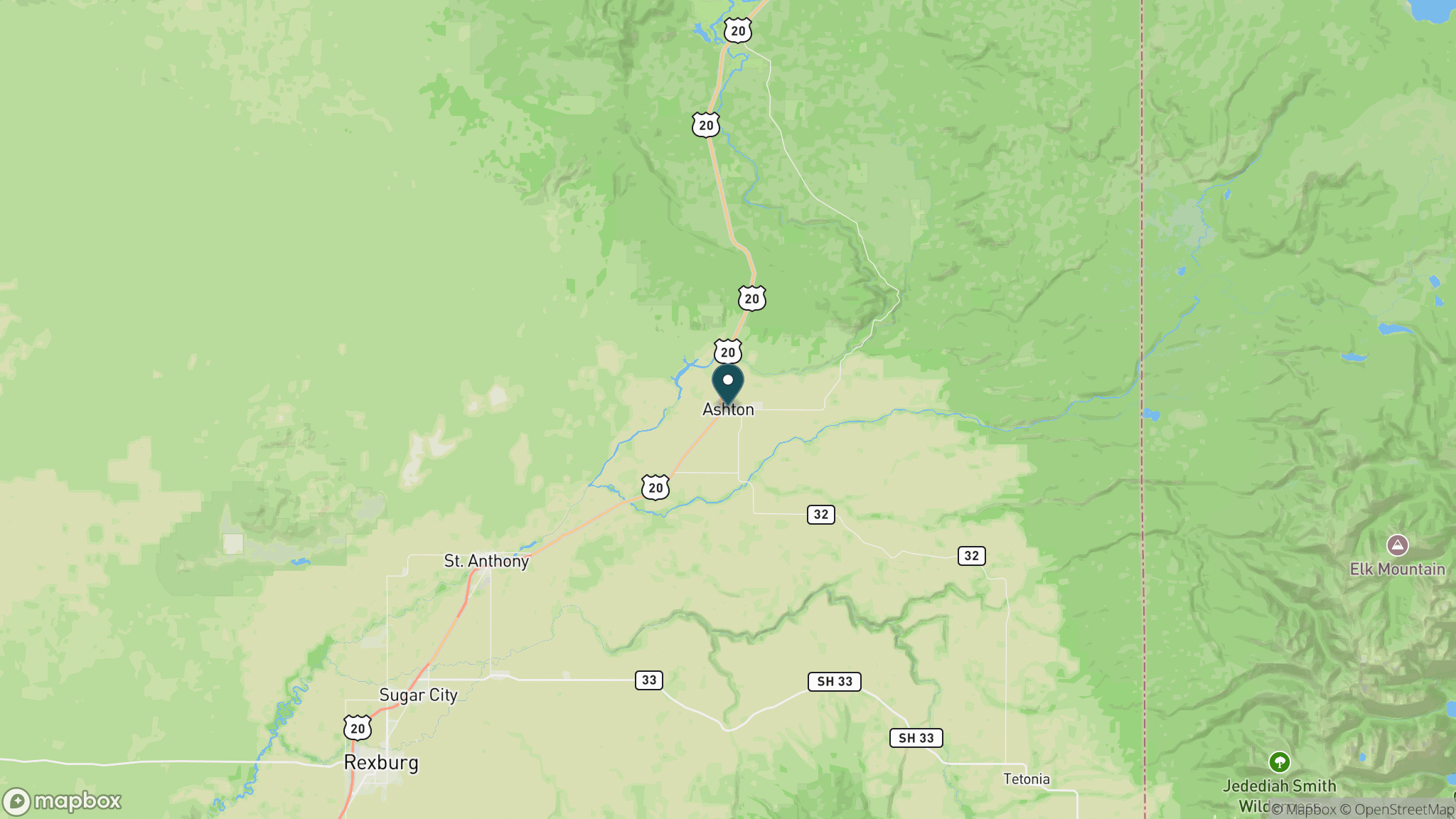
The Ashton to Tetonia Trail runs 29.6 miles across the high benchlands east of Ashton, Idaho, on the former railroad grade that once served the Teton Basin farming communities. The trail's signature features are its historic wooden trestles spanning Fall River and Bitch Creek, which offer dramatic views down into canyon gorges, and the sweeping, unobstructed panoramas of the Teton Range visible along most of the route. Historic grain elevators in the tiny community of France mark the agricultural heritage of this corridor. The trail sits at 5,277 to 6,064 feet, making it a true high-country rail-trail unlike most in the region. A multi-phase paving project is underway as of 2026, adding asphalt to several sections; check the Idaho Parks and Recreation website for current surface conditions before visiting. A visitor center is open at the Ashton end, and no overnight camping is permitted on the trail.
Getting there
The Ashton trailhead is at 801 N. Hwy. 20 in Ashton, Idaho, about 54 miles northeast of Idaho Falls and 72 miles northwest of Jackson Hole, Wyoming. Additional parking is available at the Grainville lot, Judkins area, and Tetonia end. A local shuttle service (InstaGear Outdoors, 208-206-9011) offers bike rentals and shuttles for point-to-point rides.
Official trail information
Confirm current conditions, closures, and any required trail pass on the managing agency’s page.
Idaho Parks and Recreation: Ashton to Tetonia TrailWhat to bring
Gear keyed to a long, flat trail day: footwear, hydration, sun protection, and a pack sized for the distance.
What to pack
Plan with our tools
Frequently asked questions
What makes the Ashton to Tetonia Trail unique?
Two features set it apart: the historic wooden railroad trestles over Fall River and Bitch Creek, which put you 80-plus feet above steep canyon gorges, and continuous views of the Teton Range that stretch the length of the trail. The high elevation (above 5,000 feet) also gives it an alpine feel rare among rail-trails in the region.
What is the surface of the Ashton to Tetonia Trail?
Much of the trail has historically been packed gravel or cinder surface. A federally funded paving project began in 2026 and will add asphalt to roughly 5.5 miles in sections near Ashton and Tetonia. Check the Idaho Parks and Recreation website for current conditions before your visit, as closure notices may apply to paving segments.
Is the Ashton to Tetonia Trail good in winter?
Yes. At 5,000-plus feet elevation, the trail typically receives reliable snow from November through April. Cross-country skiing and snowshoeing are popular winter uses. Motorized ATVs and OHVs are not permitted, so the corridor stays quiet in all seasons.
Is there a fee to use the trail?
There is no per-visit trail fee. The visitor center in Ashton is open seven days a week and serves as a base for trip planning. Pets are welcome on a 6-foot leash.
Looking for parks instead? Browse state parks by state.