No campground at Wachusett Mountain (day-use only)
Details- For camping near Princeton, check Otter River State Forest in Baldwinville via the Massachusetts DCR system.
State Park · Massachusetts
The highest summit in Massachusetts east of the Connecticut River at 2,006 feet, with 17 miles of trail through 3,000 acres of hardwood forest, 360-degree summit views, a hawk watch, and an adjacent alpine ski area.
Field briefing
Wachusett Mountain State Reservation changes fast with season and elevation.
Before you go
The 17-mile trail network ranges from the steep Old Indian Trail to the gentler Administration Road approach, and a paved summit road means less-mobile visitors can reach the top by car when it is open. Fall is the headline season: the foliage from 2,006 feet covers several counties and hawk watchers line the summit ridge counting thousands of raptors through October. Winter adds the ski area, making this a four-season destination with no camping on-site.
Weather, crowds, and what the season changes about the trip.
Cool with lingering snow possible on north-facing slopes into April. The summit road opens when conditions allow, and trout season opens on Balance Rock Pond.
Pack Layers for a summit that stays 10 to 15 F cooler than the valley, waterproof footwear for muddy spring trails, and traction if visiting in early April.
Warm and humid in the valley, noticeably cooler at the 2,006-foot summit. The summit provides a breeze on hot days and is a popular escape from Greater Boston heat.
Pack Water for the summit climb, sun protection on exposed ridge sections, and layers for the summit temperature drop.
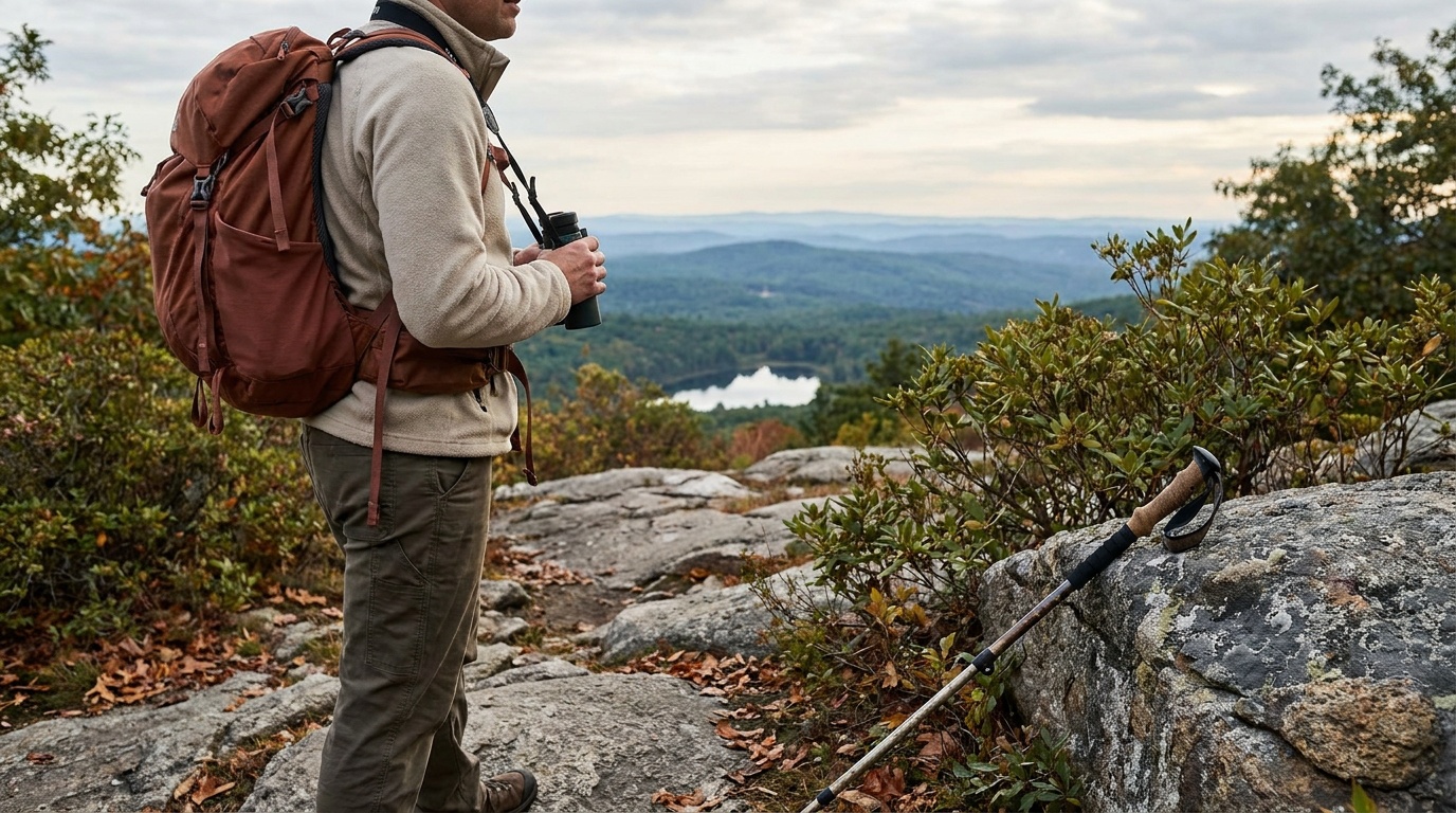
The best season: foliage peaks in mid-October and is visible across central Massachusetts from the summit. Hawk watchers gather on the summit from late August through October.
Pack Layers for the summit wind, binoculars for hawk migration counts, and early arrival on peak-foliage weekends when parking fills quickly.
Cold and often snowy, with the adjacent Wachusett Mountain Ski Area running lifts December through March when snow allows. Cross-country skiing and snowshoeing are possible on reservation trails.
Pack Insulation, waterproof layers, traction for icy trail sections, and a check on ski area conditions if combining trail hiking with resort skiing.
Summit climb with 360-degree views
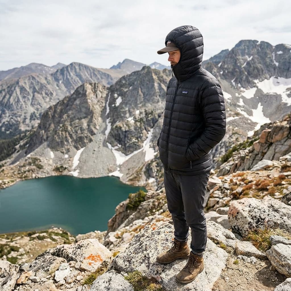
The 2,006-foot summit of Mount Wachusett offers clear-day views of the Boston skyline, Mount Monadnock in New Hampshire, the Berkshires to the west, and Mount Washington in New Hampshire. A summit road also allows car access when open.
Hawk watch at the summit (September through October)
The summit is one of the best inland hawk migration watch points in New England. Broad-winged hawks move through in September, sharp-shinneds and Cooper's hawks peak in October, and golden eagles are seen in November.
Midstate Trail traverse
The Midstate Trail, a 92-mile footpath crossing Massachusetts from New Hampshire to Rhode Island, passes through the reservation for 3.9 miles with some of the best ridge walking in central Massachusetts.
Winter skiing and cross-country trails
The adjacent Wachusett Mountain Ski Area offers the most vertical drop in eastern Massachusetts (about 1,000 feet). The reservation trails become cross-country and snowshoe routes when snowpack allows.
Put the access rule first: shuttle, parking, timed-entry, or reservation windows should decide the order of the day. For one day in Wachusett Mountain State Reservation, make Summit climb with 360-degree views the non-negotiable, add Hawk watch at the summit (September through October) only if the first stop runs clean, and keep Midstate Trail traverse as the flexible finish.
Turn Wachusett Mountain State Reservation's conditions into water, pack, and sleep-system decisions.
Build around conditions
Let season, elevation, and weather set the plan.
Plan your trip
3 quick tools, already seeded for Wachusett Mountain State Reservation. Tune the numbers around temperature swings, footing, layers, and how much margin the route needs.
Start with the gear decisions this park changes: footing, weather, camping, and water.
Kit Authority
Wachusett Mountain State Reservation packing list
0 of 15 packed. Check items as you pack, then take this list to the store, trailhead, or campsite.
Pack planning
Use this as a constraint check while you are still shaping the trip. The active checklist becomes useful once your route, dates, and sleep plan are set.
Checklist mode
15 items, grouped for the trip you are actually taking.
One researched pick
Reliable insulation is the highest-consequence gear decision when the trip includes winter exposure.
We may earn a commission from links on this page, at no extra cost to you.
THE COLD-WEATHER PICK
The Down Sweater Hoody packs 5.3 oz of 800-fill RDS down into a recycled-nylon ripstop shell, delivering above-average warmth-to-weight and a versatile fit that works as a midlayer or standalone piece down into the mid-20s. Patagonia's current iteration carries more fill than earlier versions for a meaningful warmth increase.
The buying guides that match what Wachusett Mountain State Reservation asks of your kit, with our current top picks across budget and use case.
Wachusett Mountain State Reservation has no camping. The town of Princeton, which borders the reservation, has a few inns and vacation rentals. The nearby Wachusett Mountain Ski Area has lodging packages through the resort. For state-park camping, Otter River State Forest in Baldwinville and Tolland State Forest in Otis are the nearest DCR campgrounds.
Camping reservations
The reservation is a day-use and recreational facility with no campground. For overnight stays near the mountain, Princeton has limited lodging and DCR camping is available at Otter River State Forest and Tolland State Forest.
Reviewed June 11, 2026
Booking window
Massachusetts DCR campground reservations are available online. Wachusett Mountain has no camping.
Where to book or verify
Trail maps, fees, summit road status, and current conditions.
Book DCR campgrounds at Otter River and other state forests near Wachusett.
Check for federal campground, backcountry, tour, and permit inventory tied to this park.
Campgrounds to know
Build the arrival around the reservation.
Entry windows, permit pickups, and drive time should be checked before the itinerary gets crowded.
Getting there
Arrival note
Wachusett Mountain State Reservation is in Princeton, Massachusetts, about 50 miles west of Boston.
Access note
Take Route 2 west to Route 31 south, or I-190 to Route 140 north, depending on your approach.
Car strategy
The main reservation entrance and the Wachusett Mountain Ski Area base lodge are off Mountain Road.
Pair this with lodging: choose the base that keeps the reservation or permit pickup from becoming the hardest part of the day.
Massachusetts permits shoot by shoot through towns and agencies; DCR issues the state parks photography and film permits, with a $1 million insurance requirement.
From our photography sister site, Aperture Authority. Verified 2026-07-01.
Yes. A paved summit road is open seasonally when conditions allow, typically from late spring through fall and on clear winter days. Check the reservation's Mass.gov page for current summit road status before visiting.
Yes. The 2,006-foot summit provides sweeping 360-degree views of fall color across central Massachusetts, and the hawk migration peaks simultaneously in October. Early to mid-October is the typical peak.
The adjacent Wachusett Mountain Ski Area is a private resort with about 1,000 feet of vertical drop, the most in eastern Massachusetts. It is separate from the state reservation. The reservation's own trails are used for cross-country skiing and snowshoeing when snowpack allows.
No. The reservation is day-use only. For camping near Princeton, Otter River State Forest about 25 miles north has reservable sites through the Massachusetts DCR system.