Rail trail · Maryland
Western Maryland Rail Trail
A 23-mile paved rail-trail through the Potomac River gorge in western Maryland, running alongside the historic C&O Canal and connecting to the Great Allegheny Passage for an iconic multi-trail route.
Length
23 miles
Surface
Paved
Route
Point to point
Endpoints
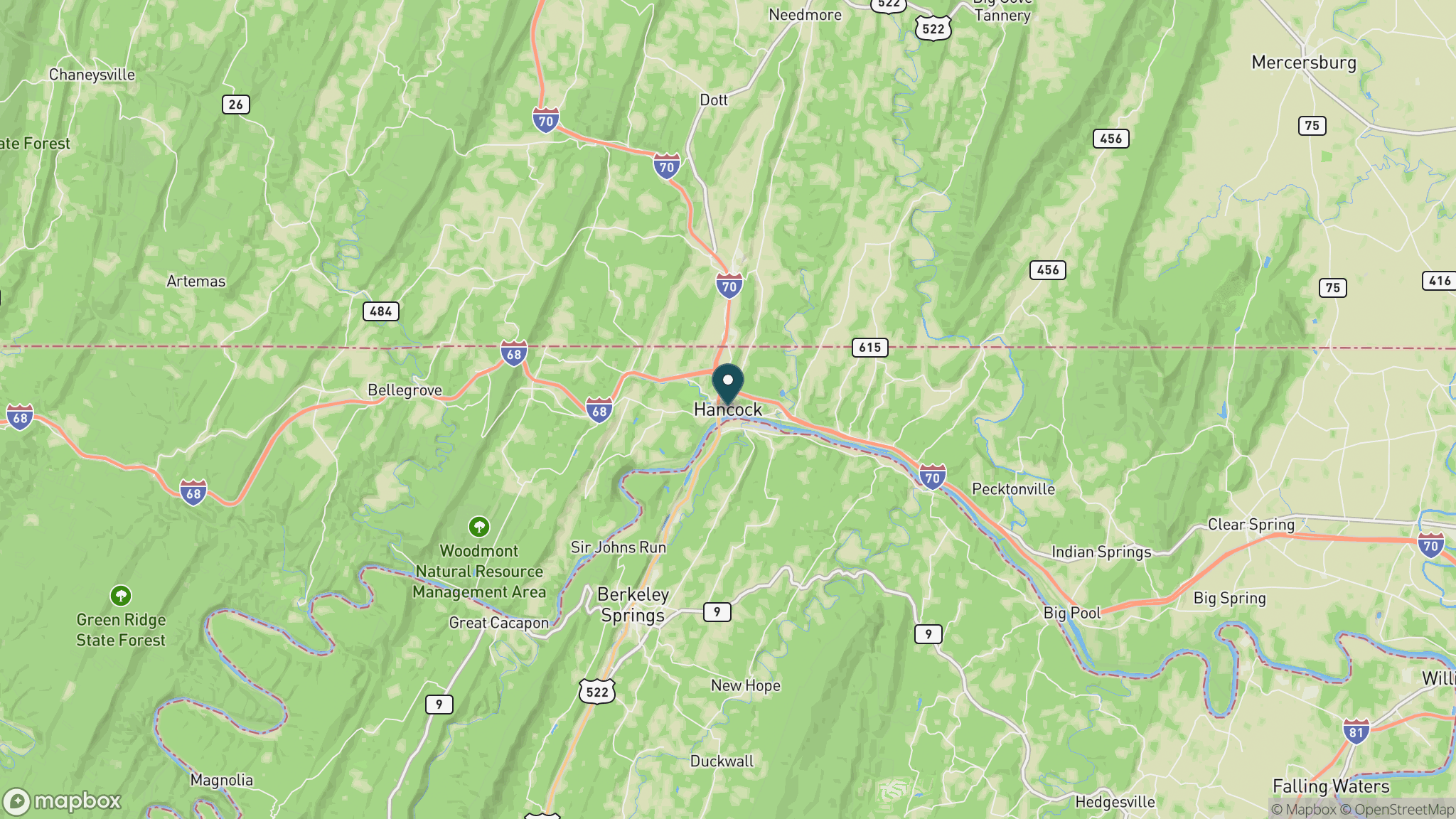
Hancock to Big Pool (Fort Frederick State Park area)
Season
Year-round; spring wildflowers and fall foliage are outstanding. Summer is warm but shaded in the gorge. Winter is cold but the paved surface stays passable when clear.
Plan your ride or walk
The Western Maryland Rail Trail follows the route of the Western Maryland Railway through one of the most scenic corridors in the mid-Atlantic: the narrow Potomac River gorge between Hancock and Fort Frederick State Park, where the river, the C&O Canal towpath, and the paved rail-trail all run within yards of each other. The 23-mile paved surface is smooth enough for road bikes, making it a strong choice for cyclists who want the view of the gorge and the C&O Canal without the packed-dirt conditions of the Canal towpath itself. The trail connects at Hancock to the Great Allegheny Passage, enabling a long multi-day route from Washington, D.C., all the way to Pittsburgh. Wildlife along the gorge includes bald eagles, great blue herons, and river otters, and the limestone cliffs and old-growth tree canopy make it one of the most visually dramatic rail corridors in the eastern United States.
Getting there
The eastern trailhead is in Hancock, Maryland, about 1.5 hours west of Baltimore and 2 hours from Washington, D.C., just off I-70. The western end is near Big Pool / Fort Frederick State Park. Trailheads with parking are in Hancock and at several road crossings including Little Orleans.
Official trail information
Confirm current conditions, closures, and any required trail pass on the managing agency’s page.
Maryland DNR: Western Maryland Rail TrailWhat to bring
Gear keyed to a long, flat trail day: footwear, hydration, sun protection, and a pack sized for the distance.
Frequently asked questions
How does the Western Maryland Rail Trail connect to the C&O Canal?
The Western Maryland Rail Trail runs parallel to the C&O Canal towpath through much of the Potomac River gorge, often within sight of each other. Both connect at Hancock, where the C&O Canal towpath continues east toward Washington, D.C., and west toward Cumberland, where it meets the Great Allegheny Passage.
Is the Western Maryland Rail Trail paved?
Yes, the entire 23-mile trail is paved, making it suitable for road bikes, hybrid bikes, walking, and running. The smooth asphalt surface is a contrast to the packed-dirt C&O Canal towpath nearby.
Can you bike from Washington, D.C., to Pittsburgh using this trail?
Yes. The C&O Canal towpath runs 184.5 miles from Georgetown in Washington, D.C., to Cumberland, Maryland. At Cumberland, the Great Allegheny Passage (GAP) continues 150 miles to Pittsburgh. The Western Maryland Rail Trail forms a paved alternative segment within that route.
Are there services along the Western Maryland Rail Trail?
Limited services are available in Hancock at the eastern end. Little Orleans, roughly midway, has a small store and campground. Fort Frederick State Park at the western end has restrooms and picnic facilities. Bring water for the full length.
More Maryland trails
Looking for parks instead? Browse state parks by state.