Rail trail · Maryland
Torrey C. Brown Rail Trail
A 19.7-mile crushed-stone trail following the former Northern Central Railway through northern Baltimore County, connecting historic small communities from Ashland to the Pennsylvania border.
Length
19.7 miles
Surface
Crushed stone
Route
Point to point
Endpoints
Ashland to the Maryland-Pennsylvania border
Season
Open year-round, sunrise to sunset; spring and fall are most popular, with colorful foliage in October and wildflowers in May
Plan your ride or walk
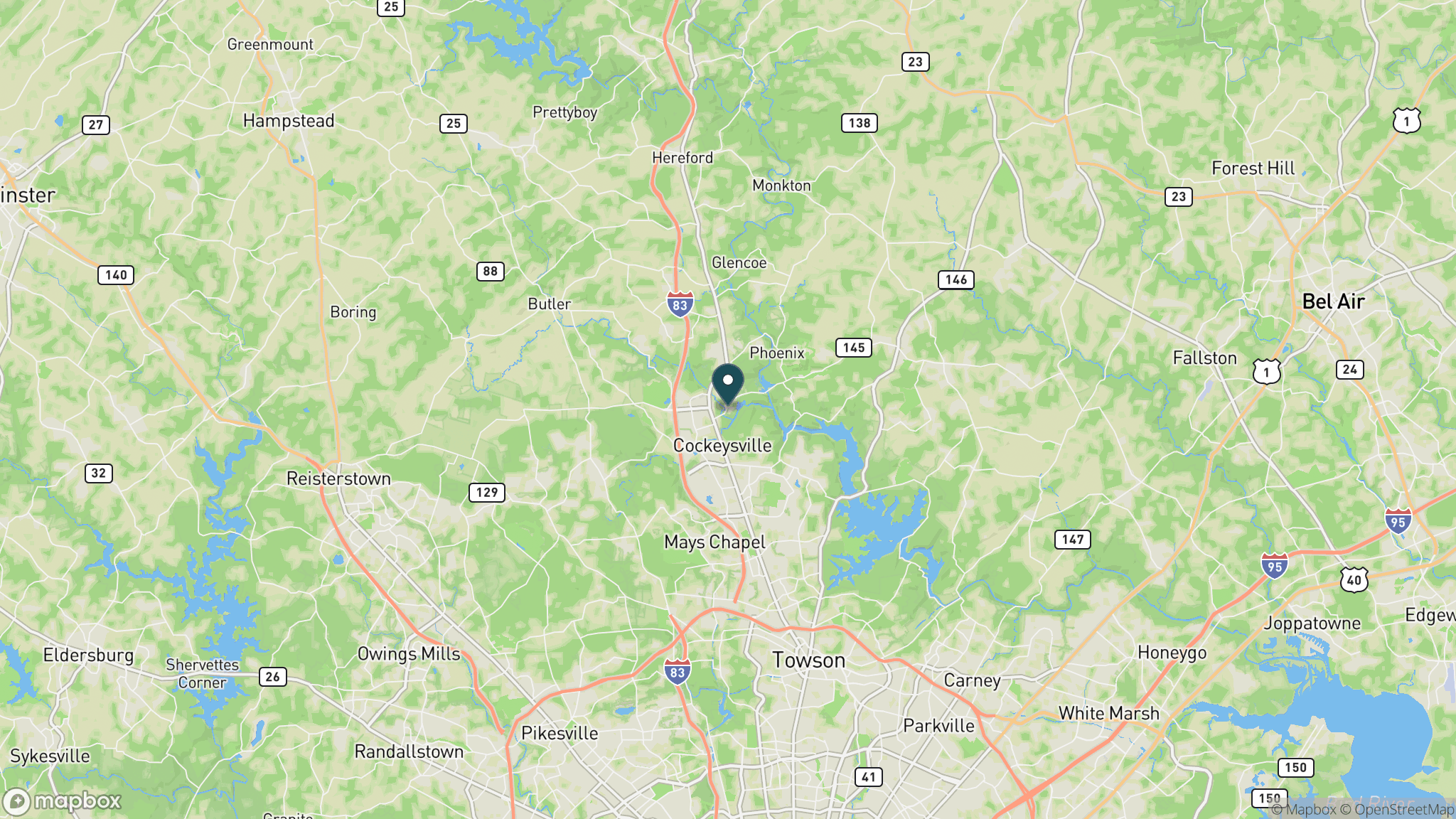
The Torrey C. Brown Rail Trail, part of Gunpowder Falls State Park, follows 19.7 miles of the former Northern Central Railway corridor from the community of Ashland in Baltimore County north to the Maryland-Pennsylvania line. The trail is ADA accessible and allows hikers, joggers, cyclists, and horseback riders, passing through historic communities including Monkton, where a restored station building serves as a local landmark. The Gunpowder Falls river runs alongside much of the route, offering fishing access and a refreshing soundtrack. Class 1 electric bicycles are permitted. The trail continues into Pennsylvania as the Heritage Rail Trail County Park, making longer rides possible for those willing to cross the state line. Hours are sunrise to sunset; the ranger station is at Monkton.
Getting there
The southern trailhead is in Ashland, off Ashland Road, about 20 miles north of downtown Baltimore via I-83. The Monkton Ranger Station at 1820 Monkton Road is a popular mid-trail access point with parking. Additional trailheads are at Phoenix, White Hall, Bentley Springs, and Freeland near the Pennsylvania border.
Official trail information
Confirm current conditions, closures, and any required trail pass on the managing agency’s page.
Maryland DNR: Torrey C. Brown Rail TrailWhat to bring
Gear keyed to a long, flat trail day: footwear, hydration, sun protection, and a pack sized for the distance.
What to pack
Plan with our tools
Frequently asked questions
How long is the Torrey C. Brown Rail Trail?
The trail runs 19.7 miles from Ashland in Baltimore County to the Maryland-Pennsylvania border. It continues north as the Heritage Rail Trail County Park in Pennsylvania, so end-to-end riders can cover considerably more distance on the same corridor.
What is the surface of the Torrey C. Brown Rail Trail?
The trail is surfaced in crushed stone throughout, suitable for hybrid bikes, gravel bikes, and comfortable walking. It is nearly flat as a former rail corridor and is ADA accessible.
Can you fish along the Torrey C. Brown Rail Trail?
Yes. The Gunpowder Falls river parallels much of the trail, and anglers frequently access the stream from the trailhead at Monkton and other points along the route. A Maryland fishing license is required.
Is there a fee to use the Torrey C. Brown Rail Trail?
There is no per-use fee. The trail is managed as part of Gunpowder Falls State Park. Parking is available at multiple trailheads at no charge. The ranger station at Monkton is staffed Monday through Friday, 8 a.m. to 4 p.m.
More Maryland trails
Looking for parks instead? Browse state parks by state.