Rail trail · Florida
Palatka-to-St. Augustine State Trail
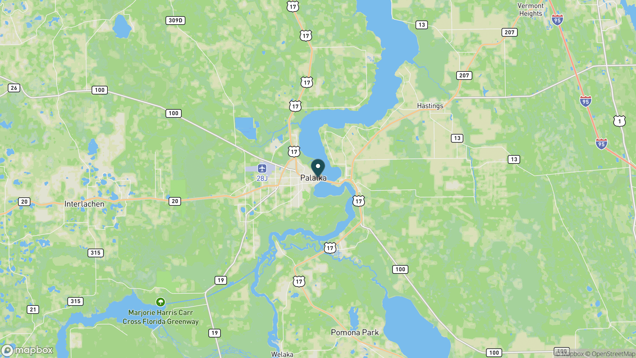
A 19-mile paved rail-trail linking Putnam and St. Johns counties through agricultural landscapes and small historic communities, forming a key segment of the 260-mile St. Johns River to Sea Loop.
Length
19 miles
Surface
Paved
Route
Point to point
Endpoints
Palatka (East River Road Trailhead) to Vermont Blvd. area near St. Augustine
Season
Open year-round, 8 a.m. to sunset; fall through spring offers the most comfortable temperatures
Plan your ride or walk
This 12-foot-wide, 19-mile paved trail follows an abandoned railway corridor through St. Johns and Putnam counties, passing through the small communities of East Palatka, Hastings, Armstrong, Elkton, and Vermont Heights. Multiple trailheads with restrooms and parking are spaced along the route. The eastern trailheads in St. Johns County are the most popular starting points; heading west toward Palatka puts you at the halfway point for a 34 to 35-mile round trip. Palatka is a designated Florida Trail Town with amenities. The trail is part of the St. Johns River to Sea Loop, a 260-mile multi-use network on the east coast of Florida. No admission fee is required. Use caution at U.S. 207 crossings where signals are provided.
Getting there
The most convenient eastern access is Vermont Heights Trailhead in St. Johns County, which has parking and restrooms. Armstrong Park (St. Johns County) offers restrooms, parking, and a picnic area 5 miles from the eastern end. The western terminus in Putnam County is reached via East River Road off U.S. 207. The trail address anchor is State Road 207, Elkton, FL 32033; contact Ravine Gardens State Park at 386-329-3721 for more information.
Official trail information
Confirm current conditions, closures, and any required trail pass on the managing agency’s page.
Florida State Parks: Palatka-to-St. Augustine State TrailWhat to bring
Gear keyed to a long, flat trail day: footwear, hydration, sun protection, and a pack sized for the distance.
Frequently asked questions
How long is the Palatka-to-St. Augustine State Trail?
The trail is 19 miles one way, point to point. A full out-and-back from the eastern end is about 35 miles round trip.
Is there a fee?
No. The trail is free to use and open every day from 8 a.m. to sunset.
Is the trail paved?
Yes, the entire 19-mile corridor is 12 feet wide and paved with asphalt.
Which direction is better to start?
Most users start at the eastern trailheads in St. Johns County (Vermont Heights or Armstrong Park) because of ample parking and the opportunity to visit the Florida Trail Town of Palatka at the far western end. Heading west to east works equally well.
More Florida trails
Looking for parks instead? Browse state parks by state.