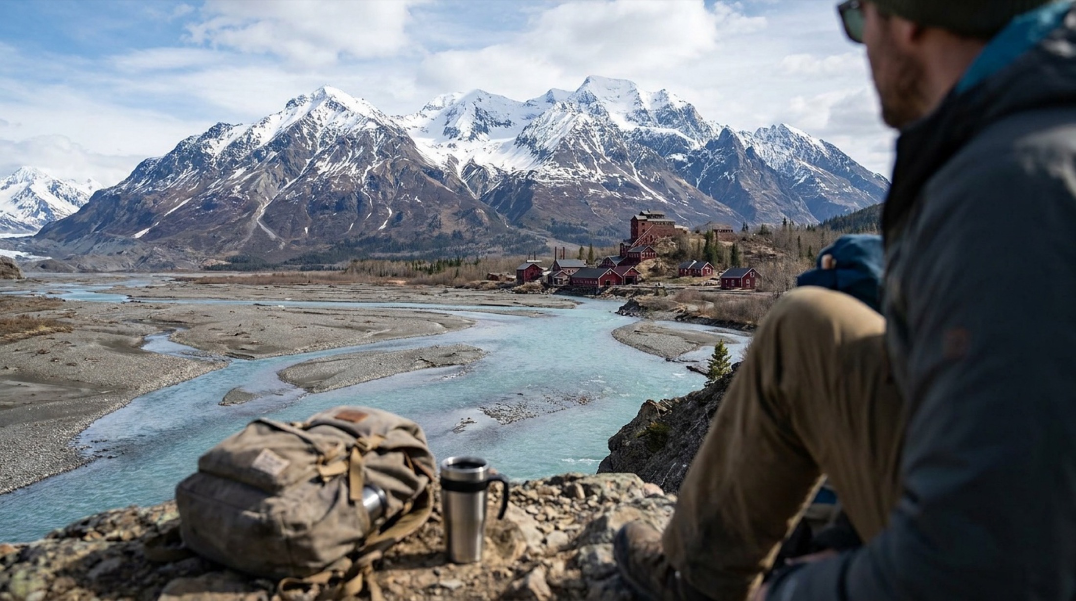
Skip to content
KITAUTHORITY
Glaciated peaks above a braided river valley with the historic Kennecott mill buildings at Wrangell-St. Elias.

National Park · Alaska

Wrangell-St. Elias

The largest national park in the U.S., a 13-million-acre wilderness of giant peaks, glaciers, and a ghost-town copper mine.

Historic red Kennecott Mill Town buildings with mountains behind them

Field briefing

Wrangell-St. Elias starts with access, not mileage.

Before you go

Wrangell-St.

Elias is the biggest national park in the country, a roadless ocean of mountains, glaciers, and tundra where the towns of McCarthy and Kennecott sit at the end of a long gravel road. Go in summer (June through August) when the McCarthy Road is open, daylight is endless, and you can hike out onto Root Glacier or tour the old copper mill. This is remote, self-reliant country, so come ready for cool wet weather and bring a solid rain shell, sturdy waterproof boots, warm layers, a bug headnet, and microspikes if you plan to walk on ice. There is no entrance fee and no reservation needed, but services are minimal, so plan fuel, food, and time carefully.

Best window
June through August
Signature routes
Kennecott Mines National Historic Landmark, Root Glacier Trail
Pack focus
Water, weather checks, layers

The landmarks worth the trip. Tap any photo to enlarge.

Location
Alaska
Established
December 2, 1980
Size
13.2M acres
Visitors
82k / year
Best time
June through August
Entrance
Free. No entrance fee and no timed-entry reservation.
Nearest airport
Ted Stevens Anchorage International (ANC), roughly a 7-8 hour, 300-plus mile drive to the McCarthy Road end; small bush flights connect Chitina and McCarthy

When to go

Conditions, crowds, and what each season asks you to pack.

Spring

Low crowds

Highs from the 30s into the 50s F, with mud, lingering snow, and rough road conditions as things thaw.

Pack Waterproof boots, layers, and patience for muddy gravel roads.

Summer

Moderate crowds

Highs in the 60s to low 70s F, long daylight, cool nights, and frequent rain.

Pack Rain shell, bug headnet, sturdy boots, and microspikes for glacier walks.

Fall

Low crowds

Highs in the 40s and 50s F, brilliant tundra color, and the first snows by late September.

Pack Warm insulating layers, gloves, and a windproof jacket.

Winter

50F

Low crowds

Bitter cold with interior lows that can reach -50F, deep snow, and very short days.

Pack Expedition-grade insulation, traction, and full cold-weather survival gear.

Backpackers sitting in alpine meadow below snowy Mentasta Mountains

Top things to do

Historic red Kennecott Mill Town buildings with mountains behind them

Kennecott Mines National Historic Landmark

Easy

A preserved early-1900s copper mill town with towering red buildings you can tour.

Root Glacier terrain below Porphyry Mountain in Wrangell-St. Elias

Root Glacier Trail

4 mi round tripModerate

An accessible hike from Kennecott out onto a real glacier, ideal with a guide and microspikes.

Icy Bay and Mount St. Elias with glaciers meeting the ocean

Mount St. Elias

At 18,008 feet, the second-tallest peak in the U.S., rising almost straight from the sea.

Snow-covered Wrangell Mountains rising above dense forest

Mount Wrangell

A massive active volcano with an ice-filled summit caldera, visible across the western park.

The Kuskulana Bridge on the McCarthy Road

McCarthy Road and Kuskulana Bridge

60 mi gravel road

A rugged 60-mile gravel route to the heart of the park, crossing a dramatic old railroad trestle.

How long to spend

Anchor the day around Kennecott Mines National Historic Landmark

Treat transport weather as part of the itinerary, with a real buffer day instead of a tight turnaround. For one day in Wrangell-St. Elias, make Kennecott Mines National Historic Landmark the non-negotiable, add Root Glacier Trail only if the first stop runs clean, and keep Mount St. Elias as the flexible finish.

  1. 1Start with Kennecott Mines National Historic Landmark: A preserved early-1900s copper mill town with towering red buildings you can tour.
  2. 2Add Root Glacier Trail: An accessible hike from Kennecott out onto a real glacier, ideal with a guide and microspikes.
  3. 3Use Mount St. Elias as the optional finish, not as a reason to rush the whole day.

Plan your trip

Turn Wrangell-St. Elias's conditions into water, pack, and sleep-system decisions.

Root Glacier terrain below Porphyry Mountain in Wrangell-St. Elias

Build around access

Plan the transfer before the trail list.

Plan your trip

4 quick tools, already seeded for Wrangell-St. Elias. Tune the route, pack weight, weather margin, and overnight setup after the access plan is real.

  1. 01Size your water for a cool day on the trail
  2. 02Dial in your pack base weight before you load up
  3. 03Find the pack size a multi-day trip here needs
  4. 04Check you will sleep warm down to about 50F

What to pack

Start with the gear decisions Wrangell-St. Elias changes: water, footing, weather, and overnight needs. The checklist is there once your route and dates are set.

Pack planning

Decide what Wrangell-St. Elias asks of your kit before you start checking boxes.

Use this as a constraint check while you are still shaping the trip. The active checklist becomes useful once your route, dates, and sleep plan are set.

  • First constraintHydration and exposureWater, hat, sunscreen, sunglasses, Navigationmap, downloaded GPS, or a GPS watch, 3 more
  • Route realityFooting and tractionHiking boots, Hiking socks, Trekking poles
  • Load choicePack and carry systemBackpacking pack
  • If overnightSleep and shelterBackpacking tent, Sleeping bag, Sleeping pad, 1 more

Checklist mode

22 items, grouped for the trip you are actually taking.

  1. Dates and season are set.
  2. Primary route, campground, or lodge is chosen.
  3. Water, footwear, and overnight needs are sized.

Gear for Wrangell-St. Elias

The buying guides that match what Wrangell-St. Elias asks of your kit. Each one has our current top picks across budget and use case.

Where to stay

Historic red Kennecott Mill Town buildings with mountains behind them

Stay strategy

Sleep where the first morning stays simple.

Stay strategy

Base in McCarthy or Kennecott only if you accept the road, or fly in.

Wrangell-St. Elias is an access decision disguised as a lodging decision. McCarthy and Kennecott put you near the mill town and Root Glacier, Copper Center and Glennallen are staging bases, and the deep backcountry usually begins with a bush plane.

Main route
McCarthy Road, about 60 miles of gravel from Chitina
Drive time
Chitina to McCarthy area often takes 2 to 3 hours
NPS camping
No typical road-accessible developed campgrounds
Deep access
Bush planes are common for backcountry routes

Compare base options

Compare each base by the first morning: where you park, what you ride, and how many decisions happen before the trail or viewpoint.

Historic red Kennecott Mill Town buildings with mountains behind them

Historic core

McCarthy and Kennecott

McCarthy Road guide
Best for
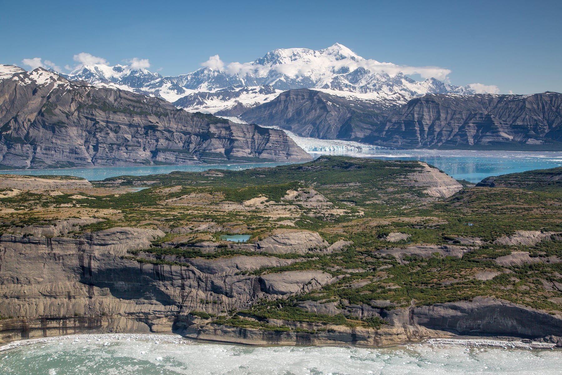
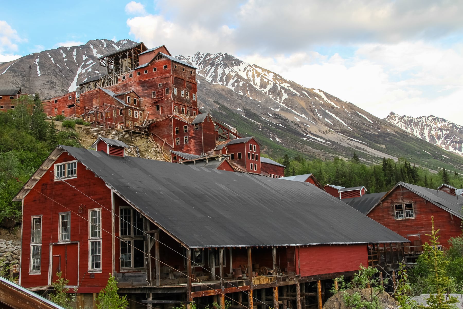
Kennecott Mines, Root Glacier, guided glacier walks, and the classic first visit
Tradeoff
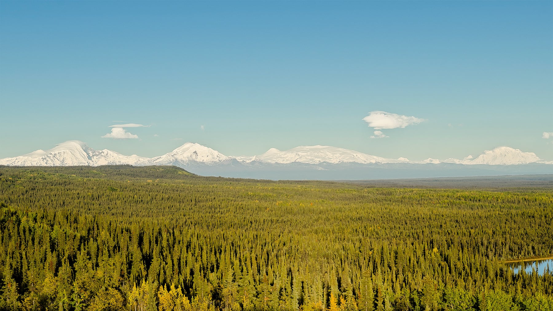
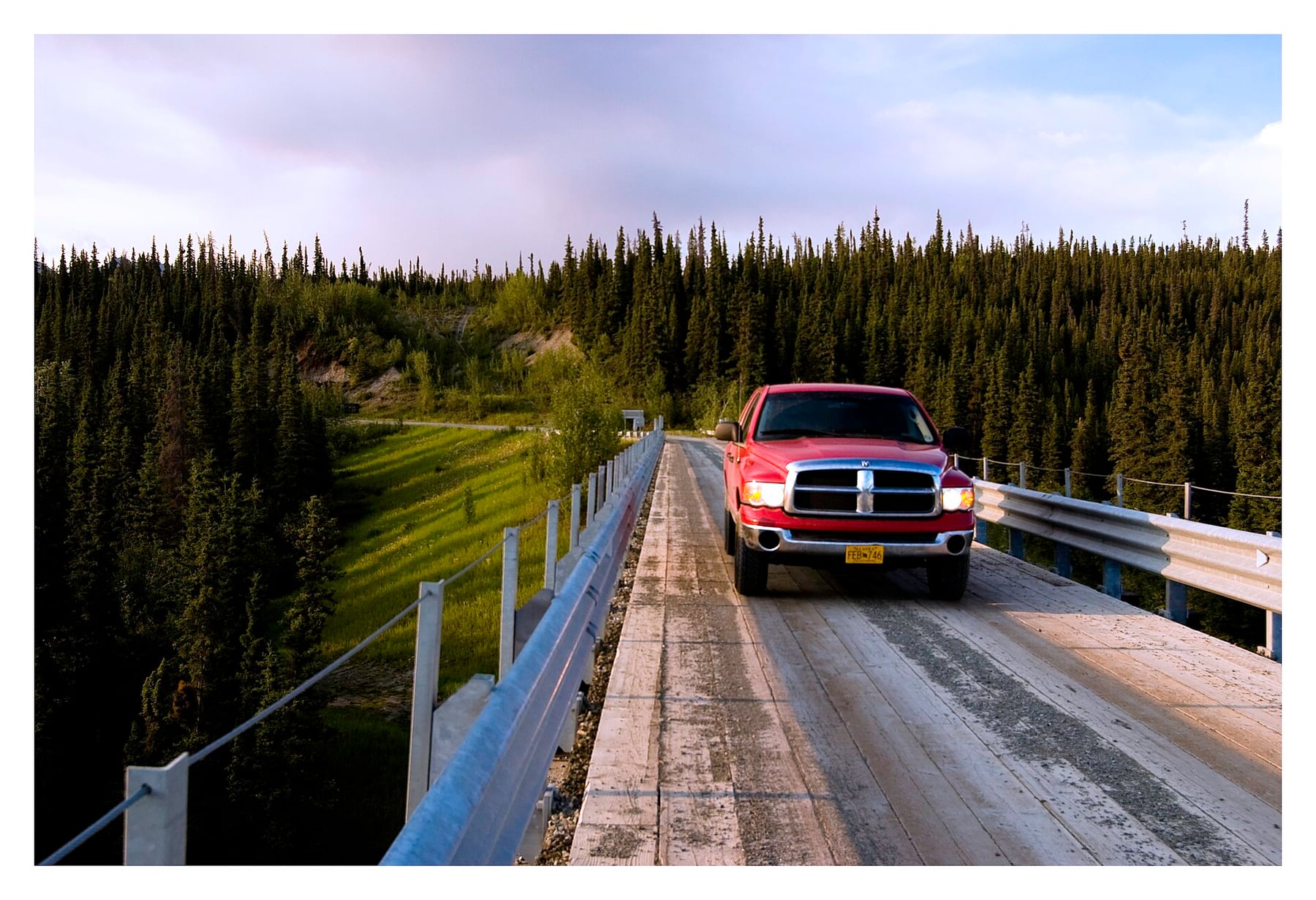
The gravel road, footbridge logistics, and limited services require patience.
Planning detail

This is the right base when the trip is about Kennecott and Root Glacier. Arrive with fuel, food, a tire plan, and realistic expectations for a slow road.

Copper Center Visitor Center at Wrangell-St. Elias

Staging towns

Copper Center, Glennallen, or Chitina

Best for
Fuel, groceries, first-night staging, and travelers not ready for the full gravel push
Tradeoff
Too far from Kennecott for a relaxed daily commute.
Planning detail

Use these towns to stock up, visit the Copper Center side, or break the long Anchorage drive. They are not a substitute for staying near McCarthy if Root Glacier is the priority.

Backpackers sitting in alpine meadow below snowy Mentasta Mountains

Fly-in wilderness

Bush-plane supported backcountry

Backcountry details
Best for
Experienced wilderness travelers, glacier routes, and remote alpine basins
Tradeoff
Weather, river crossings, glacier hazards, and pilot coordination drive the itinerary.
Planning detail

This is the big-park version of Wrangell-St. Elias, and it demands real Alaska systems. Plan with flight operators, carry conservative gear, and leave schedule slack.

The Kuskulana Bridge on the McCarthy Road

Private camp

McCarthy-area private campgrounds

Best for
Lower-cost access to the Kennecott corridor with a vehicle-based setup
Tradeoff
Facilities vary, and you still need to manage the footbridge or shuttle logistics.
Planning detail

Private camping near the end of the road can be the best value for the historic core. Confirm access rules and services before you commit.

Road day

Treat the McCarthy Road as an activity, not a normal transfer.

Gear bias

Bring layers, rain gear, and tire confidence before worrying about optional luxury items.

Camping reservations

Camping reservations

Camping reservations for Wrangell-St. Elias

Campground systems change by season and sometimes by individual campground. Start with the official park camping page, then confirm open dates, reservation windows, and permit rules before booking.

Reviewed June 6, 2026

Booking window

Check the official park camping page before choosing dates.

  • Use the official park page as the source of truth for campground status, seasonal closures, and first-come rules.
  • Many federal campsite, backcountry, tour, and permit reservations are handled through Recreation.gov, but not every park uses the same system.

Where to book or verify

Official NPS camping page

Use this first for current campground status and park-specific rules.

Search Recreation.gov

Check for federal campground, backcountry, tour, and permit inventory tied to this park.

Permits and reservations

Use this for wilderness permits, timed systems, tours, and other park-specific reservations.

Getting there and practical info

Backpackers sitting in alpine meadow below snowy Mentasta Mountains

Make the transfer plan before the trail plan.

Weather windows, boat schedules, flight buffers, and backup days shape what is realistic.

Getting there

Get to Wrangell-St. Elias by solving the transfer first.

Nearest airport
Ted Stevens Anchorage International (ANC), roughly a 7-8 hour, 300-plus mile drive to the McCarthy Road end; small bush flights connect Chitina and McCarthy
Access rhythm
Plan the last mile
Region
Alaska
  1. Car strategy

    From Anchorage it is roughly a 7 to 8 hour drive of more than 300 miles: take the Glenn Highway to Glennallen, then the Richardson Highway south to Chitina, where the pavement ends.

  2. Car strategy

    From Chitina the McCarthy Road runs about 60 miles of gravel to the Kennicott River footbridge near McCarthy, a slow 2 to 3 hour drive.

  3. Car strategy

    The separate Nabesna Road enters the park's north side off the Tok Cutoff.

Pair this with lodging: the best base is the one that protects the departure window, pickup point, or weather buffer.

LocationAlaska, beyond the continental map

Frequently asked questions

Do I need a reservation or pay an entrance fee for Wrangell-St. Elias?

No. Wrangell-St. Elias charges no entrance fee and requires no timed-entry reservation. You can drive in or fly in whenever access roads are open. Keep in mind that guided trips, flightseeing, and lodging in McCarthy and Kennecott do cost money and often book up in summer.

What is the best time of year to visit Wrangell-St. Elias?

Summer, roughly June through August, is the best window. The McCarthy Road is open and drier, daylight is very long, and guided glacier hikes and tours of the Kennecott mill run on full schedules. Expect cool, often rainy weather and pack a rain shell and warm layers even in July.

How hard is it to get to McCarthy and Kennecott?

It takes effort. From Anchorage it is a 7 to 8 hour drive, ending with about 60 miles of gravel on the McCarthy Road. You park near the Kennicott River and cross a footbridge into McCarthy, then take a shuttle or hike the last few miles to Kennecott. Drivers who want to avoid the gravel can fly between Chitina and McCarthy on small air services.

Can I actually walk on a glacier here?

Yes. The Root Glacier Trail from Kennecott leads to the edge of Root Glacier, and you can walk on the ice. Going with a local guide and wearing microspikes is strongly recommended, since glacier surfaces have crevasses and meltwater channels that are dangerous to cross unprepared.

Keep planning