Skip to content
KITAUTHORITY
The North Fork of the Koyukuk River winding through the Brooks Range between the steep peaks of Frigid Crags and Boreal Mountain, the namesake "gates" of Gates of the Arctic National Park and Preserve, Alaska, seen from the summit of Eroded Mountain.

National Park · Alaska

Gates of the Arctic

The least-visited U.S. national park: 8.4 million roadless, trailless acres of Brooks Range wilderness you reach only by bush plane.

Cacophony via Wikimedia Commons (CC BY-SA 3.0)
A float plane on Takahula Lake in Brooks Range wilderness

Field briefing

Gates of the Arctic starts with access, not mileage.

Before you go

Gates of the Arctic is the wildest national park in the country: 8.4 million acres above the Arctic Circle with no roads, no trails, no campgrounds, and no cell service.

You go in summer (mid-June through August) because that is the only stretch when the tundra is travelable and the rivers are open, and even then you commit to a multi-day, fully self-supported trip reached by bush plane. Pack like an expedition: a four-season-capable shelter, a warm sleep system, river-crossing footwear, a head net for the mosquitoes, a bear-resistant food container (free to borrow at park visitor centers), and a satellite communicator. This is a backpacking, packrafting, and wildlife trip for experienced, self-reliant travelers, not a drive-up park.

Best window
Mid-June through August, when the tundra is dry enough to travel and daylight runs nearly around the clock
Signature routes
Arrigetch Peaks, Alatna River
Pack focus
Water, weather checks, layers

The landmarks worth the trip. Tap any photo to enlarge.

Location
Alaska
Established
December 2, 1980
Size
8.5M acres
Visitors
12k / year
Best time
Mid-June through August, when the tundra is dry enough to travel and daylight runs nearly around the clock
Entrance
No entrance fee. The real cost is the bush flight in, typically $1,500 to $3,500 per trip depending on drop-off and group size.
Nearest airport
Fairbanks International (FAI), then a small-plane hop to a gateway like Bettles or Coldfoot

When to go

Conditions, crowds, and what each season asks you to pack.

Spring

Low crowds

Cold and snowbound into May, with highs from the 20s to low 40s F and rivers still locked in ice.

Pack Full winter and shoulder-season layering; this is still snow travel, not hiking.

Summer

Low crowds

The short usable window. Highs in the 60s to low 70s F, near 24-hour daylight, and relentless mosquitoes.

Pack Head net and strong bug protection, river-crossing footwear, and a reliable shelter.

Fall

Low crowds

Brief and beautiful. Tundra turns gold in late August, highs drop into the 30s and 40s F, first snow arrives by September.

Pack Cold-rated sleep system and waterproof layers; weather can turn to winter overnight.

Winter

Low crowds

Deep Arctic cold and darkness, with highs often below 0 F and far colder lows. Expert-only travel.

Pack Expedition cold-weather gear, a satellite communicator, and genuine winter expedition experience.

The granite spires of the Arrigetch Peaks in Gates of the Arctic

Top things to do

The granite spires of the Arrigetch Peaks in Gates of the Arctic

Arrigetch Peaks

A cluster of sheer granite spires that draws backpackers and climbers for multi-day off-trail routes.

A remote Brooks Range river valley in Gates of the Arctic

Alatna River

A classic float trip; paddlers fly in, drift through the heart of the Brooks Range, and take out by plane.

Mount Doonerak above the North Fork of the Koyukuk River

Mount Doonerak

A striking peak near the park's namesake Gates, the twin mountains Bob Marshall named Frigid Crags and Boreal Mountain.

Open tundra and mountain country near the Noatak River headwaters

Noatak River headwaters

Wide-open tundra valleys and one of the longest undammed wild rivers in the country.

Anaktuvuk Pass village and tundra ridges seen from the air

Anaktuvuk Pass

A Nunamiut Inupiat village inside the park boundary and the only community with scheduled air service.

How long to spend

Anchor the day around Arrigetch Peaks

Treat transport weather as part of the itinerary, with a real buffer day instead of a tight turnaround. For one day in Gates of the Arctic, make Arrigetch Peaks the non-negotiable, add Alatna River only if the first stop runs clean, and keep Mount Doonerak as the flexible finish.

  1. 1Start with Arrigetch Peaks: A cluster of sheer granite spires that draws backpackers and climbers for multi-day off-trail routes.
  2. 2Add Alatna River: A classic float trip; paddlers fly in, drift through the heart of the Brooks Range, and take out by plane.
  3. 3Use Mount Doonerak as the optional finish, not as a reason to rush the whole day.

Plan your trip

Turn Gates of the Arctic's conditions into water, pack, and sleep-system decisions.

Mount Doonerak above the North Fork of the Koyukuk River

Build around access

Plan the transfer before the trail list.

Plan your trip

4 quick tools, already seeded for Gates of the Arctic. Tune the route, pack weight, weather margin, and overnight setup after the access plan is real.

  1. 01Size your water for a mild day on the trail
  2. 02Dial in your pack base weight before you load up
  3. 03Find the pack size a multi-day trip here needs
  4. 04Check you will sleep warm down to about 30F

What to pack

Start with the gear decisions Gates of the Arctic changes: water, footing, weather, and overnight needs. The checklist is there once your route and dates are set.

Pack planning

Decide what Gates of the Arctic asks of your kit before you start checking boxes.

Use this as a constraint check while you are still shaping the trip. The active checklist becomes useful once your route, dates, and sleep plan are set.

  • First constraintHydration and exposureWater, hat, sunscreen, sunglasses, Navigationmap, downloaded GPS, or a GPS watch, 3 more
  • Route realityFooting and tractionHiking boots, Hiking socks, Trekking poles
  • Load choicePack and carry systemBackpacking pack
  • If overnightSleep and shelterBackpacking tent, Sleeping bag, Sleeping pad, 1 more

Checklist mode

21 items, grouped for the trip you are actually taking.

  1. Dates and season are set.
  2. Primary route, campground, or lodge is chosen.
  3. Water, footwear, and overnight needs are sized.

Gear for Gates of the Arctic

The buying guides that match what Gates of the Arctic asks of your kit. Each one has our current top picks across budget and use case.

Where to stay

A float plane on Takahula Lake in Brooks Range wilderness

Stay strategy

Make the access plan before the lodging plan.

Stay strategy

Plan the flight chain before you plan the route.

Gates of the Arctic has no roads, trails, lodges, campgrounds, or services inside the park. The stay plan is really an access plan: Fairbanks for buffers, Bettles or Coldfoot for staging, then fully self-supported backcountry camping after an air-taxi drop.

Park services
No lodging, campgrounds, roads, trails, or cell service
Entry fee
No entrance fee
Real cost
Bush flights commonly drive the trip budget
Ranger step
Backcountry orientation and bear-resistant food storage are strongly recommended

Compare base options

Read these as access plans first. The right base is the one that makes the transfer reliable, then the room or campsite can follow.

A float plane on Takahula Lake in Brooks Range wilderness

Buffer base

Fairbanks

Directions
Best for
Arrival nights, weather delays, gear checks, and post-trip recovery
Tradeoff
It is not the park gateway itself, just the practical flight hub.
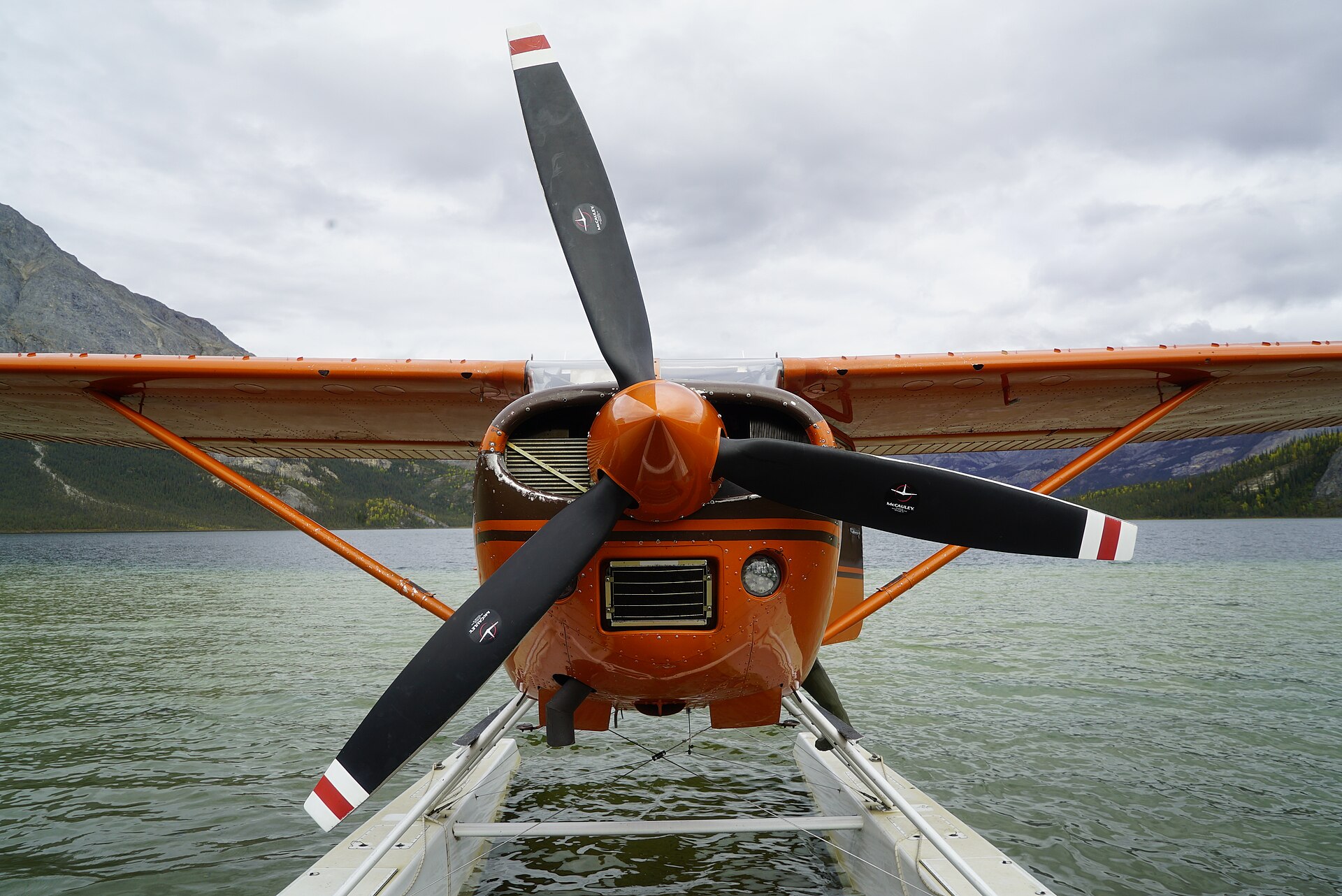
Planning detail

Most trips should book Fairbanks nights on both ends. Arctic weather can ground planes, so same-day onward flights are a fragile plan.

A remote Brooks Range river valley in Gates of the Arctic

Air-taxi stage

Bettles

Best for
Fly-in backpacking, paddling, and outfitted trips into the central Brooks Range
Tradeoff
Limited beds and weather-dependent flight schedules.
Planning detail

Bettles is the common staging point for trips that need an air taxi into lakes, gravel bars, and river corridors inside the park.

Mount Doonerak above the North Fork of the Koyukuk River

Dalton side

Coldfoot or Wiseman

Best for
Dalton Highway logistics, guided trips, and northern Brooks Range approaches
Tradeoff
Still roadless into the park proper unless you are an expert walking in from the corridor.
Planning detail

Use this side when the route, outfitter, or flight operator is tied to the Dalton Highway rather than Bettles.

The granite spires of the Arrigetch Peaks in Gates of the Arctic

Inside the park

Camp where your route and landing zone allow

Backcountry details
Best for
Experienced, self-reliant backpackers, packrafters, and paddlers
Tradeoff
No maintained trail, no rescue infrastructure, and no easy exit if the weather turns.
Planning detail

Once dropped off, your shelter, food storage, navigation, river crossings, and pickup timing are the trip. Treat this as expedition planning, not campground planning.

Weather buffer

Build spare days on both sides of the park segment before buying fixed onward flights.

Bug season

For mid-summer trips, a head net belongs on the core gear list, not in the maybe pile.

Camping reservations

Camping reservations

Camping reservations for Gates of the Arctic

Campground systems change by season and sometimes by individual campground. Start with the official park camping page, then confirm open dates, reservation windows, and permit rules before booking.

Reviewed June 6, 2026

Booking window

Check the official park camping page before choosing dates.

  • Use the official park page as the source of truth for campground status, seasonal closures, and first-come rules.
  • Many federal campsite, backcountry, tour, and permit reservations are handled through Recreation.gov, but not every park uses the same system.

Where to book or verify

Official NPS camping page

Use this first for current campground status and park-specific rules.

Search Recreation.gov

Check for federal campground, backcountry, tour, and permit inventory tied to this park.

Permits and reservations

Use this for wilderness permits, timed systems, tours, and other park-specific reservations.

Getting there and practical info

The granite spires of the Arrigetch Peaks in Gates of the Arctic

Make the transfer plan before the trail plan.

Weather windows, boat schedules, flight buffers, and backup days shape what is realistic.

Getting there

Get to Gates of the Arctic by solving the transfer first.

Nearest airport
Fairbanks International (FAI), then a small-plane hop to a gateway like Bettles or Coldfoot
Access rhythm
Transfer time matters
Region
Alaska
  1. Fly in

    Fly to Fairbanks International, then take a scheduled small-plane flight to a gateway such as Bettles or Coldfoot.

  2. Transfer plan

    From there an air taxi on floats or tundra tires drops you at a lake or gravel bar inside the park, and picks you up on an arranged date.

  3. Car strategy

    There are no roads or maintained trails into the park.

Pair this with lodging: the best base is the one that protects the departure window, pickup point, or weather buffer.

LocationAlaska, beyond the continental map

Frequently asked questions

Why is Gates of the Arctic the least-visited national park?

It is the most remote park in the system, sitting entirely north of the Arctic Circle with no roads, no trails, and no facilities. The only practical way in is a chartered bush plane, which usually costs $1,500 to $3,500, so it drew only about 11,900 recreation visits in 2024. The barrier is access and self-sufficiency, not a lack of scenery.

Is there an entrance fee for Gates of the Arctic?

No, the park charges no entrance fee and requires no reservation or timed entry. The real expense is the flight in. Most visitors spend between $1,500 and $3,500 on bush-plane charters, plus the cost of getting to Fairbanks and a gateway town first.

How do you actually get to Gates of the Arctic?

Fly to Fairbanks, connect on a small plane to a gateway community like Bettles or Coldfoot, then charter an air taxi that lands you on a lake or gravel bar inside the park. You arrange a pickup date and must be entirely self-supported in between. There is no driving in, and weather frequently delays flights, so plan extra days.

When is the best time to visit Gates of the Arctic?

Mid-June through August is the usable season, when the tundra is dry enough to walk, rivers are open for paddling, and daylight lasts nearly all night. Bring serious mosquito protection in this window. Late August brings gold tundra and fewer bugs but colder nights, and winter travel is for expert expeditions only.

Do you need a permit or a guide for Gates of the Arctic?

No permit is required for backcountry travel, but the park strongly recommends stopping at a visitor center for a backcountry orientation and to borrow a free bear-resistant food container. Many first-timers hire a guide service or a flightseeing outfitter because the park has no trails, no signage, and no rescue infrastructure. You must be capable of fully self-supported wilderness travel.

Keep planning