When to go
Weather, crowds, and what the season changes about the trip.
Spring
288F
Highly variable and frequently severe at 6,288 feet; snow and ice persist into June, with the mountain often socked in.
Pack Full winter mountaineering gear if hiking, even in May; check the Observatory forecast before any approach.
Summer
The best window for summit visits but still volatile; expect rapid weather changes, wind, and cold above tree line even in July.
Pack Wind shell, warm layers, sun protection, and water even for a Sherman Adams building visit; serious mountaineering gear for hikers.
Fall
Crisp and clear on good days with exceptional long-range views, but storms arrive early and the mountain can ice in September.
Pack Full insulation, wind protection, microspikes for trail ice from September onward, and an Observatory forecast check.
Winter
One of the most extreme environments in the eastern US: recorded wind gusts over 200 mph, wind chills far below zero, and near-whiteout conditions are common.
Pack Expedition-level winter mountaineering gear; the summit is closed to casual visitors and extremely dangerous without proper training and equipment.
Top things to do
Sherman Adams Summit Building
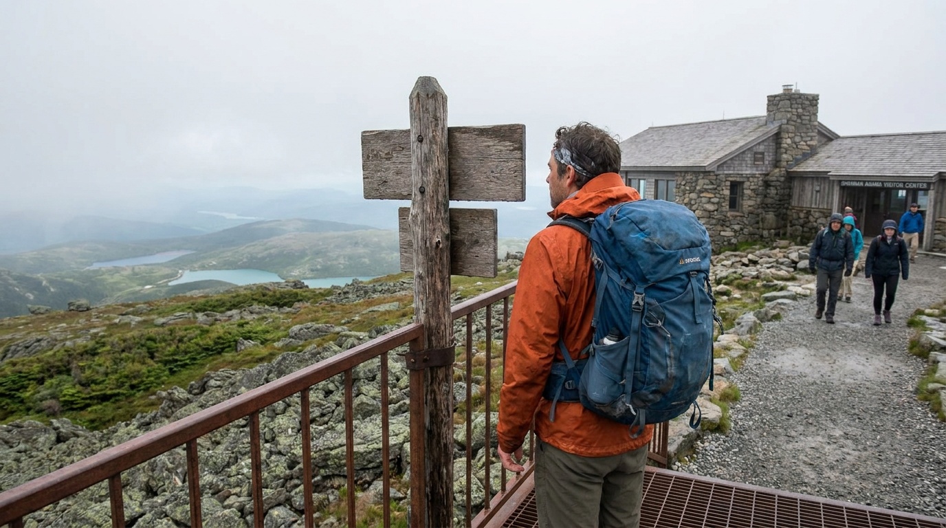
The modern visitor center at the 6,288-foot summit houses a cafeteria, gift shop, restrooms, hikers' pack room, a post office, and the Mount Washington Observatory's Extreme Weather Interactive Museum, open mid-May to mid-October.
The summit views
On a clear day the 6,288-foot summit offers views of more than 100 miles, north to Canada, east to the Atlantic Ocean, south to Massachusetts, and west to New York's Adirondacks, making it one of the broadest panoramas in the eastern United States.
Hiking routes to the summit
More than 20 trails converge on the summit from all directions through the surrounding White Mountain National Forest; the Tuckerman Ravine Trail from Pinkham Notch is the most popular approach, a strenuous 8.4-mile round trip through the famous glacial headwall.
Anchor the day around Sherman Adams Summit Building
Keep one flexible slot in the day, because weather, parking, and energy usually decide more than the map does. For one day in Mt. Washington State Park, make Sherman Adams Summit Building the non-negotiable, add The summit views only if the first stop runs clean, and keep Hiking routes to the summit as the flexible finish.
- 1Start with Sherman Adams Summit Building: The modern visitor center at the 6,288-foot summit houses a cafeteria, gift shop, restrooms, hikers' pack room, a post office, and the Mount Washington Observatory's.
- 2Add The summit views: On a clear day the 6,288-foot summit offers views of more than 100 miles, north to Canada, east to the Atlantic Ocean, south to Massachusetts, and west to New York's.
- 3Use Hiking routes to the summit as the optional finish, not as a reason to rush the whole day.
Plan your trip
Turn Mt. Washington's conditions into water, pack, and sleep-system decisions.
Build around conditions
Let season, elevation, and weather set the plan.
Plan your trip
2 quick tools, already seeded for Mt. Washington State Park. Tune the numbers around temperature swings, footing, layers, and how much margin the route needs.
What to pack
Start with the gear decisions this park changes: footing, weather, camping, and water.
Kit Authority
Mt. Washington State Park packing list
0 of 15 packed. Check items as you pack, then take this list to the store, trailhead, or campsite.
Pack planning
Decide what Mt. Washington State Park asks of your kit before you start checking boxes.
Use this as a constraint check while you are still shaping the trip. The active checklist becomes useful once your route, dates, and sleep plan are set.
- First constraintHydration and exposureWater, hat, sunscreen, sunglasses, Navigationmap, downloaded GPS, or a GPS watch, 3 more
- Route realityFooting and tractionHiking boots, Hiking socks, Trekking poles
- Load choicePack and carry systemDaypack
- Season checkLayers for conditionsMoisture-wicking base layers, Rain jacket, Insulated jacket, 1 more
Checklist mode
15 items, grouped for the trip you are actually taking.
- Dates and season are set.
- Primary route, campground, or lodge is chosen.
- Water, footwear, and overnight needs are sized.
One researched pick
The first gear decision for Mt. Washington
A stable daypack is the one purchase that organizes water, layers, food, first aid, and the small safety margin.
We may earn a commission from links on this page, at no extra cost to you.
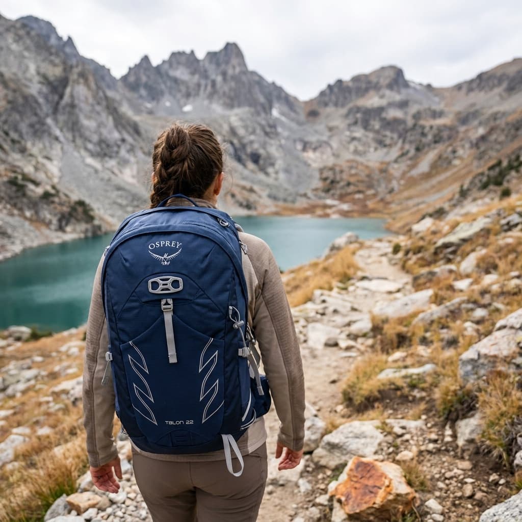
THE DAY-HIKE PICK
Osprey Talon 22
- Volume
- 22 L
- Weight
- 2 lb 1 oz (945 g)
- Back Panel
- AirScape foam with ventilation channels
- Hipbelt Pockets
- 2 zippered
- Hydration
- Compatible up to 3 L reservoir (sold separately)
- Warranty
- All Mighty Guarantee (lifetime repair or replace)
The Talon 22 is the daypack you see on the trail more than any other for good reason: it packs in a padded hipbelt, adjustable torso harness, and dual hipbelt pockets into a 22-liter package that handles loads up to 20 lb without complaint. Owners across hundreds of Amazon ratings consistently cite its adjustability and durability as standouts.
- Adjustable torso fit covers a wide range of body sizes
- Padded hipbelt and dual hipbelt pockets at this size are rare
- At 2 lb 1 oz it runs heavier than ultralight rivals for the same volume
Best for
Hikers who want a proven all-around daypack with solid load support, plenty of adjustment, and a warranty they can actually use.
Gear for Mt. Washington
The buying guides that match what Mt. Washington asks of your kit, with our current top picks across budget and use case.
Where to stay
There is no camping at Mt. Washington State Park. Hikers approaching on foot typically base at the AMC huts and Highland Center near Crawford Notch, at Pinkham Notch, or at private lodges and campgrounds in the surrounding White Mountain towns. Bretton Woods is the closest resort town, with the historic Mount Washington Hotel just below the western flanks of the mountain. North Conway, 25 miles southeast, has the densest concentration of lodging and outfitters.
Camping reservations
Camping reservations
Mt. Washington State Park has no camping; access the summit by Auto Road, Cog Railway, or trail.
The summit park is a day-use destination only, with the Sherman Adams building open mid-May to mid-October. There is no camping on the summit. Overnight trail stays in the White Mountain National Forest use AMC huts and shelters on a separate reservation system.
Reviewed June 11, 2026
Booking window
No camping reservations apply to the state park itself. For AMC hut reservations on hiking routes to the summit, use the Appalachian Mountain Club reservation system.
- Mt. Washington State Park is a day-use summit facility; there is no camping at or near the summit.
- The Auto Road charges a separate toll per vehicle plus driver and additional passenger fees; the Cog Railway sells timed tickets from its base station in Bretton Woods.
- The Sherman Adams building is open mid-May through mid-October, roughly 8:30 am to 5:00 pm in peak season, with limited hours in May and October; call the park at 603-466-3347 for current hours.
Where to book or verify
Official NH State Parks page for Sherman Adams building hours, weather, and park details.
Toll road to the summit from the east side; check current tolls, hours, and road conditions.
Steam and biodiesel train to the summit from the west side; timed ticket reservations required.
Check for federal campground, backcountry, tour, and permit inventory tied to this park.
Campgrounds to know
No camping at Mt. Washington State Park
Details- Booking
- Not applicable; the park is day-use only.
- Season
- Sherman Adams building open mid-May to mid-October; summit accessible year-round by trail at hikers' own risk.
- Sites
- None. The summit state park does not allow camping.
- For trail-based overnight trips, the AMC White Mountain hut system provides lodging at various elevations, reservable through the Appalachian Mountain Club.
Getting there and practical info
Match the arrival mode to the park day.
Rail, shuttles, rental cars, and local transfers all need to line up with the routes you want most.
Getting there
Get to Mt. Washington State Park, then keep the local movement simple.
- Access rhythm
- Rail can help
- Region
- New Hampshire
Car strategy
The summit of Mt. Washington is reached by three means: the Mount Washington Auto Road from the east side off Route 16 in Pinkham Notch, the Mount Washington Cog Railway from the west side near Bretton Woods off Route 302, or by foot on one of more than 20 hiking trails from multiple directions through the White Mountain National Forest.
Car strategy
The Auto Road is about 8 miles from base to summit and charges a per-vehicle toll; the Cog Railway runs from its base station with timed departures and requires advance tickets.
Car strategy
Neither road nor railway guarantees summit visibility; the mountain is frequently in clouds.
Pair this with lodging: the useful base is the one that connects cleanly to how you actually arrive.
Can you photograph here? Permit and drone rules
New Hampshire has no general filming permit at all; the exceptions are state parks (100 dollar special use permit), numbered state highways, and the State House grounds.
- Permit
- Usually fine for personal shoots; commercial or large productions can need a permit
- Drones
- Commercial drone work requires FAA Part 107
- Land
- Yes: you can photograph what is visible from public space in the US
From our photography sister site, Aperture Authority. Verified 2026-07-01.
Frequently asked questions
How do you get to the top of Mt. Washington?
There are three ways to reach the 6,288-foot summit: the Mount Washington Auto Road (a private toll road from Route 16 on the east), the Mount Washington Cog Railway (steam and biodiesel train from Bretton Woods on the west), or on foot via one of more than 20 hiking trails. The most popular hiking route is the Tuckerman Ravine Trail, a strenuous 8.4-mile round trip from Pinkham Notch.
What is the weather like on top of Mt. Washington?
Extreme and unpredictable year-round. The summit held the world record for highest recorded surface wind speed (231 mph, April 1934) for decades, and conditions can change from clear to whiteout in minutes at any season. Even summer days can see temperatures near freezing with high winds. Always check the Mount Washington Observatory forecast before visiting or hiking.
What is in the Sherman Adams building?
The state-owned visitor center at the summit houses a cafeteria serving hot food, a gift shop, restrooms, a pack room for hikers, a small post office, and the Mount Washington Observatory's Extreme Weather Interactive Museum. It is the shelter, food source, and weather refuge for the roughly 300,000 annual visitors who reach the summit. It is open mid-May through mid-October.
Can you camp at Mt. Washington State Park?
No. The summit state park is day-use only with no camping. Overnight options for hikers are the AMC hut system at various elevations around the mountain and backcountry sites in the White Mountain National Forest, all on separate reservation systems from the state park.