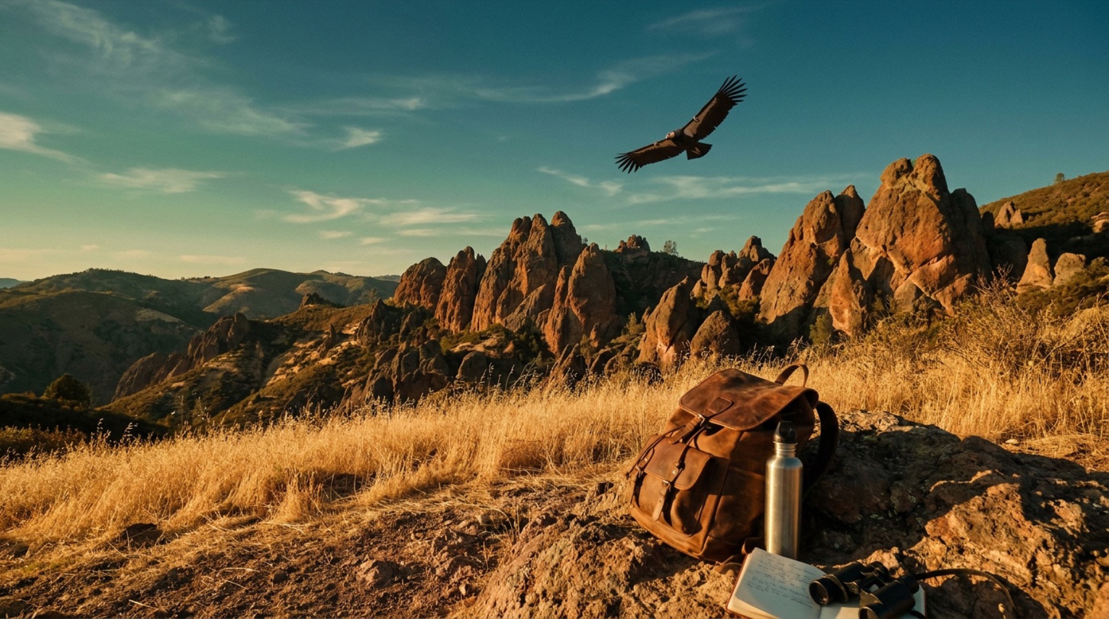
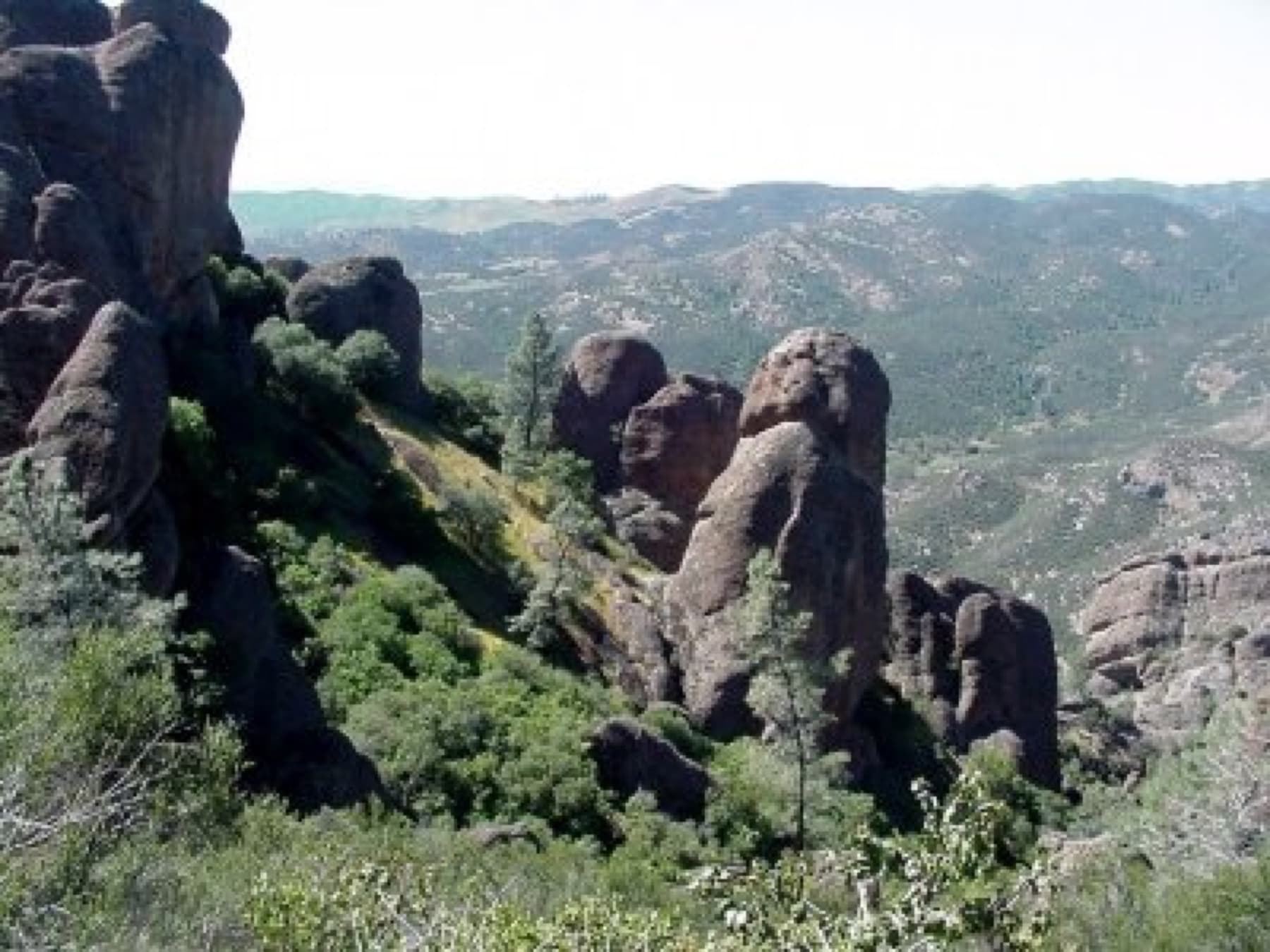
Skip to content
KITAUTHORITY
The rock spires of Pinnacles National Park rising above golden chaparral hills at sunset.

National Park · California

Pinnacles

Volcanic rock spires, two talus caves you can climb through, and the best odds anywhere of spotting a wild California condor.

Condor Gulch landscape with volcanic rock formations

Field briefing

Pinnacles changes fast with season and elevation.

Before you go

Pinnacles is a compact, day-hike park built around the eroded remains of an ancient volcano, and spring is the time to go: mild temperatures, wildflowers, and your best chance at spotting a soaring California condor.

The two halves of the park (East and West) connect only by foot trail, so pick your entrance before you arrive. Plan around the heat, since summer regularly tops 90F and there is little shade once you leave the canyon floors. Bring a headlamp for the talus caves, more water than feels necessary, sturdy shoes for steep carved steps, and layers for cool mornings. There is no backcountry camping, so this is a day-trip or front-country campground park.

Best window
Spring (March-April), when wildflowers peak and temperatures are mild
Signature routes
High Peaks Trail, Bear Gulch Cave
Pack focus
Water, weather checks, layers

The landmarks worth the trip. Tap any photo to enlarge.

Location
California
Established
1908 as a national monument, redesignated a national park in 2013
Size
27k acres
Visitors
275k / year
Best time
Spring (March-April), when wildflowers peak and temperatures are mild
Entrance
$30 per vehicle, valid 1-7 days (also $25 per motorcycle, $15 per person on foot or bike). No timed-entry reservation is required to enter. Entrance stations are cashless, so bring a card.
Nearest airport
San Jose International (SJC), roughly 90 minutes north. Monterey Regional (MRY) is a smaller closer option, about 75 minutes west.

When to go

Conditions, crowds, and what each season asks you to pack.

Spring

65-80F

Peak crowds

Highs 65-80F, cool mornings, peak wildflower bloom in March and April.

Pack Layers for chilly starts, plus a headlamp for the talus caves.

Summer

90-100F

Low crowds

Highs often 90-100F-plus, very hot and dry by midday.

Pack Far more water than you think, sun protection, and an early start.

Fall

75-90F

Moderate crowds

Highs 75-90F early, easing into the 60s and 70s by November.

Pack Sun cover early in the season, a light layer once it cools.

Winter

55-65F

Low crowds

Highs 55-65F, cool and sometimes rainy, rarely freezing.

Pack A rain shell and traction for muddy, slick trail sections.

Pinnacles rock formations in the High Peaks

Top things to do

High Peaks Trail with steep rock and railings

High Peaks Trail

5-6+ mi loop optionsHard

The signature loop through the spires, with steep carved steps and railings near the top.

Visitors entering Bear Gulch Cave

Bear Gulch Cave

Short east-side cave routeModerate

An east-side talus cave you scramble through by headlamp; closes seasonally for bat pups.

The Balconies Cave talus passage

Balconies Cave Trail

West-side talus cave loopModerate

A west-side talus cave loop, flatter and family-friendly with a flashlight.

Condor Gulch landscape from above

Condor Gulch Overlook

Short climb to overlookModerate

A short climb to a viewpoint that is one of the best places to scan for California condors.

Sunset on the North Chalone Peak Trail

North Chalone Peak

Long climb to 3,304 ftHard

The park high point at 3,304 feet, a long climb to a fire lookout and big valley views.

How long to spend

Anchor the day around High Peaks Trail

Put the access rule first: shuttle, parking, timed-entry, or reservation windows should decide the order of the day. For one day in Pinnacles, make High Peaks Trail the non-negotiable, add Bear Gulch Cave only if the first stop runs clean, and keep Balconies Cave Trail as the flexible finish.

  1. 1Start with High Peaks Trail: The signature loop through the spires, with steep carved steps and railings near the top.
  2. 2Add Bear Gulch Cave: An east-side talus cave you scramble through by headlamp; closes seasonally for bat pups.
  3. 3Use Balconies Cave Trail as the optional finish, not as a reason to rush the whole day.

Plan your trip

Turn Pinnacles's conditions into water, pack, and sleep-system decisions.

The Balconies Cave talus passage

Build around conditions

Let season, elevation, and weather set the plan.

Plan your trip

4 quick tools, already seeded for Pinnacles. Tune the numbers around temperature swings, footing, layers, and how much margin the route needs.

  1. 01Size your water for a hot day on the trail
  2. 02Find the right daypack size for a day out
  3. 03Check you will sleep warm down to about 55F
  4. 04Estimate the stove fuel to pack for the trip

What to pack

Start with the gear decisions Pinnacles changes: water, footing, weather, and overnight needs. The checklist is there once your route and dates are set.

Pack planning

Decide what Pinnacles asks of your kit before you start checking boxes.

Use this as a constraint check while you are still shaping the trip. The active checklist becomes useful once your route, dates, and sleep plan are set.

  • First constraintHydration and exposureWater, Electrolyte mix, hat, sunscreen, sunglasses, 4 more
  • Route realityFooting and tractionHiking boots, Hiking socks, Trekking poles
  • Load choicePack and carry systemDaypack
  • If overnightSleep and shelterTent, Sleeping bag, Sleeping pad

Checklist mode

23 items, grouped for the trip you are actually taking.

  1. Dates and season are set.
  2. Primary route, campground, or lodge is chosen.
  3. Water, footwear, and overnight needs are sized.

Gear for Pinnacles

The buying guides that match what Pinnacles asks of your kit. Each one has our current top picks across budget and use case.

Where to stay

High Peaks Trail in Pinnacles National Park

Stay strategy

Sleep where the first morning stays simple.

Stay strategy

Choose East or West before you book, because the roads do not connect.

Pinnacles is small on the map but split in practice. The East side has the campground, visitor center, Bear Gulch, and easier High Peaks access. The West side is the Balconies Cave approach from Soledad. Hotels outside the park work well, but pick the side first.

Road connection
East and West entrances do not connect inside the park
Only in-park stay
Pinnacles Campground on the East side
No backcountry
No backcountry camping in the park
Spring pressure
Wildflower season brings the biggest crowds

Compare base options

Compare each base by the first morning: where you park, what you ride, and how many decisions happen before the trail or viewpoint.

The entrance bridge to Bear Gulch Cave

East side

Pinnacles Campground

Campground details
Best for
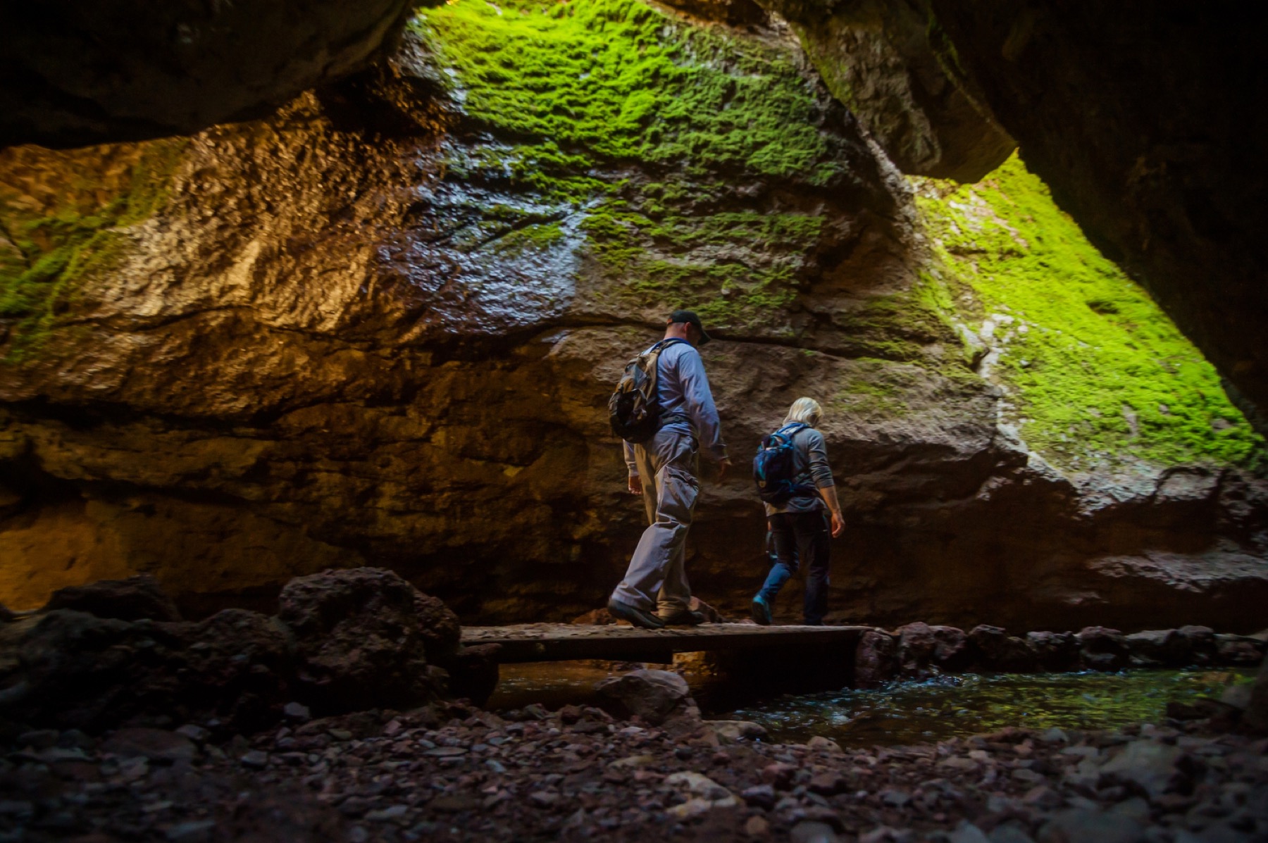
Bear Gulch Cave, High Peaks, condor scanning, and no morning commute
Tradeoff
It books quickly in spring and can be hot outside the cool months.
Planning detail

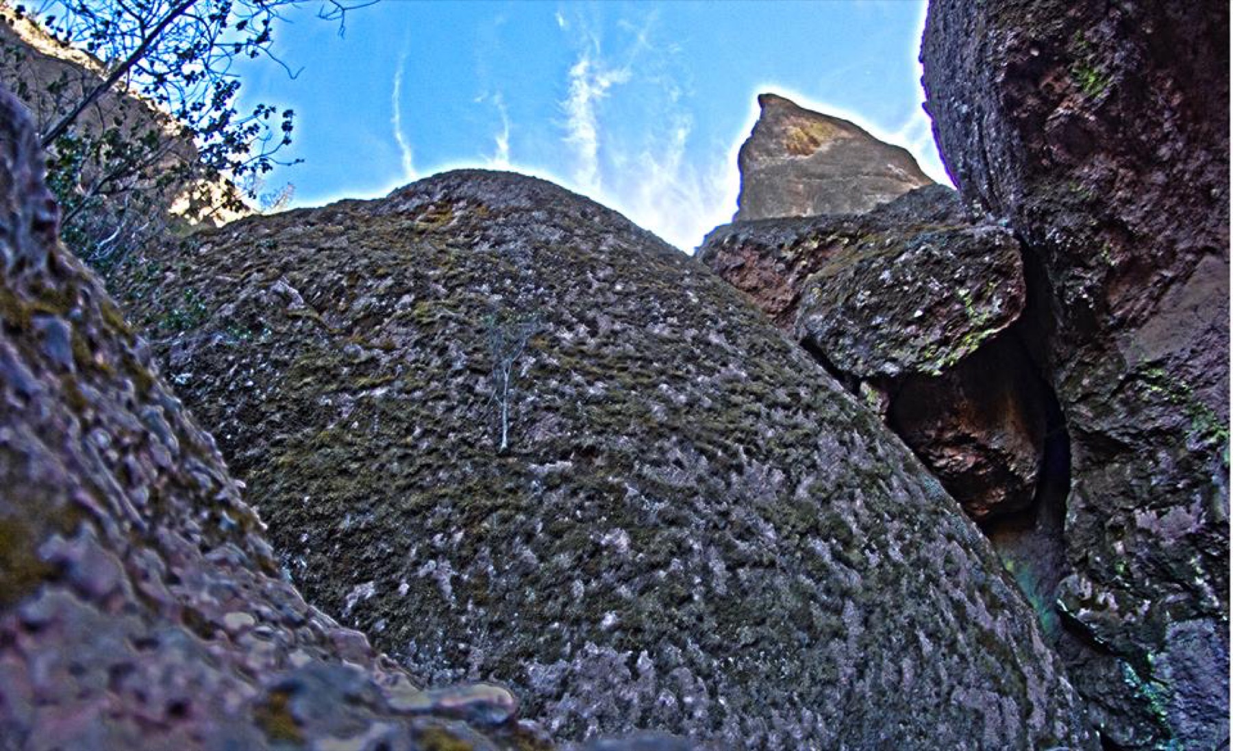
Choose the campground when the East side is your focus. Bring a headlamp for caves, water for heat, and a plan for seasonal cave closures.

Balconies Cave in Pinnacles National Park

West side

Soledad

Best for
Balconies Cave and a quick west-entrance day
Tradeoff
You cannot drive through to Bear Gulch or the campground.
Planning detail

Use Soledad when Balconies Cave is the priority. If Bear Gulch or the campground is next, plan the long outside drive rather than assuming a park road connects them.

Condor Gulch viewed from above

Town base

Hollister, Salinas, or Monterey

Best for
Hotel variety, food, and a larger central-coast itinerary
Tradeoff
Your start time matters because heat and parking build quickly.
Planning detail

Pick the town that matches the entrance you want. Monterey and Salinas are better for a broader coast trip, while Hollister favors the East side.

Entrance first

Do not book lodging until you know which cave or trailhead anchors the day.

Heat plan

In warm months, treat a dawn start and extra water as the cost of admission.

Camping reservations

Camping reservations

Camping reservations for Pinnacles

Campground systems change by season and sometimes by individual campground. Start with the official park camping page, then confirm open dates, reservation windows, and permit rules before booking.

Reviewed June 6, 2026

Booking window

Check the official park camping page before choosing dates.

  • Use the official park page as the source of truth for campground status, seasonal closures, and first-come rules.
  • Many federal campsite, backcountry, tour, and permit reservations are handled through Recreation.gov, but not every park uses the same system.

Where to book or verify

Official NPS camping page

Use this first for current campground status and park-specific rules.

Search Recreation.gov

Check for federal campground, backcountry, tour, and permit inventory tied to this park.

Permits and reservations

Use this for wilderness permits, timed systems, tours, and other park-specific reservations.

Getting there and practical info

Pinnacles rock formations in the High Peaks

Plan the handoff from arrival to shuttle.

Parking, pedestrian entrances, and shuttle timing decide how calmly the first morning starts.

Getting there

Get to Pinnacles, then remove the first-morning friction.

Nearest airport
San Jose International (SJC), roughly 90 minutes north. Monterey Regional (MRY) is a smaller closer option, about 75 minutes west.
Access rhythm
Plan the last mile
Region
California
  1. Arrival note

    Pinnacles sits east of the Salinas Valley in central California, about 5 miles east of Soledad and roughly 80 miles southeast of San Jose.

  2. Car strategy

    The catch: the East and West entrances do not connect by road inside the park, so choose based on what you want to see.

  3. Shuttle access

    The East entrance (off CA-25 near Paicines) has the campground, visitor center, and Bear Gulch Cave; the West entrance (off CA-146 from Soledad) is smaller and reaches Balconies Cave.

Pair this with lodging: sleep where the park transfer is simple, especially if your route needs an early start.

LocationCalifornia

Frequently asked questions

Do I need a reservation to enter Pinnacles National Park?

No, Pinnacles does not require a timed-entry reservation to get in. You pay the $30 per vehicle fee (valid 1-7 days) at the entrance station, which is cashless, so bring a card. You do need a separate reservation if you want to stay at Pinnacles Campground.

Can you drive between the East and West entrances of Pinnacles?

No. The two sides of the park are connected only by hiking trails, not by any road through the park. To reach the other entrance by car you have to drive all the way around the outside, which takes well over an hour. Decide which side you want before you arrive.

What is the best time to visit Pinnacles National Park?

Spring, roughly March through April, is the sweet spot: mild highs in the 65-80F range, peak wildflowers, and active condors. Summer is the quietest but brutally hot, often topping 90-100F with little shade. Fall and winter are cooler and uncrowded, with winter bringing occasional rain.

Will I actually see a California condor at Pinnacles?

Pinnacles is a release site for the endangered California condor and one of the best places in the country to spot one in the wild, though sightings are never guaranteed. Your best odds are early morning or late afternoon from high vantage points like the Condor Gulch Overlook or the High Peaks. Bring binoculars and scan the thermals.

Keep planning