Skip to content
KITAUTHORITY
View from Mount Tamalpais over Marin and the San Francisco Bay

State Park · California

Mount Tamalpais State Park

Marin County's iconic peak above the Golden Gate, with the East Peak summit, the Steep Ravine and Matt Davis loops, the Dipsea route, first-come campsites, and reservable Steep Ravine cabins.

The East Peak summit and fire lookout on Mount Tamalpais

Field briefing

Mount Tamalpais State Park changes fast with season and elevation.

Before you go

Mount Tam packs a drive-up summit and one of the Bay Area's best canyon hikes into a single Marin peak.

The planning hinges on parking and lodging: the lots at Pantoll and East Peak fill on clear weekends, the walk-in campsites are first-come, and the coveted Steep Ravine cabins are awarded through an advance reservation drawing rather than a normal booking.

Best window
April to October for clear summit views and dry coastal trails
Signature routes
East Peak and Verna Dunshee Trail, Steep Ravine, Dipsea, and Matt Davis loop
Pack focus
Water, weather checks, layers

The landmarks worth the trip. Tap any photo to enlarge.

Location
California
Best time
April to October for clear summit views and dry coastal trails
Entrance
$8 per vehicle parking fee at Pantoll, Bootjack, and East Peak lots

When to go

Weather, crowds, and what the season changes about the trip.

Spring

High crowds

Green hills, wildflowers, and seasonal waterfalls in Steep Ravine, with variable fog.

Pack Layers for wind on the ridge and grippy footwear for the ladder section.

Summer

Peak crowds

Warm inland but cool and foggy near the coast, with packed weekend lots.

Pack Wind layer, sun protection, water, and an early-arrival parking plan.

Fall

High crowds

Often the clearest summit weather of the year, with light winds and far Bay views.

Pack Layers for cool mornings and a warm shell for the exposed summit.

Winter

Moderate crowds

Cool and wet, with the strongest waterfalls in Steep Ravine and occasional storms.

Pack Waterproof shell, traction for slick rock and ladders, and warm layers.

Top things to do

  • East Peak and Verna Dunshee Trail

    The drive-up summit at 2,571 feet with a paved loop to panoramic Bay Area views and the historic fire lookout, the low-effort payoff for any group.

  • Steep Ravine, Dipsea, and Matt Davis loop

    The signature hike, descending a fern-draped redwood canyon with wooden ladders to Stinson Beach and climbing back through coastal grassland.

  • Cataract and the high ridges

    Longer ridge and creek routes for hikers and trail runners who want mileage above the fog line.

How long to spend

Anchor the day around Steep Ravine, Dipsea, and Matt Davis loop

Put the access rule first: shuttle, parking, timed-entry, or reservation windows should decide the order of the day. For one day in Mount Tamalpais State Park, make Steep Ravine, Dipsea, and Matt Davis loop the non-negotiable, add East Peak and Verna Dunshee Trail only if the first stop runs clean, and keep Cataract and the high ridges as the flexible finish.

  1. 1Start with Steep Ravine, Dipsea, and Matt Davis loop: The signature hike, descending a fern-draped redwood canyon with wooden ladders to Stinson Beach and climbing back through coastal grassland.
  2. 2Add East Peak and Verna Dunshee Trail: The drive-up summit at 2,571 feet with a paved loop to panoramic Bay Area views and the historic fire lookout, the low-effort payoff for any group.
  3. 3Use Cataract and the high ridges as the optional finish, not as a reason to rush the whole day.

Plan your trip

Turn Mount Tamalpais's conditions into water, pack, and sleep-system decisions.

Coastal view toward Stinson Beach from the Matt Davis Trail

Build around conditions

Let season, elevation, and weather set the plan.

Plan your trip

4 quick tools, already seeded for Mount Tamalpais State Park. Tune the numbers around temperature swings, footing, layers, and how much margin the route needs.

  1. 01Size your water for a mild day on the trail
  2. 02Find the right daypack size for a day out
  3. 03Check you will sleep warm down to about 30F
  4. 04Estimate the stove fuel to pack for the trip

What to pack

Start with the gear decisions this park changes: footing, weather, camping, and water.

Pack planning

Decide what Mount Tamalpais State Park asks of your kit before you start checking boxes.

Use this as a constraint check while you are still shaping the trip. The active checklist becomes useful once your route, dates, and sleep plan are set.

  • First constraintHydration and exposureWater, hat, sunscreen, sunglasses, Navigationmap, downloaded GPS, or a GPS watch, 3 more
  • Route realityFooting and tractionTrail running shoes, Hiking socks, Trekking poles
  • Load choicePack and carry systemDaypack
  • If overnightSleep and shelterTent, Sleeping bag, Sleeping pad

Checklist mode

22 items, grouped for the trip you are actually taking.

  1. Dates and season are set.
  2. Primary route, campground, or lodge is chosen.
  3. Water, footwear, and overnight needs are sized.

Gear for Mount Tamalpais

The buying guides that match what Mount Tamalpais asks of your kit, with our current top picks across budget and use case.

Where to stay

For the most atmospheric stay, enter the Steep Ravine cabin and environmental-campsite drawing months ahead, since those clifftop cabins above the ocean south of Stinson Beach are among the most sought-after in the system. Pantoll and Bootjack offer first-come walk-in tent sites for flexible trips. Mill Valley, Stinson Beach, and the wider Marin and San Francisco area cover hotels when camping is full.

Camping reservations

Camping reservations

Enter the Steep Ravine drawing early, or plan for first-come walk-in sites.

Mount Tam splits its overnight options: first-come walk-in campsites at Pantoll and Bootjack, and the reservation-drawing-only Steep Ravine cabins and environmental campsites on the coast.

Reviewed June 11, 2026

Booking window

Pantoll and Bootjack walk-in sites are first-come, first-served. Steep Ravine cabins and environmental campsites are awarded through a ReserveCalifornia drawing: apply up to eight months ahead, with drawings run about seven months before the dates.

  • Pantoll and Bootjack walk-in tent sites run about $25 per night ($23 for seniors) and cannot be reserved.
  • Steep Ravine cabins and environmental campsites require winning the advance reservation drawing through ReserveCalifornia.
  • Day-use parking at Pantoll, Bootjack, and East Peak is about $8 per vehicle; California State Parks annual passes are accepted.

Where to book or verify

ReserveCalifornia

Official system for the Steep Ravine cabin and environmental-campsite drawing, or call 1-800-444-7275.

Mount Tamalpais State Park page

Official park page with trails, campgrounds, fees, and conditions.

Search Recreation.gov

Check for federal campground, backcountry, tour, and permit inventory tied to this park.

Campgrounds to know

Pantoll and Bootjack walk-in campgrounds

Details
Booking
First-come, first-served; no reservations.
Season
Open year-round, weather permitting.
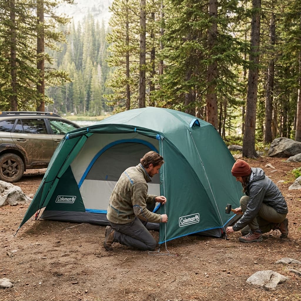
Sites
Walk-in tent sites a short carry from the parking lot, no hookups.
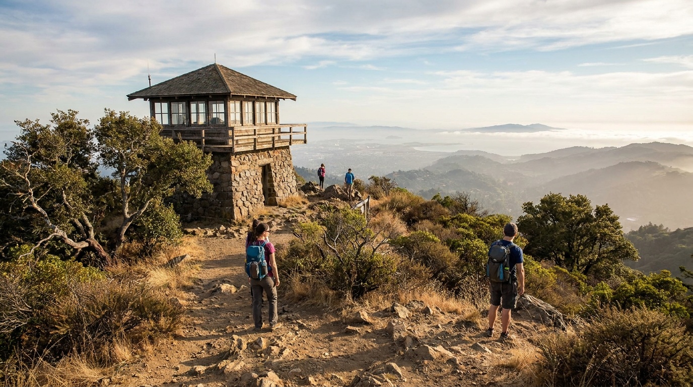
Best for flexible mid-week trips and hikers who want to be on the mountain at first light.

Steep Ravine cabins and environmental campsites

Details
Booking
Apply for the ReserveCalifornia drawing up to eight months ahead.
Season
Open year-round.
Sites
Rustic clifftop cabins and walk-in environmental campsites above the ocean south of Stinson Beach.
The marquee stay on Mount Tam. Plan months ahead and treat the drawing as the whole trip's pivot.

Getting there and practical info

View from Mount Tamalpais over Marin and the San Francisco Bay

Plan the handoff from arrival to shuttle.

Parking, pedestrian entrances, and shuttle timing decide how calmly the first morning starts.

Getting there

Get to Mount Tamalpais State Park, then remove the first-morning friction.

Access rhythm
Plan the last mile
Region
California
  1. Arrival note

    Mount Tamalpais sits in Marin County just north of the Golden Gate, reached by the winding Panoramic Highway off Highway 1.

  2. Car strategy

    A car is the practical way to move between the East Peak summit road, the Pantoll trailheads, and the Stinson Beach coast.

  3. Car strategy

    Plan for narrow mountain roads and full lots on clear weekends.

Pair this with lodging: sleep where the park transfer is simple, especially if your route needs an early start.

Frequently asked questions

Can you drive to the top of Mount Tamalpais?

You can drive to the East Peak area at about 2,571 feet, then walk the short paved Verna Dunshee loop for panoramic Bay Area views and reach the summit fire lookout on a brief climb. Parking at East Peak carries an $8 fee.

How do you book the Steep Ravine cabins?

The Steep Ravine cabins and environmental campsites are not booked like normal sites. You apply for a ReserveCalifornia reservation drawing up to eight months ahead, with drawings run about seven months before the dates. They are among the most competitive reservations in the California system.

Are Mount Tamalpais campsites reservable?

The walk-in tent sites at Pantoll and Bootjack are first-come, first-served and cannot be reserved. Only the Steep Ravine cabins and environmental campsites use the advance drawing.

Keep planning