We may earn a commission from links on this page, at no extra cost to you.
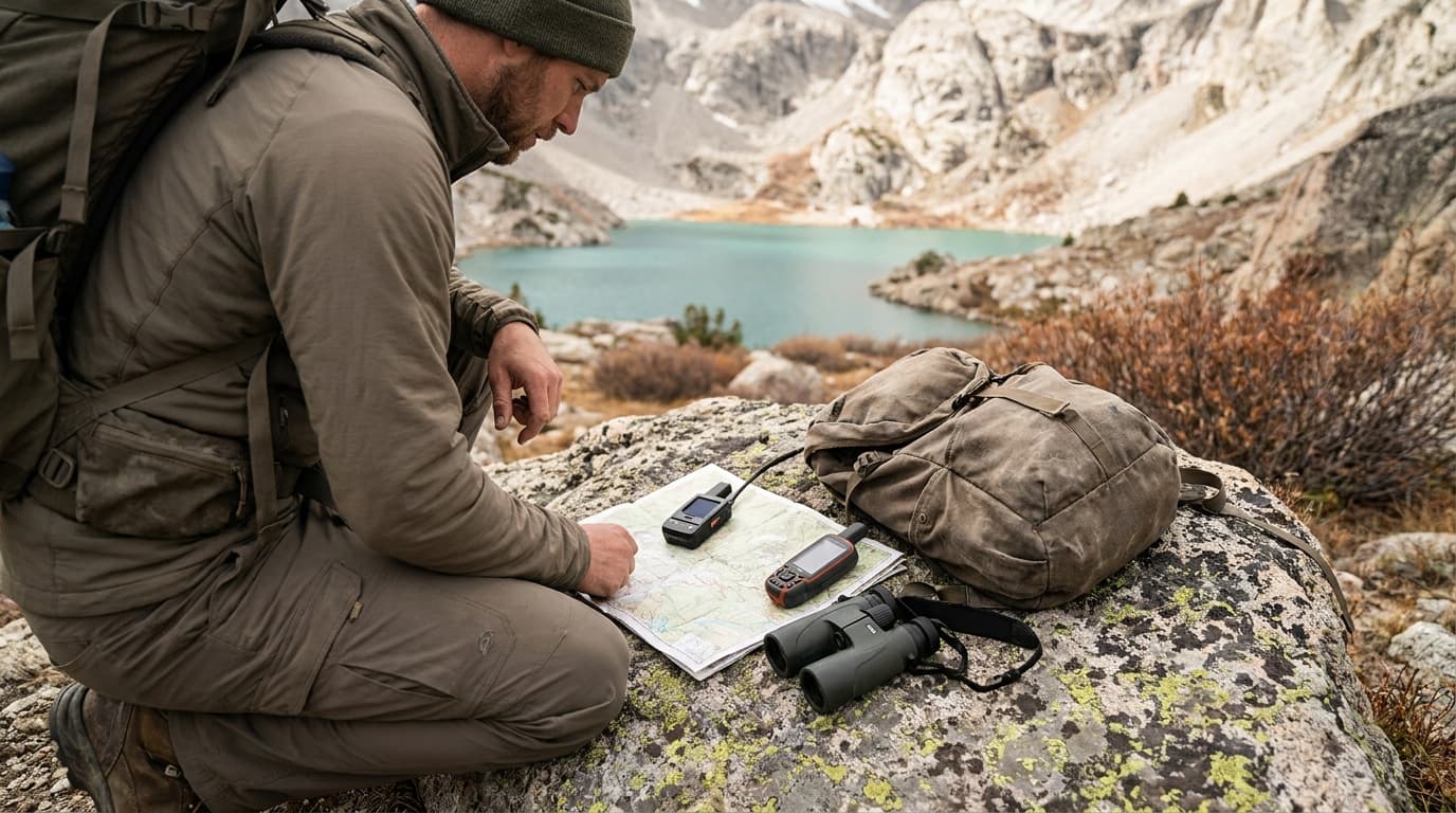
The inReach Mini 2 and the GPSMAP 67i both carry Garmin's satellite communication hardware and route SOS alerts to the same emergency coordination center. Everything else about them is different. One is a 3.5 oz communicator that leans on your phone; the other is a 9.7 oz standalone GPS unit that does not need one.
The core split
These two devices are not in direct competition. The Mini 2 is a satellite communicator with a minimal screen that pairs with your phone for any real navigation. The GPSMAP 67i is a full GPS unit with satellite communication built in. They solve different problems, and buying the wrong one for your style means either carrying extra weight you did not need or reaching for your phone in conditions where it will fail you.
The question to ask first: do you navigate by phone today, and do you trust it?
Weight and form factor
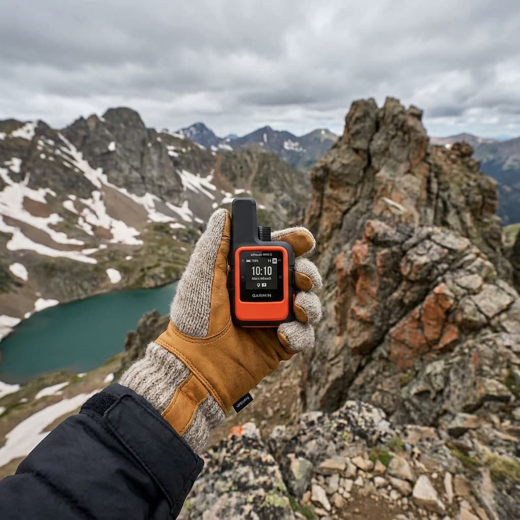
At 3.5 oz the Garmin inReach Mini 2 disappears into a hip-belt pocket. Most hikers carrying it never notice it is there. The 67i at 9.7 oz is a dedicated device you carry instead of a separate GPS unit, not alongside one. If you already carry a GPS, the 67i replaces it and adds satellite communication. If you do not, the 67i asks you to carry 9.7 oz where you were previously carrying nothing.
Both devices carry an IPX7 waterproof rating, meaning they survive submersion to one meter for 30 minutes, and both operate from -20 to 60 degrees Celsius (-4 to 140 degrees Fahrenheit). Neither is fragile in real conditions.
Mapping and navigation
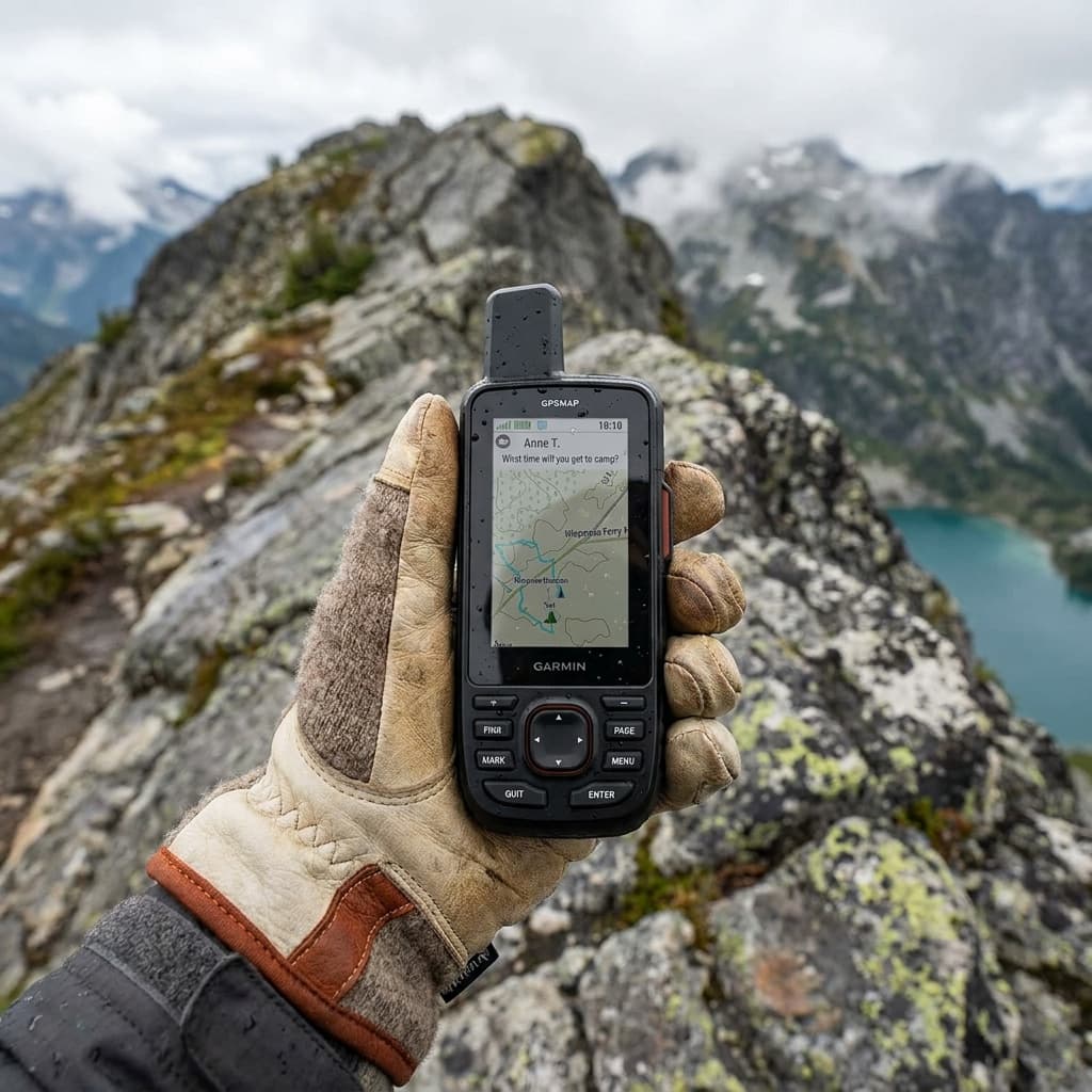
The 67i's 3-inch color screen with preloaded TopoActive maps is the single most meaningful upgrade over the Mini 2 for hikers who want to navigate without a phone.
The Garmin GPSMAP 67i ships with preloaded TopoActive maps for the US, Mexico, and Canada on a 3-inch color display. Its multi-band GNSS achieves roughly 6-foot accuracy even under dense tree cover, and it stores up to 10,000 waypoints. You can plan routes, check your position against the terrain, and navigate to a waypoint with no phone in range.
The Mini 2's 1.27-inch monochrome screen shows a basic breadcrumb track and your GPS coordinates. It stores 200 waypoints. That is enough to confirm you are moving in the right direction, but not enough to navigate a complex route or identify terrain features. Anything beyond coordinates requires pairing with Gaia GPS, CalTopo, or the Garmin Messenger app on a phone.
If your current hiking system is a phone running Gaia GPS with offline maps downloaded and a portable battery to back it up, the Mini 2 fits that workflow and adds nothing you do not need. If you regularly go to places where a dead or frozen phone is a realistic risk, the 67i gives you a genuine backup that does not depend on a second device.
Battery life
At the default 10-minute tracking interval, the Mini 2 lasts twice as long as the 67i: 14 days versus 6.8 days. For a standard two-week backcountry trip at normal tracking, the Mini 2 covers the window without a recharge. The 67i needs power roughly once a week if you are using it actively for navigation.
The 67i can stretch past 17 days in expedition mode, but that setting limits GPS fidelity to preserve battery. For trips where you genuinely need active navigation every day and cannot charge, that tradeoff matters.
SOS: identical where it counts
Both devices connect via Iridium's 100% global satellite network. Both route SOS alerts to Garmin Response, the 24/7 emergency coordination center in Montgomery, Texas. After you activate SOS, both transmit your GPS coordinates every 60 seconds for the first 10 minutes. The SOS function is functionally identical.
The one practical difference is location accuracy in demanding conditions. The 67i's multi-band GNSS pins your position to roughly 6 feet even under heavy canopy. The Mini 2's standard GPS is slightly less precise in those same conditions, though in most situations the difference is not operationally meaningful for an SOS response.
Price and subscription
The Mini 2 retails for approximately $300 and the 67i for approximately $600. The subscription cost is the same for both: $34.99 per month on the Recreation satellite plan. As of September 2024, Garmin moved all consumer plans to month-to-month with a $39.99 activation fee, so you are not locked in if you only use the device seasonally.
The $300 gap between devices is real money. Framed another way, the 67i costs roughly a Mini 2 plus a quality portable battery pack. Whether that gap buys you anything useful depends entirely on how you navigate.
How to decide: a direct comparison
Match the device to your situation
You navigate by phone today
The Mini 2 is the logical fit. It adds satellite communication and SOS to the system you already use without changing your navigation workflow or adding meaningful weight.
You want one device, not two
The 67i handles navigation, communication, and SOS with no phone required. For people who want simplicity or who travel where phones fail, that consolidation is worth the premium.
You are doing a two-week or longer expedition
At the default tracking interval, the Mini 2 lasts the full window without a recharge. If navigation is secondary and weight is primary, the Mini 2 wins outright.
You work in dense canopy or winter conditions
The 67i's multi-band GNSS performs better under heavy tree cover, and a phone that freezes or dies in the cold does not affect a standalone GPS unit.
You already carry a dedicated GPS
Adding a Mini 2 gives you satellite communication for $300 and 3.5 oz without replacing the GPS you already trust.
Budget is the deciding factor
At half the price with the same SOS capability, the Mini 2 is the default recommendation unless a specific use case requires the 67i's standalone navigation.
Who each device suits
The Mini 2 is the right device for ultralight backpackers, trail runners, weekend hikers who navigate by phone, and anyone who already carries a dedicated GPS and simply needs to add satellite communication. Its 3.5 oz weight and 14-day battery at standard tracking make it the easiest device to live with on any trip.
The 67i is the right device for thru-hikers who want to shed a separate GPS unit, professional guides, search and rescue volunteers, winter campers where phone batteries fail consistently, and hunters or backcountry travelers who regularly work in remote terrain without phone signal or battery support. The 3-inch color screen and preloaded maps make it a genuine all-in-one navigation and communication tool.
For a broader look at standalone navigation devices, see our guide to the best handheld GPS units for hiking.
FAQ
Do I still need my phone if I buy the GPSMAP 67i?
No. The 67i is a fully standalone GPS with preloaded TopoActive maps for the US, Mexico, and Canada, a 3-inch color screen, and 10,000-waypoint storage. You can plan routes, navigate, track your position, send messages, and trigger SOS without a phone present. The Mini 2 is the opposite: its 1.27-inch screen shows a basic track and coordinates, and anything beyond that (detailed maps, route planning, weather overlays) requires pairing with Gaia GPS, CalTopo, or the Garmin Messenger app on a phone.
Is the SOS on the Mini 2 less capable than on the 67i?
No. Both devices use the same Iridium satellite network and both route SOS to the same Garmin Response 24/7 coordination center. After activation, both transmit your GPS coordinates every 60 seconds for the first 10 minutes. The SOS function is functionally identical. The one difference is location precision under heavy tree cover: the 67i's multi-band GNSS achieves roughly 6-foot accuracy in those conditions, while the Mini 2's standard GPS is slightly less precise, though rarely in a way that affects an emergency response.
Which device has better battery life for a 2-week backcountry trip?
The Mini 2 lasts longer as a communicator. At the default 10-minute tracking interval it runs 14 days (336 hours) versus the 67i's 6.8 days (165 hours). If you extend the 67i to expedition mode, it can stretch past 17 days, but that limits GPS fidelity. For a 2-week trip where weight and battery are the priority and you carry a phone for navigation, the Mini 2 is the more practical choice. If you need active GPS navigation every day, the 67i requires a recharge roughly every week.
Explore more gear picks and trail-tested comparisons in hike gear, or read how we research and rate to see how Kit Authority puts its scores together.
Recommended gear
Our current top picks from the Best handheld GPS devices for hiking and backcountry guide, if you are ready to buy.
GARMIN
Garmin GPSMAP 67i
- Battery life
- 165 hours (10-min tracking); 840 hours expedition mode; USB-C rechargeable
- Weight
- 8.1 oz (230g)
- Display
- 3.0-inch color transflective, 240x400 pixels; sunlight-readable
- Satellite systems
- Multi-band GNSS: GPS, Galileo, QZSS, BeiDou, IRNSS (no GLONASS; Iridium frequency proximity prevents it)
- Durability
- MIL-STD-810; IPX7 waterproof (3 ft, 30 min)
- Messaging/SOS
- Two-way text via Iridium network; interactive 24/7 SOS (subscription required)
The GPSMAP 67i combines full-featured topo mapping with built-in inReach satellite messaging and interactive SOS, so it functions as both a primary navigator and an emergency communicator without needing a paired phone. Multi-band GNSS across five satellite constellations delivers consistent 6-foot accuracy even in canyons and heavy tree cover.
- Standalone unit: full topo maps, satellite messaging, and SOS in one device with no phone required
- Multi-band GNSS holds a clean 6-foot fix in canyons and dense forest where single-band units drift
- Subscription required for messaging and SOS; without it the unit is a GPS-only navigator at a premium price
GARMIN
Garmin inReach Mini 2
- Weight
- 3.5 oz (100g)
- Battery life
- Up to 336 hours in 10-min tracking mode; real-world 8 to 11 days in summer conditions
- Display
- 1.27-inch monochrome, 200x265 pixels
- Satellite network
- Iridium (100% global coverage); GPS, Galileo, QZSS for positioning
- Durability
- IPX7 waterproof; operates -4 to 140 degrees F
- Subscription
- Required; plans from $7.99/month (Enabled) to $49.99/month (Premium); $39.99 one-time activation
At 3.5 oz the inReach Mini 2 is the lightest way to carry two-way satellite messaging and interactive SOS into the backcountry, pairing with any phone or watch for map navigation while operating independently for emergency functions. It runs on the Iridium network for true global coverage including polar regions.
- Lightest Garmin inReach option: clips to a shoulder strap and adds near-zero weight penalty on long routes
- True global Iridium coverage with professionally staffed 24/7 SOS response, verified in real-world activations
- No onboard maps; navigation is limited to basic waypoints and TracBack, so a phone or separate GPS is still needed for route-finding
GARMIN
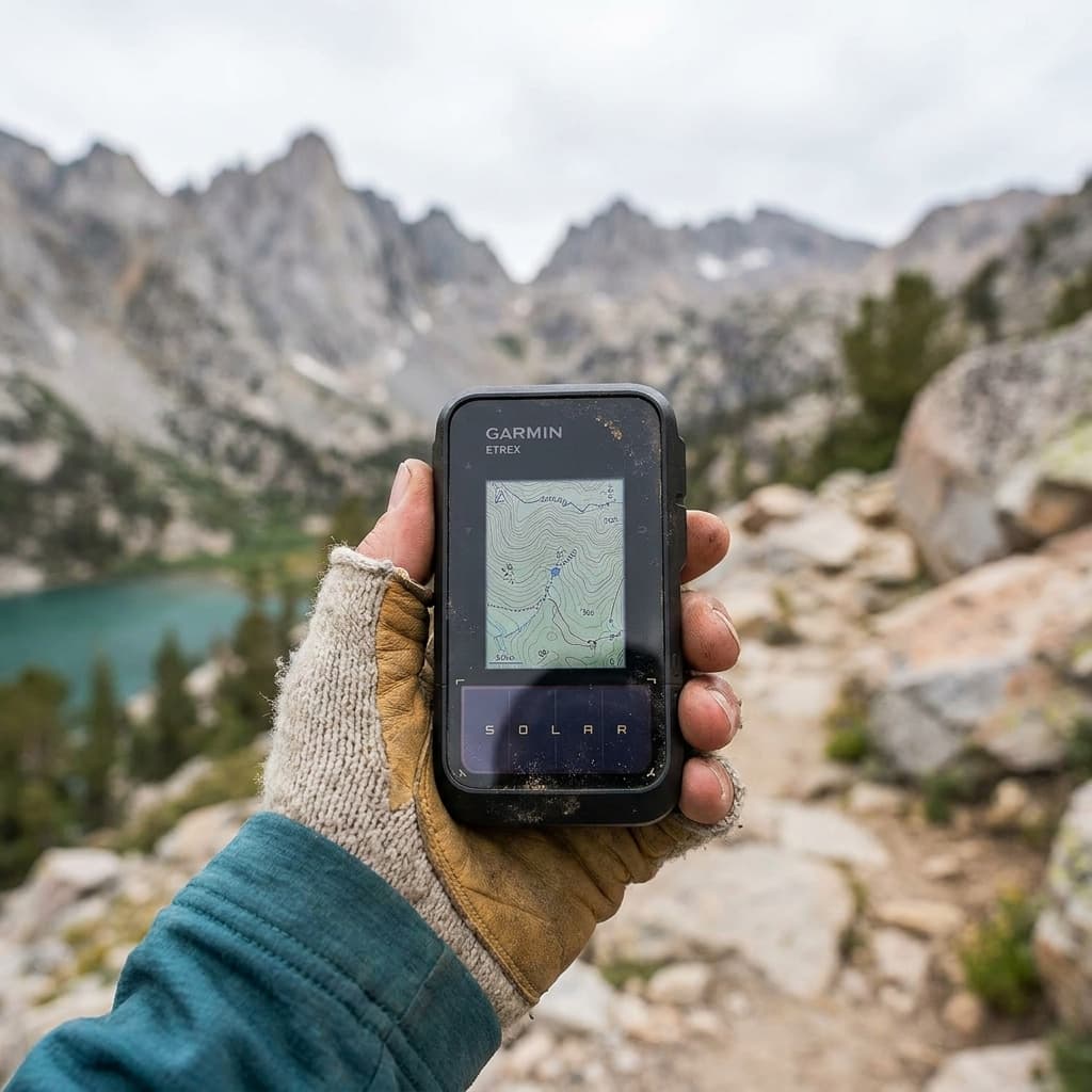
Garmin eTrex Solar
- Weight
- 5.0 oz (141g)
- Battery life
- 200 hours standard; 1,800 hours expedition mode; unlimited with direct solar (75,000 lux)
- Display
- 2.2-inch monochrome, 240x320 pixels; sunlight-readable
- Satellite systems
- Multi-band GNSS: GPS (L1+L5), GLONASS, Galileo, QZSS, BeiDou, IRNSS
- Durability
- IPX7 waterproof; USB-C charging; internal rechargeable lithium-ion
- Mapping
- Basic basemap only; GPX route import via Garmin Explore app; no onboard topo
The eTrex Solar pairs multi-band GNSS accuracy with an onboard solar panel that can sustain the device indefinitely in direct sunlight, making it a uniquely capable choice for extended trips where recharging is impractical. No subscription is required, and GPX routes from Gaia GPS or CalTopo load via the Garmin Explore app.
- Solar charging adds genuine field insurance on long trips: reviewers document visible real-time charge gains even under partial sun
- Multi-band GNSS across six constellations delivers 6-foot accuracy comparable to devices costing twice as much
- No onboard topo maps: detailed route navigation requires a paired phone running the Garmin Explore app, which reduces the independence advantage of a dedicated GPS
See all picks in Best handheld GPS devices for hiking and backcountry

Complete hike loadout
Day hike kit
Seven slots for a full trail day, from the pack and water system to light and weather protection.
Build the complete kitRelated guides

Buying guide
Best handheld GPS devices for hiking and backcountry
The best handheld GPS units for hiking ranked on satellite messaging, mapping, battery life, and value, plus when a dedicated GPS beats your phone.
Read guide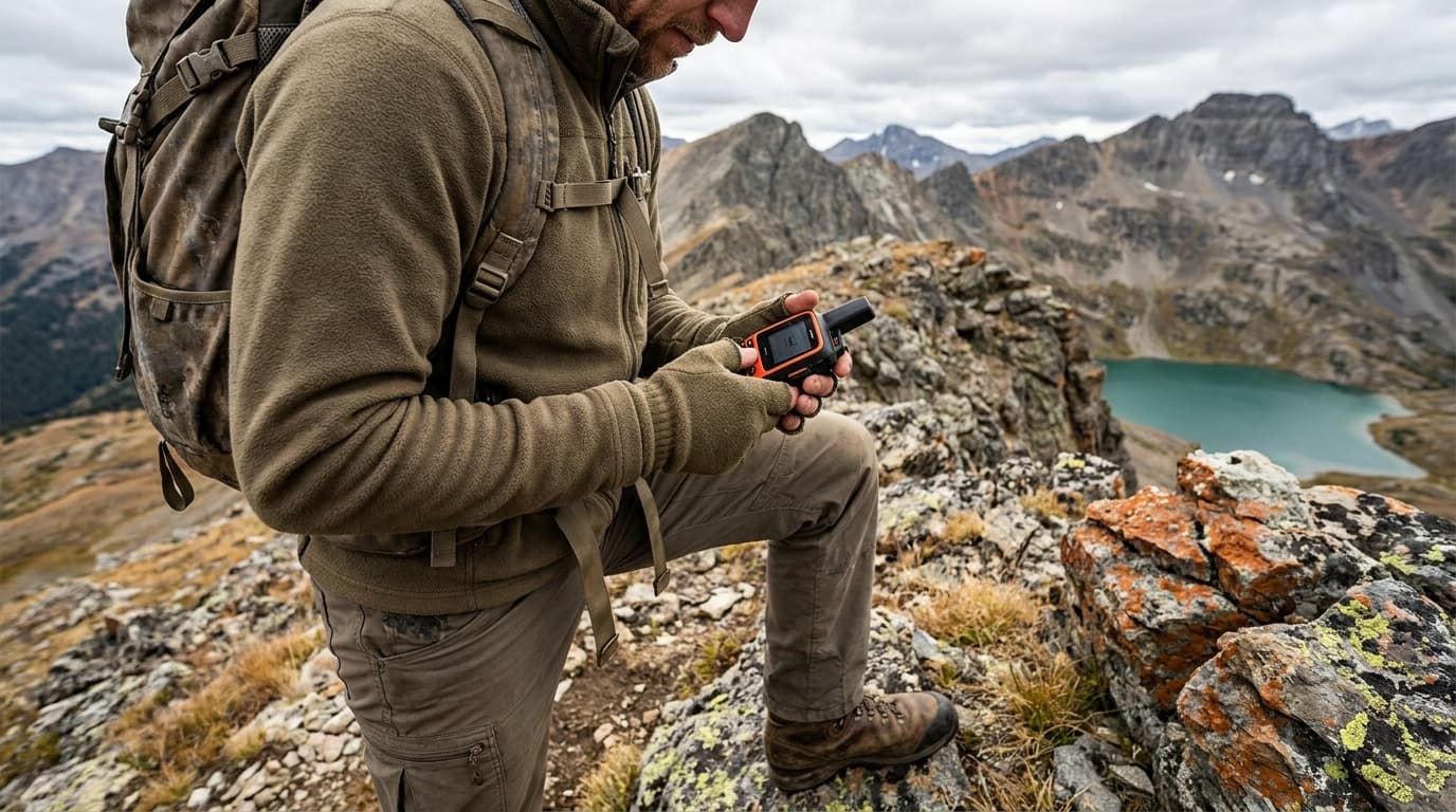
Buying guide
Best satellite messengers for backcountry hiking 2026
The best satellite messengers for backcountry hiking: two-way messaging vs SOS-only, Iridium network reliability, subscription costs, battery life, and weight compared.
Read guide
Field guide
Do you need a satellite messenger? When yes, when no
Yes for solo and remote backcountry trips; skip it where cell service holds. Where iPhone satellite SOS fits, and what $15-$50/month plans actually buy.
Read guide
Comparison
Satellite messenger vs PLB: the $0 vs $15/month choice
Most hikers should carry a two-way satellite messenger despite the $15-$50 monthly plan. A PLB triggers a free government-monitored SOS with no subscription.
Read guideResearched, not personally tested: picks come from specs, verified-owner reviews, and expert sources, scored into the Kit Score. As an Amazon Associate I earn from qualifying purchases. We may earn a commission from links here, at no extra cost to you. How we research →