
We may earn a commission from links on this page, at no extra cost to you.
Top picks
Our quick picks


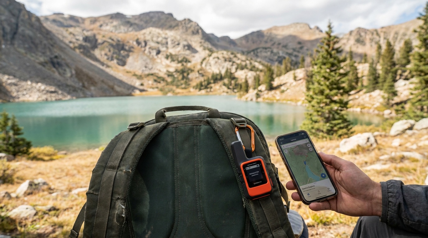
A phone navigation app is fine on a trail with cell coverage and a charged battery. Step into the backcountry, add a multi-day route, and those conditions disappear together. Dedicated GPS units fix all three problems at once, and the better ones add satellite messaging so someone can find you if things go sideways.
How we picked
Our ratings aggregate manufacturer specs, verified-owner reviews across retailers, and outdoor-publication coverage into a single Kit Score. For GPS devices we weight satellite coverage, battery life, and SOS capability most heavily, because on a remote route those are the specs that actually matter.
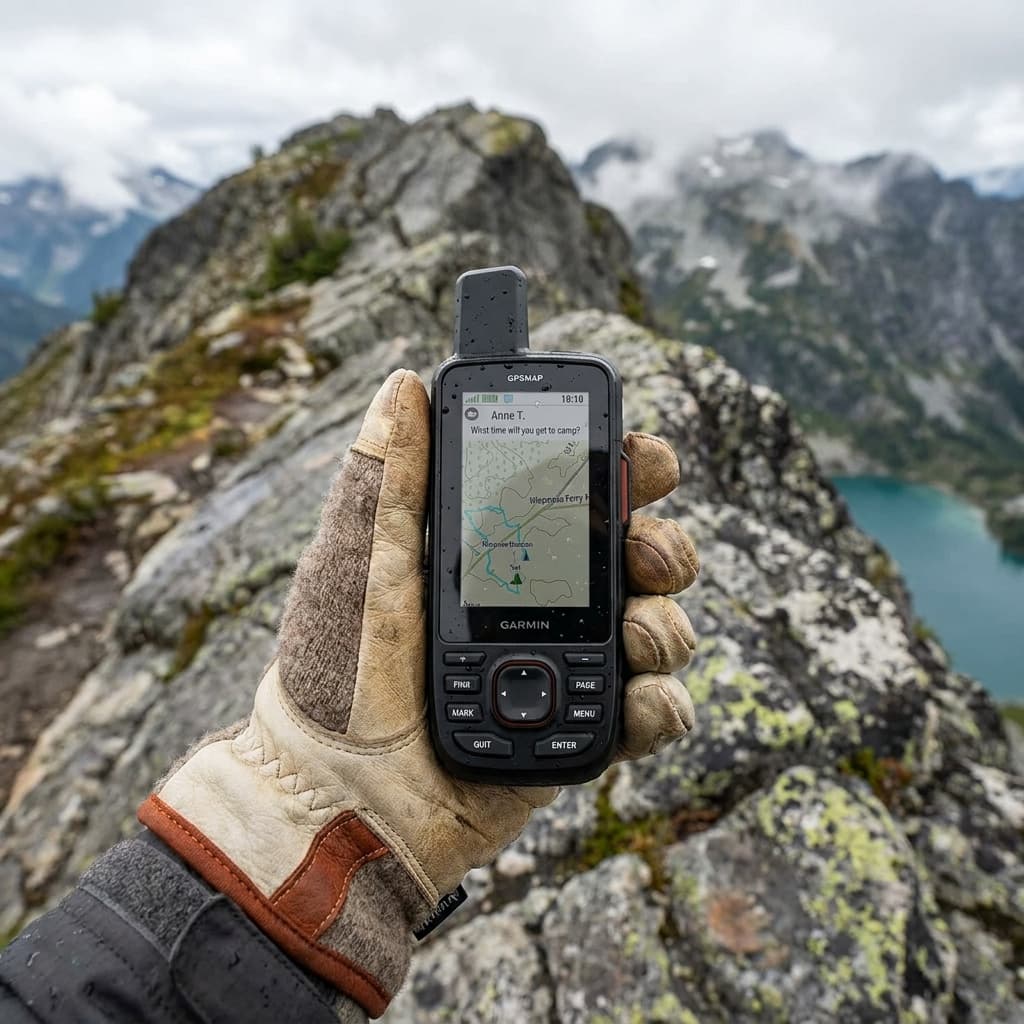
Best overall: Garmin GPSMAP 67i
The GPSMAP 67i is the answer when you want one device that handles everything without compromise. It runs on Garmin's multi-band GNSS (GPS, GLONASS, Galileo, and QZSS), which locks position faster and holds it more accurately in deep canyons and under heavy tree cover than single-band receivers. Built-in inReach satellite messaging means you can send and receive texts and trigger an SOS anywhere on the planet, with no cell network required. The screen is a 3-inch transflective display that stays readable in direct sunlight, and the whole unit is rated MIL-STD-810 and IPX7.
Garmin's subscription plan for the satellite messaging runs separately from the device cost. The Explore tier (around $15/month) covers most hikers; heavier communicators can move up. That ongoing cost is the honest tradeoff for the two-way messaging.
BEST OVERALL
Garmin GPSMAP 67i
Best for: Backcountry hikers and mountaineers who want a single device that handles navigation, off-grid messaging, and emergency SOS without relying on phone signal.
Kit Score 8.4/10 · $500+
- Standalone unit: full topo maps, satellite messaging, and SOS in one device with no phone required
- Multi-band GNSS holds a clean 6-foot fix in canyons and dense forest where single-band units drift
- Subscription required for messaging and SOS; without it the unit is a GPS-only navigator at a premium price
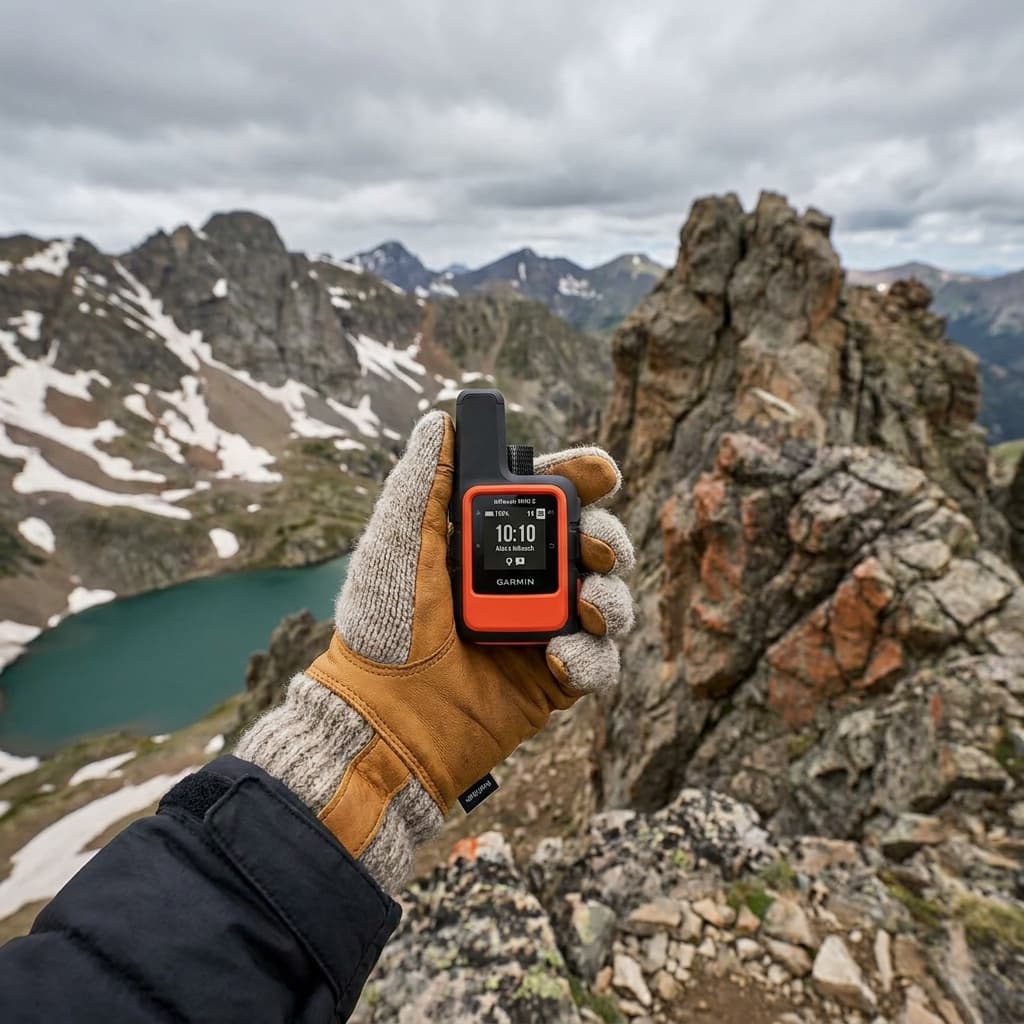
Editor's choice: Garmin inReach Mini 2
The Mini 2 is not a standalone navigation device, it is a satellite communicator that pairs with your phone via Bluetooth. That distinction matters. If you already navigate confidently by phone or a separate GPS, the Mini 2 lets you add two-way satellite messaging and a 160-country SOS network at 3 ounces and around $300. It is the right tool for trail runners, ultralight backpackers, and anyone who considers their phone the primary nav device and wants a dedicated safety net for the moments when it is not enough.
The pairing app (Garmin Explore) works well for route sharing and tracking; you can also send and receive messages from any Iridium-connected device, including a partner's inReach or a rescue coordination center.
EDITOR'S CHOICE
Garmin inReach Mini 2
Best for: Weight-conscious backpackers and trail runners who already navigate by phone or dedicated GPS and want to add satellite messaging and SOS without carrying a heavier device.
Kit Score 7.8/10 · $250–$500
- Lightest Garmin inReach option: clips to a shoulder strap and adds near-zero weight penalty on long routes
- True global Iridium coverage with professionally staffed 24/7 SOS response, verified in real-world activations
- No onboard maps; navigation is limited to basic waypoints and TracBack, so a phone or separate GPS is still needed for route-finding
The single most underrated GPS feature is not the map chip or the satellite count, it is whether the screen is readable at noon in August without shading it with your hand.
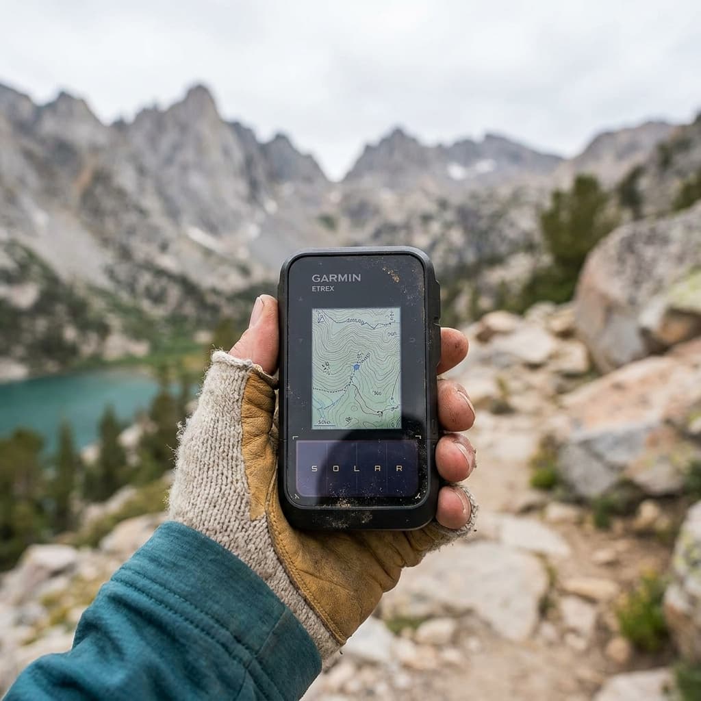
Best value: Garmin eTrex Solar
The eTrex Solar is built around one idea: keep working when every other battery-dependent device has quit. It combines a 1.2W solar charging panel on the face with an internal lithium battery, and under real mixed-light conditions (partial cloud, angled sun, typical hiking speeds) the solar input meaningfully offsets drain during a long day. In pure GPS mode without solar, Garmin claims 23 hours; add solar under favorable conditions and multi-day operation without a power bank is realistic.
Navigation is map-based using pre-loaded Garmin TopoActive maps, and the unit accepts imported GPX routes. There is no satellite messaging, so this is the right pick for hikers who are comfortable with the navigation side and whose primary concern is outlasting their power supply on a thru-hike or expedition.
BEST VALUE
Garmin eTrex Solar
Best for: Thru-hikers and expedition trekkers doing long stretches without power access who follow pre-planned GPX routes and want multi-day battery confidence without carrying extra batteries or a power bank.
Kit Score 7.9/10 · $150–$250
- Solar charging adds genuine field insurance on long trips: reviewers document visible real-time charge gains even under partial sun
- Multi-band GNSS across six constellations delivers 6-foot accuracy comparable to devices costing twice as much
- No onboard topo maps: detailed route navigation requires a paired phone running the Garmin Explore app, which reduces the independence advantage of a dedicated GPS
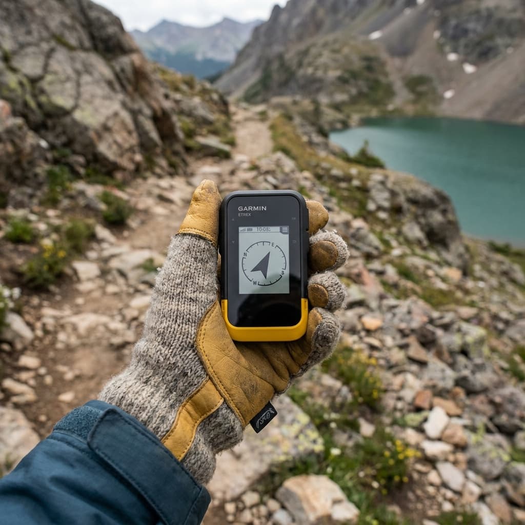
Best budget: Garmin eTrex SE
The eTrex SE is the GPS to buy when your requirements are: accurate position fix, long battery life, and no subscription. It uses two standard AA batteries and Garmin claims multiple weeks of runtime in power-save mode, which makes it the easiest device on this list to keep charged anywhere on earth. It connects to GPS and GLONASS satellites, supports imported GPX routes via the Garmin Explore app, and the whole thing weighs 5 ounces.
What it does not have: satellite messaging, a color display, or pre-loaded topo maps (you build and load routes before you leave). For a day hiker who plans routes in advance and wants a reliable backup that never needs a wall outlet, that is an entirely reasonable set of tradeoffs for under $165.
BEST BUDGET
Garmin eTrex SE
Best for: Day hikers and weekend backpackers who want a no-subscription dedicated GPS backup with exceptional battery life, and who plan routes in advance using the Garmin Explore app.
Kit Score 7.1/10 · $100–$150
- 168-hour battery life from standard AA batteries removes charger anxiety entirely, including in cold weather where lithium cells maintain performance
- Five-constellation GNSS provides 3-meter positioning accuracy at a price point historically reserved for single-band units
- No onboard maps and only 28 MB of storage: navigation depends on pre-loaded waypoints or a paired phone, which limits utility if you go off-route
How they compare
| Product | Kit Score | Price | Best for |
|---|---|---|---|
| Garmin GPSMAP 67i | 8.4 | $500+ | Backcountry hikers and mountaineers who want a single device that handles navigation, off-grid messaging, and emergency SOS without relying on phone signal. |
| Garmin inReach Mini 2 | 7.8 | $250–$500 | Weight-conscious backpackers and trail runners who already navigate by phone or dedicated GPS and want to add satellite messaging and SOS without carrying a heavier device. |
| Garmin eTrex Solar | 7.9 | $150–$250 | Thru-hikers and expedition trekkers doing long stretches without power access who follow pre-planned GPX routes and want multi-day battery confidence without carrying extra batteries or a power bank. |
| Garmin eTrex SE | 7.1 | $100–$150 | Day hikers and weekend backpackers who want a no-subscription dedicated GPS backup with exceptional battery life, and who plan routes in advance using the Garmin Explore app. |
How to choose the right unit
Match the device to your actual trip
Satellite messaging first, then navigation
If you go into terrain where a broken ankle ends in a helicopter call, prioritize a device with inReach SOS (GPSMAP 67i or Mini 2) over one with a better map chip.
Phone as primary nav? Go minimal
The Mini 2 adds the one thing a phone cannot do (satellite messaging) without duplicating the navigation you already carry.
No power for days
Solar or AA batteries beat lithium-only units on multi-day routes. The eTrex Solar handles partial shade better than you'd expect; the eTrex SE lets you grab batteries anywhere.
Know your route before you go
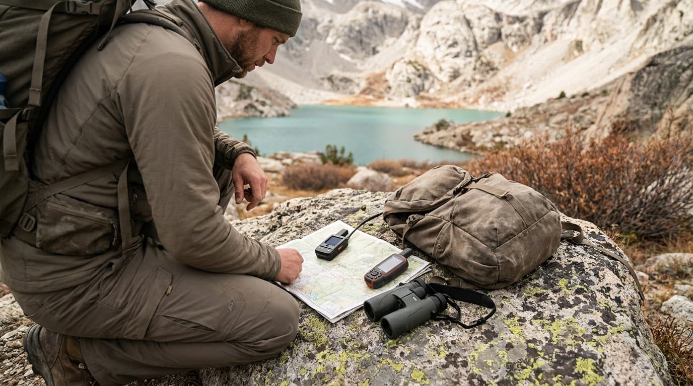
The eTrex SE requires pre-loaded GPX routes. If you improvise on trail, you need a device with on-device mapping (GPSMAP 67i or eTrex Solar with TopoActive).
Budget for the subscription
The GPSMAP 67i and Mini 2 require a Garmin inReach service plan for satellite messaging. Factor that into the real cost before you buy.
GPS device vs. phone app: the honest answer
Apps like Gaia GPS and Garmin Explore are genuinely capable when your phone has battery and you are in range of a cell tower for the initial download. The problems stack up fast in the backcountry: cold temperatures cut lithium battery life by 20 to 40 percent, a phone screen in direct sun is nearly unreadable, and nothing about a phone is waterproof by default.
A dedicated GPS unit is not a replacement for your phone navigation app. It is the thing that works when the phone does not. The two are better together than either alone.
FAQ
Do I need a satellite messenger if I already have a GPS device?
It depends on the device. Units with Garmin inReach built in (like the GPSMAP 67i) include two-way satellite messaging and SOS. A GPS-only device like the eTrex SE or eTrex Solar gives you navigation but no way to call for help or send messages off-grid. If you are going into terrain with no cell coverage, the inReach capability is worth the extra cost and subscription.
How accurate are handheld GPS devices for hiking?
Modern multi-band units (like the GPSMAP 67i with GPS, GLONASS, Galileo, and QZSS) typically achieve 3-meter accuracy or better in open terrain. Single-band receivers are closer to 5-10 meters under normal conditions. Both are accurate enough for trail navigation. Accuracy degrades in narrow canyons and dense canopy, which is precisely where multi-band receivers earn their price premium.
Can I use a handheld GPS without a subscription?
Yes, for navigation. All four devices on this list provide position tracking and GPX route following without any subscription. The subscription applies only to the satellite messaging and SOS features on inReach-capable units (GPSMAP 67i and Mini 2). If you buy one of those and skip the plan, you still have a fully functional GPS navigator.
A good GPS device is the most low-drama insurance you can carry in the backcountry. Get one that fits your trip, load your routes before you leave, and the nav side takes care of itself.
See more hike gear and trail picks, or read how we research and rate every piece of kit on this site.

Complete hike loadout
Day hike kit
Seven slots for a full trail day, from the pack and water system to light and weather protection.
Build the complete kitRelated guides
Comparison
Garmin inReach Mini 2 vs GPSMAP 67i: same SOS, $300 apart
The $300 inReach Mini 2 wins for most hikers: 3.5 oz and longer battery. The $600 GPSMAP 67i adds standalone mapping. SOS is identical, so here is how to pick.
Read guide
Field guide
Do you need a satellite messenger? When yes, when no
Yes for solo and remote backcountry trips; skip it where cell service holds. Where iPhone satellite SOS fits, and what $15-$50/month plans actually buy.
Read guide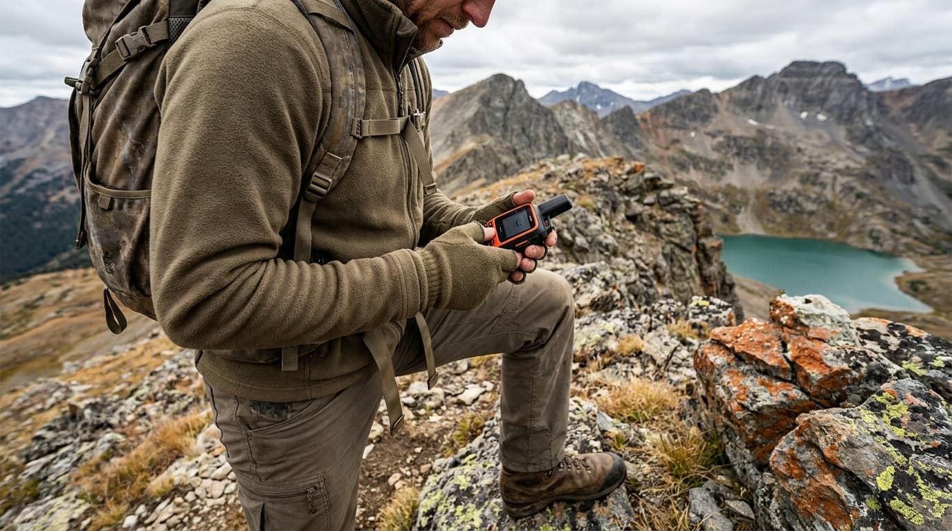
Buying guide
Best satellite messengers for backcountry hiking 2026
The best satellite messengers for backcountry hiking: two-way messaging vs SOS-only, Iridium network reliability, subscription costs, battery life, and weight compared.
Read guide
Comparison
Satellite messenger vs PLB: the $0 vs $15/month choice
Most hikers should carry a two-way satellite messenger despite the $15-$50 monthly plan. A PLB triggers a free government-monitored SOS with no subscription.
Read guideResearched, not personally tested: picks come from specs, verified-owner reviews, and expert sources, scored into the Kit Score. As an Amazon Associate I earn from qualifying purchases. We may earn a commission from links here, at no extra cost to you. How we research →