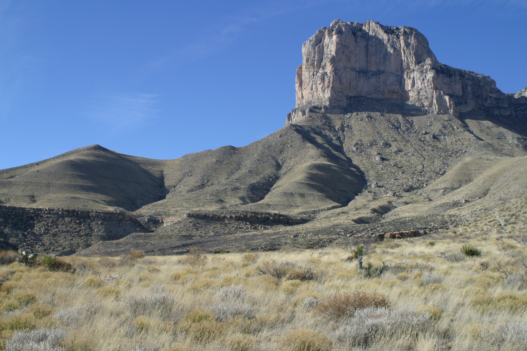
Skip to content
KITAUTHORITY
El Capitan, the signature limestone peak of the Guadalupe Mountains, rising above the Chihuahuan Desert in Guadalupe Mountains National Park, Texas

National Park · Texas

Guadalupe Mountains

Texas's highest peak, the world's best fossil reef, and dark desert skies, all in one wild West Texas range.

Leaflet / Wikimedia Commons (CC BY-SA 3.0)
Lower Pine Spring Canyon with the Guadalupe Peak Trail visible on the opposite ridge

Field briefing

Guadalupe Mountains changes fast with season and elevation.

Before you go

Guadalupe Mountains is a rugged, uncrowded West Texas range built on a fossilized Permian reef, home to Guadalupe Peak, the highest point in Texas.

Go in fall for mild temperatures, calm air, and McKittrick Canyon's maple color, the park's true peak season. This is a hiker's park with almost no scenic driving inside it, so come ready to walk: a Guadalupe Peak summit or a McKittrick Canyon stroll are the headline days. Pack far more water than you think you need, real wind protection for the famous spring gusts, and layers for cold desert nights. There are no lodges, gas, or food in the park, so arrive self-sufficient.

Best window
Fall (late October to mid-November), when McKittrick Canyon's maples turn and temperatures are mild
Signature routes
Guadalupe Peak Trail, McKittrick Canyon
Pack focus
Water, layers

The landmarks worth the trip. Tap any photo to enlarge.

Location
Texas
Established
September 30, 1972
Size
86k acres
Visitors
206k / year
Best time
Fall (late October to mid-November), when McKittrick Canyon's maples turn and temperatures are mild
Entrance
$10 per person (ages 16 and up), valid 1-7 consecutive days. No timed-entry reservation required.
Nearest airport
El Paso International Airport (ELP), about 110 miles and roughly a 2-hour drive west

When to go

Conditions, crowds, and what each season asks you to pack.

Spring

65-80F

Moderate crowds

Highs around 65-80F at the trailheads, cooler and windier up high. Famous for relentless spring wind.

Pack A real windbreaker and a buff or hat that stays on in 40 mph gusts.

Summer

85-95F

Moderate crowds

Hot in the lowlands with highs 85-95F, more bearable at elevation but the sun is intense.

Pack More water than feels reasonable (a gallon per person), sun shirt, and an early start.

Fall

65-80F

Peak crowds

Comfortable highs 65-80F, crisp nights, calmer air, and peak foliage in late October.

Pack Layers for cool mornings plus a daypack for the long canyon and peak hikes.

Winter

50-60F

Low crowds

Highs 50-60F by day, freezing nights, and occasional snow or ice on Guadalupe Peak.

Pack Insulated layers, traction for icy upper trails, and a warm hat for cold camp nights.

El Capitan rising beyond desert wildflowers

Top things to do

Guadalupe Peak above Pine Spring Canyon

Guadalupe Peak Trail

8.4 mi round tripStrenuous

Strenuous 8.4-mile round trip climbing over 3,000 feet to the 8,751-foot rooftop of Texas.

The wooded McKittrick Canyon Trail

McKittrick Canyon

Variable out-and-back to Pratt Cabin or fartherModerate

A spring-fed canyon famous for its fiery bigtooth maples in late fall, leading to the historic Pratt Cabin.

Pine Spring Canyon framed by Guadalupe Peak and Hunter Peak

Devil's Hall Trail

3.8 mi round tripModerate

A scrambly 3.8-mile round trip up a rocky streambed to a natural stone staircase and narrow hallway.

El Capitan at sunset

El Capitan

Roadside landmarkEasy

The sheer limestone prow that anchors the range, a landmark for Butterfield stagecoach travelers and a classic photo subject.

White gypsum dunes below the Guadalupe Mountains

Salt Basin Dunes

Remote west-side day-use areaModerate

Remote gypsum dunes on the park's west side, glowing white against the mountains at sunset.

How long to spend

Anchor the day around Guadalupe Peak Trail

Put the access rule first: shuttle, parking, timed-entry, or reservation windows should decide the order of the day. For one day in Guadalupe Mountains, make Guadalupe Peak Trail the non-negotiable, add McKittrick Canyon only if the first stop runs clean, and keep Devil's Hall Trail as the flexible finish.

  1. 1Start with Guadalupe Peak Trail: Strenuous 8.4-mile round trip climbing over 3,000 feet to the 8,751-foot rooftop of Texas.
  2. 2Add McKittrick Canyon: A spring-fed canyon famous for its fiery bigtooth maples in late fall, leading to the historic Pratt Cabin.
  3. 3Use Devil's Hall Trail as the optional finish, not as a reason to rush the whole day.

Plan your trip

Turn Guadalupe Mountains's conditions into water, pack, and sleep-system decisions.

El Capitan glowing at sunset

Build around conditions

Let season, elevation, and weather set the plan.

Plan your trip

4 quick tools, already seeded for Guadalupe Mountains. Tune the numbers around temperature swings, footing, layers, and how much margin the route needs.

  1. 01Size your water for a hot day on the trail
  2. 02Dial in your pack base weight before you load up
  3. 03Find the pack size a multi-day trip here needs
  4. 04Check you will sleep warm down to about 50F

What to pack

Start with the gear decisions Guadalupe Mountains changes: water, footing, weather, and overnight needs. The checklist is there once your route and dates are set.

Pack planning

Decide what Guadalupe Mountains asks of your kit before you start checking boxes.

Use this as a constraint check while you are still shaping the trip. The active checklist becomes useful once your route, dates, and sleep plan are set.

  • First constraintHydration and exposureWater, Electrolyte mix, hat, sunscreen, sunglasses, 4 more
  • Route realityFooting and tractionHiking boots, Hiking socks, Trekking poles
  • Load choicePack and carry systemBackpacking pack
  • If overnightSleep and shelterBackpacking tent, Sleeping bag, Sleeping pad, 1 more

Checklist mode

21 items, grouped for the trip you are actually taking.

  1. Dates and season are set.
  2. Primary route, campground, or lodge is chosen.
  3. Water, footwear, and overnight needs are sized.

Gear for Guadalupe Mountains

The buying guides that match what Guadalupe Mountains asks of your kit. Each one has our current top picks across budget and use case.

Where to stay

Lower Pine Spring Canyon near the main park hub

Stay strategy

Sleep where the first morning stays simple.

Stay strategy

Arrive self-sufficient, then choose Pine Springs access or Carlsbad services.

Guadalupe Mountains has no lodge, food, fuel, or casual scenic-drive infrastructure inside the park. Pine Springs is the practical hiking hub. Carlsbad and White's City are the service bases. Dog Canyon is quiet and remote, best when the north side is your plan.

Inside lodging
None
Main camp
Pine Springs near the visitor center
Remote camp
Dog Canyon on the north side
Service base
Carlsbad, New Mexico, about 55 miles north

Compare base options

Compare each base by the first morning: where you park, what you ride, and how many decisions happen before the trail or viewpoint.

Pine Spring Canyon below Guadalupe Peak and Hunter Peak

Hiking hub

Pine Springs Campground

Campground details
Best for
Guadalupe Peak, Devil's Hall, visitor center access, and the simplest early start
Tradeoff
Basic campground, no hookups, no food, no gas, and exposure to wind.
Planning detail

Choose Pine Springs when the main goal is hiking. Fill fuel and water before arrival, and assume wind can make camp feel colder than the forecast.

El Capitan at sunset

Service base

Carlsbad or White's City

Best for
Hotels, food, fuel, and pairing with Carlsbad Caverns
Tradeoff
You add a meaningful drive before and after hiking days.
Planning detail

Use Carlsbad for the most reliable services. It is the practical choice when camping is full, wind is ugly, or you are pairing the park with Carlsbad Caverns.

A wooded trail section in Guadalupe Mountains

Quiet north side

Dog Canyon

Best for
Repeat visitors, north-side hiking, and a cooler, quieter campground
Tradeoff
It is a separate approach through New Mexico, away from Pine Springs.
Planning detail

Dog Canyon is not an overflow lot for the main entrance. Choose it only when you want that side of the range and have planned the drive.

Guadalupe Peak rising above Pine Spring Canyon

Wilderness

Backcountry camps by permit

Backpacking details
Best for
Experienced hikers ready to carry every drop of water
Tradeoff
No water in the backcountry changes weight, range, and route choice.
Planning detail

Backpacking here is a water-carrying problem first. Get the permit, choose conservative mileage, and build the trip around wind, sun, and cold nights.

Fuel rule

Arrive with a full tank, food, and all drinking water.

Fall color

For McKittrick Canyon foliage, make lodging and parking timing the first decision.

Camping reservations

Camping reservations

Camping reservations for Guadalupe Mountains

Campground systems change by season and sometimes by individual campground. Start with the official park camping page, then confirm open dates, reservation windows, and permit rules before booking.

Reviewed June 6, 2026

Booking window

Check the official park camping page before choosing dates.

  • Use the official park page as the source of truth for campground status, seasonal closures, and first-come rules.
  • Many federal campsite, backcountry, tour, and permit reservations are handled through Recreation.gov, but not every park uses the same system.

Where to book or verify

Official NPS camping page

Use this first for current campground status and park-specific rules.

Search Recreation.gov

Check for federal campground, backcountry, tour, and permit inventory tied to this park.

Permits and reservations

Use this for wilderness permits, timed systems, tours, and other park-specific reservations.

Getting there and practical info

El Capitan rising beyond desert wildflowers

Plan the handoff from arrival to shuttle.

Parking, pedestrian entrances, and shuttle timing decide how calmly the first morning starts.

Getting there

Get to Guadalupe Mountains, then remove the first-morning friction.

Nearest airport
El Paso International Airport (ELP), about 110 miles and roughly a 2-hour drive west
Access rhythm
Car required
Region
Texas
  1. Shuttle access

    Most visitors fly into El Paso International Airport (ELP), rent a car, and drive about 110 miles (roughly 2 hours) east on US-62/180 to the Pine Springs Visitor Center, the park's main entrance.

  2. Car strategy

    The park sits right on the highway, so access is easy by car even though it feels remote.

  3. Fly in

    Cavern City Air Terminal in Carlsbad, New Mexico is technically closer (about 55 miles north) but has very limited flights and no airport car rental, so El Paso is the practical choice.

Pair this with lodging: sleep where the park transfer is simple, especially if your route needs an early start.

LocationTexas

Frequently asked questions

Do you need a reservation to visit Guadalupe Mountains National Park?

No timed-entry or day-use reservation is required to enter the park. You simply pay the $10 per-person entrance fee (good for up to 7 days). Reservations are only needed for the small first-come, first-served campgrounds in busy season and for backcountry wilderness permits.

How hard is the Guadalupe Peak hike?

It is strenuous: about 8.4 miles round trip with over 3,000 feet of elevation gain to the 8,751-foot summit, the highest point in Texas. Plan on 6 to 8 hours and carry plenty of water, since there is none on the trail. Wind near the top can be fierce, so a real windbreaker is essential.

When is the best time to see fall colors at McKittrick Canyon?

The bigtooth maples in McKittrick Canyon typically peak from late October into mid-November, though exact timing shifts year to year. This is the park's busiest stretch, so arrive early to get a parking spot at the McKittrick Canyon trailhead. The park posts foliage updates each fall.

Is there food, gas, or lodging in the park?

No. Guadalupe Mountains has no lodge, restaurant, store, or gas station inside its boundaries. Come fully self-sufficient with food, water, and a full tank, and base in Carlsbad, New Mexico or El Paso, Texas for services.

Keep planning