Skip to content
KITAUTHORITY
Wide panoramic landscape of Death Valley National Park at dusk, with layered desert mountain ridges receding under a deep blue twilight sky.

National Park · California

Death Valley

The hottest, driest, lowest national park in the country, where below-sea-level salt flats meet 11,000-foot peaks.

Dan Duriscoe / U.S. National Park Service (Public domain)
White salt flats under dark storm clouds in Death Valley

Field briefing

Death Valley changes fast with season and elevation.

Before you go

Death Valley is a park of extremes, and the calendar makes or breaks the trip.

Go from November through March, when valley highs sit in the 60s to 80s F and the salt flats, badlands, and dunes are genuinely walkable. Skip the summer for anything strenuous: midday heat above 115F below sea level is the real hazard, not the mileage. This is mostly a scenic-driving, short-hike, and night-sky park, with a few big climbs for the fit. Whatever the season, water is the headline item: carry far more than feels reasonable, add electrolytes, and start hikes at first light. Pack sun protection, a warm layer for cold desert nights, sturdy shoes for rocky canyons, and a full tank of gas, since services are sparse and distances are huge.

Best window
Late fall through early spring (November to March), with a March-April wildflower spike in good years
Signature routes
Badwater Basin, Zabriskie Point
Pack focus
Water, weather checks, layers

The landmarks worth the trip. Tap any photo to enlarge.

Location
California
Established
October 31, 1994
Size
3.4M acres
Visitors
1.4M / year
Best time
Late fall through early spring (November to March), with a March-April wildflower spike in good years
Entrance
$30 per vehicle, valid for 7 days ($25 motorcycle, $15 per person on foot or bike). No timed-entry reservation. Fees are cashless. An America the Beautiful annual pass also covers entry.
Nearest airport
Harry Reid International Airport (LAS) in Las Vegas, about 120 miles and 2 to 2.5 hours by car to Furnace Creek

When to go

Conditions, crowds, and what each season asks you to pack.

Spring

Peak crowds

Highs climb from the 80s F in March to the 90s and low 100s F by May. Most comfortable hiking window and prime wildflower season after wet winters.

Pack Layers for cool mornings, sun protection, and far more water than you think you need.

Summer

115-120F

Low crowds

Brutal. Daytime highs routinely top 115-120F at Furnace Creek, among the hottest on Earth. Hiking below sea level is dangerous after mid-morning.

Pack Gallons of water per person, electrolytes, and a stay-in-the-car-and-AC mindset for midday.

Fall

Moderate crowds

Heat breaks slowly: 90s-100s F in October easing to 70s-80s F by late November. Crowds and comfort both rebuild.

Pack Sun protection and steady water, plus a light layer for cooler evenings.

Winter

High crowds

Mild valley days in the 60s-70s F with chilly nights near freezing; snow caps Telescope Peak while the valley floor stays dry.

Pack A warm layer for cold mornings and sturdy shoes for rocky canyon trails.

Desert gold wildflowers below snowcapped mountains in Panamint Valley

Top things to do

People walking across the salt flats of Badwater Basin

Badwater Basin

Short walkEasy

The lowest point in North America at 282 feet below sea level, a surreal flat of cracked salt polygons.

Zabriskie Point badlands glowing pink and orange at sunset

Zabriskie Point

Short walkEasy

A short walk to a golden badlands overlook that glows at sunrise and sunset.

Curving ridges across the Mesquite Flat Sand Dunes

Mesquite Flat Sand Dunes

Moderate

Easy-to-reach rolling dunes near Stovepipe Wells, best at dawn or under a full moon.

Mineral-colored hills at Artists Palette in Death Valley

Artists Drive and Artists Palette

Easy

A one-way scenic loop past hillsides streaked in mineral greens, pinks, and purples.

Telescope Peak rising above Death Valley National Park

Telescope Peak

14 mi round tripStrenuous

A strenuous 14-mile round-trip climb to 11,049 feet, the park's high point with snow into spring.

How long to spend

Anchor the day around Badwater Basin

Put the access rule first: shuttle, parking, timed-entry, or reservation windows should decide the order of the day. For one day in Death Valley, make Badwater Basin the non-negotiable, add Zabriskie Point only if the first stop runs clean, and keep Mesquite Flat Sand Dunes as the flexible finish.

  1. 1Start with Badwater Basin: The lowest point in North America at 282 feet below sea level, a surreal flat of cracked salt polygons.
  2. 2Add Zabriskie Point: A short walk to a golden badlands overlook that glows at sunrise and sunset.
  3. 3Use Mesquite Flat Sand Dunes as the optional finish, not as a reason to rush the whole day.

Plan your trip

Turn Death Valley's conditions into water, pack, and sleep-system decisions.

Curving ridges across the Mesquite Flat Sand Dunes

Build around conditions

Let season, elevation, and weather set the plan.

Plan your trip

4 quick tools, already seeded for Death Valley. Tune the numbers around temperature swings, footing, layers, and how much margin the route needs.

  1. 01Size your water for a hot day on the trail
  2. 02Dial in your pack base weight before you load up
  3. 03Find the pack size a multi-day trip here needs
  4. 04Check you will sleep warm down to about 115F

What to pack

Start with the gear decisions Death Valley changes: water, footing, weather, and overnight needs. The checklist is there once your route and dates are set.

Pack planning

Decide what Death Valley asks of your kit before you start checking boxes.

Use this as a constraint check while you are still shaping the trip. The active checklist becomes useful once your route, dates, and sleep plan are set.

  • First constraintHydration and exposureWater, Electrolyte mix, hat, sunscreen, sunglasses, 4 more
  • Route realityFooting and tractionHiking boots, Hiking socks, Trekking poles
  • Load choicePack and carry systemBackpacking pack
  • If overnightSleep and shelterBackpacking tent, Sleeping bag, Sleeping pad, 1 more

Checklist mode

25 items, grouped for the trip you are actually taking.

  1. Dates and season are set.
  2. Primary route, campground, or lodge is chosen.
  3. Water, footwear, and overnight needs are sized.

Gear for Death Valley

The buying guides that match what Death Valley asks of your kit. Each one has our current top picks across budget and use case.

Where to stay

Sunset over the salt valley floor from Dantes View

Stay strategy

Choose the base that protects the permit window.

Stay strategy

Base in the park if you want sunrise and sane drive times.

Death Valley distances are the lodging decision. Furnace Creek keeps the classic low-elevation stops close. Stovepipe Wells works for the dunes and north valley. Panamint Springs, Beatty, and Pahrump save money or change the route, but they add real driving.

Main airport
Las Vegas, about 2 to 2.5 hours to Furnace Creek
Core base
Furnace Creek is closest to Badwater, Zabriskie, and Artists Drive
Heat rule
Summer hiking below sea level is unsafe after mid-morning
Services
Fuel, water, and food are sparse and far apart

Compare base options

Use the options below to protect the permit, pickup, and early-start parts of the trip before you optimize for comfort.

White salt flats under dark storm clouds in Death Valley

Most efficient

Furnace Creek

Best for
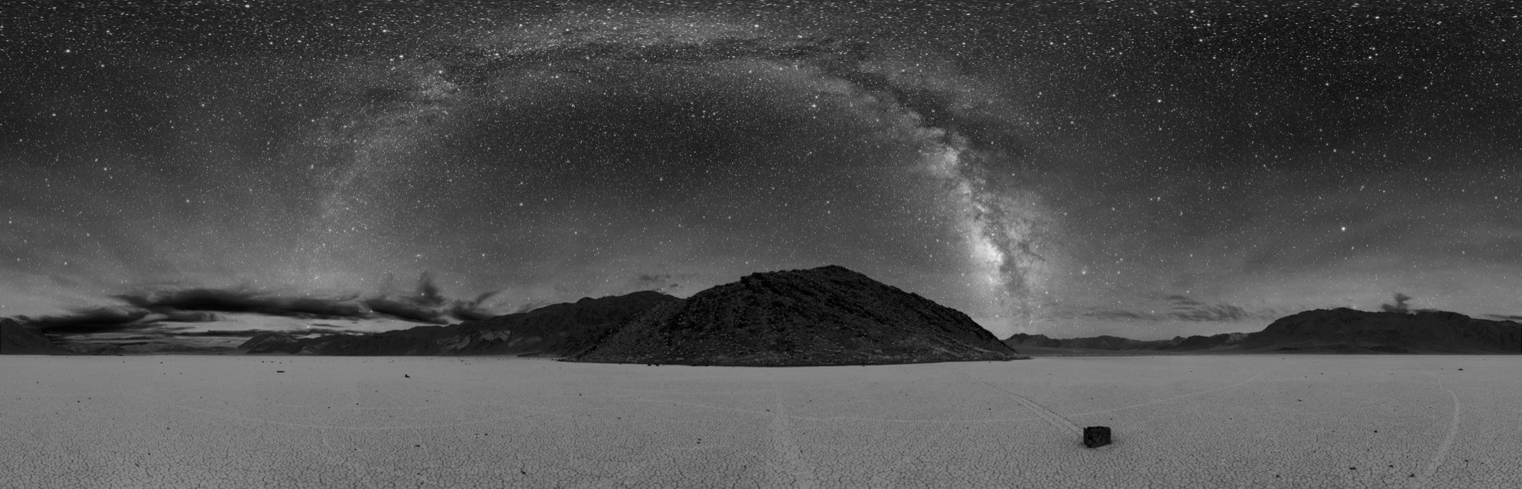
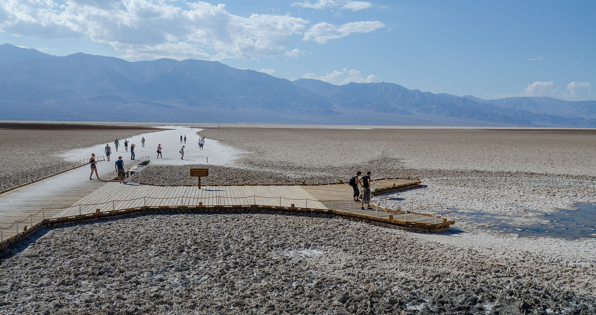
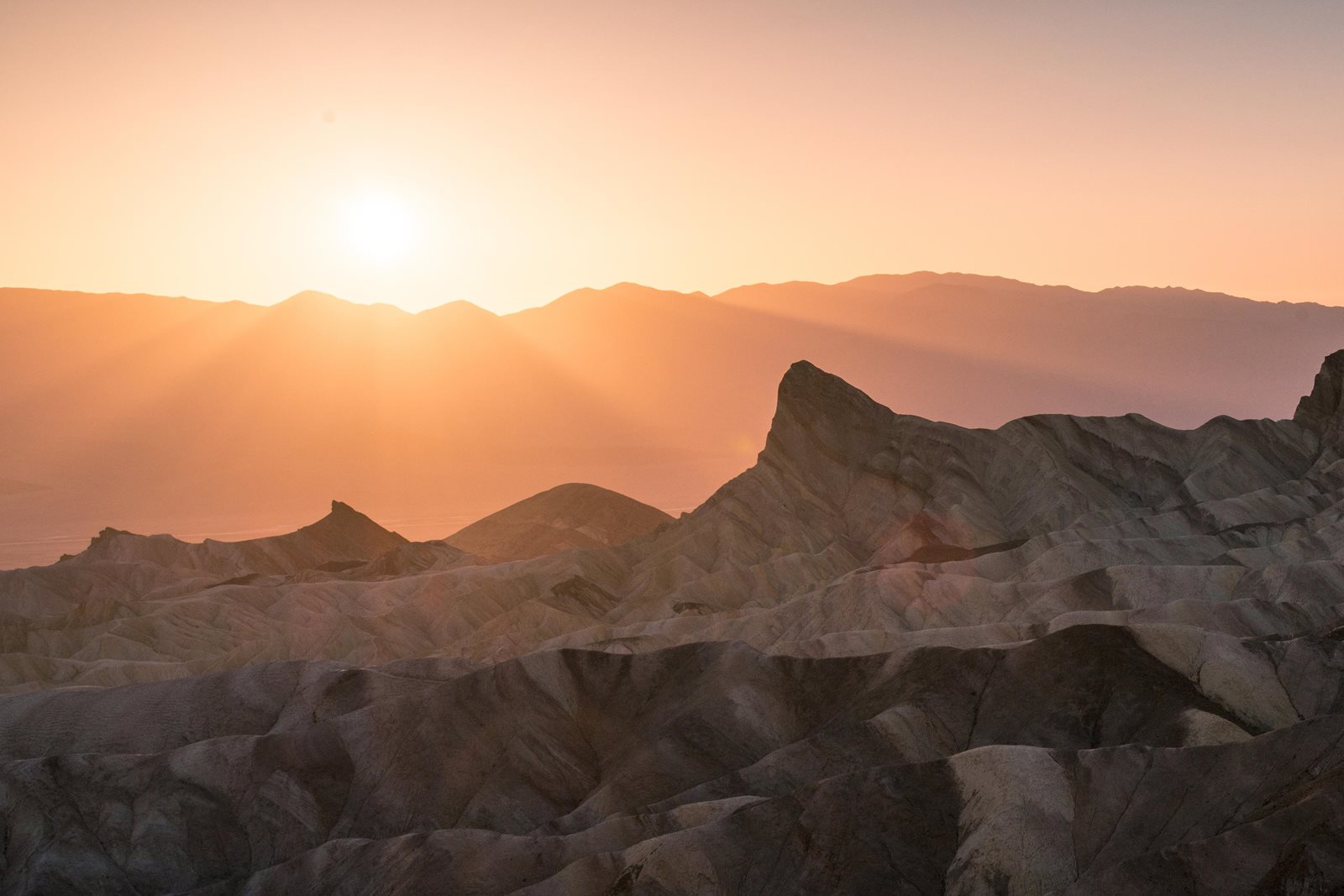
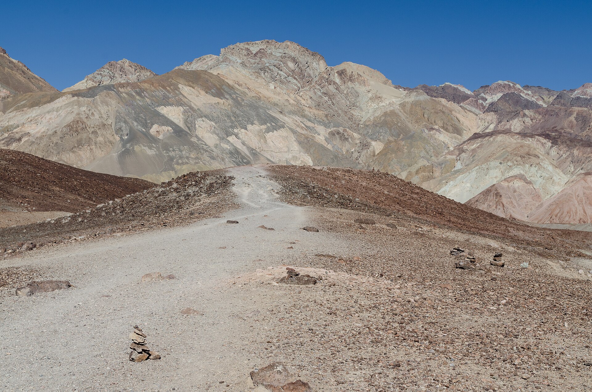
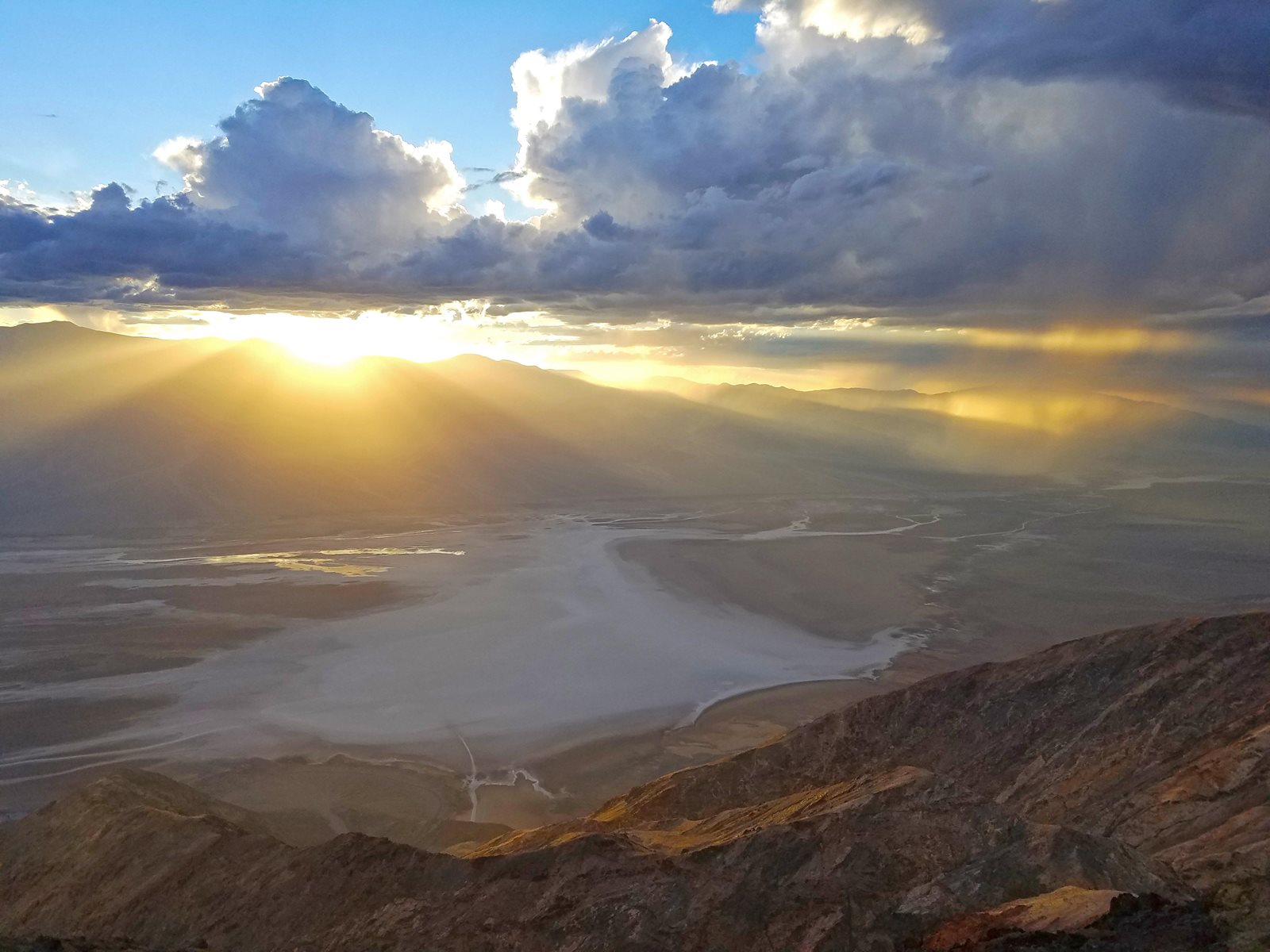
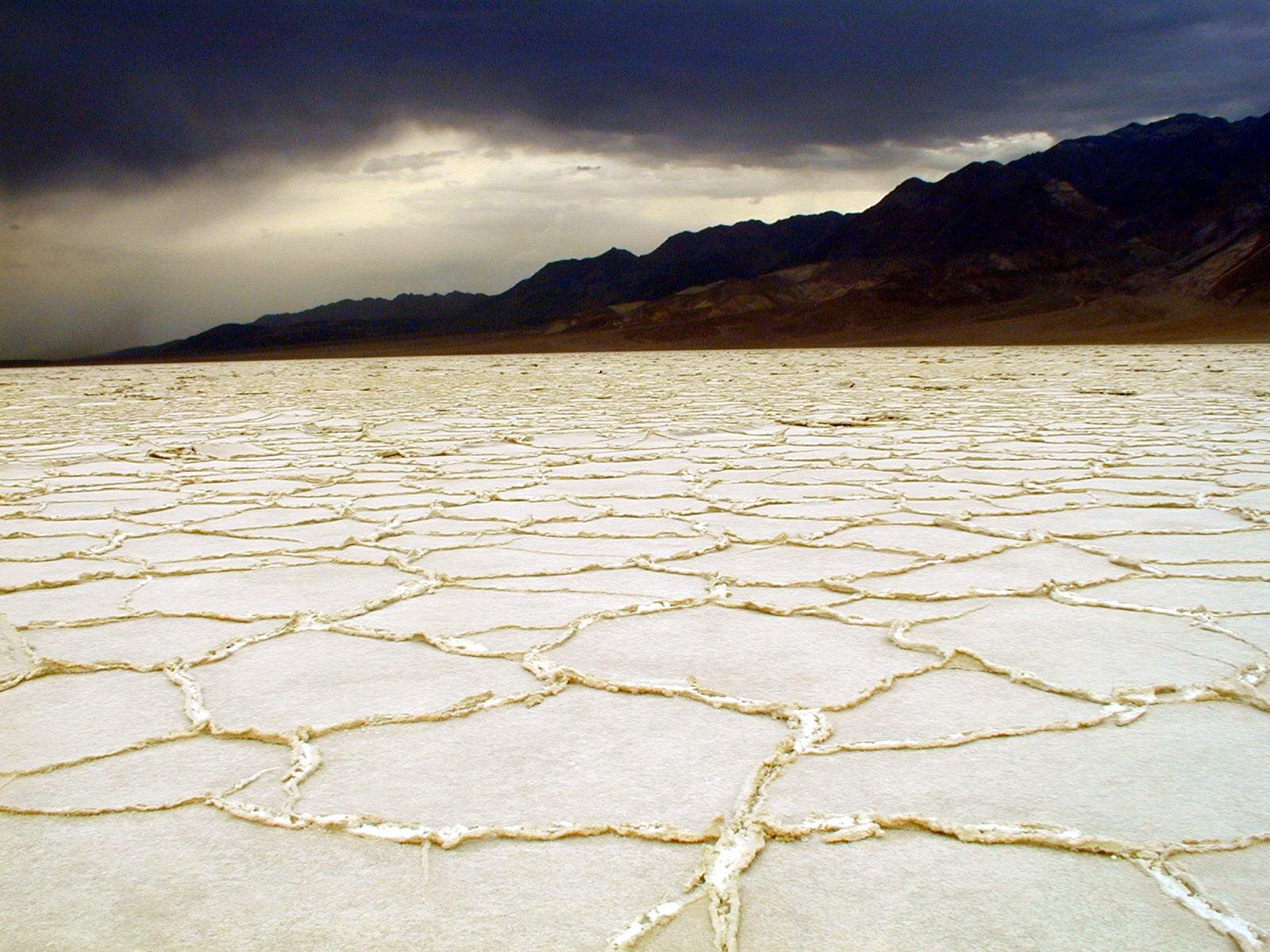
Badwater Basin, Zabriskie Point, Artists Drive, Dantes View, and first-light photography
Tradeoff
The best location is also the most expensive and most booked.
Planning detail

Choose Furnace Creek when the trip is built around the central valley. It reduces the daily penalty of Death Valley's scale and makes dawn or night-sky plans easier.

Curving ridges across the Mesquite Flat Sand Dunes

North valley

Stovepipe Wells or Mesquite Flat area

Best for
Dune sunrise, Mosaic Canyon, northern routes, and simpler motel logistics
Tradeoff
Longer drives to Badwater and the southern classics.
Planning detail

Stovepipe Wells is the practical alternative when dune photography or a north-south route matters more than central-valley convenience.

Desert gold wildflowers below snowcapped mountains in Panamint Valley

Outside base

Beatty, Pahrump, or Panamint Springs

Best for
Budget rooms, road-trip loops, or entering from a specific side of the park
Tradeoff
Every day starts with a long desert drive.
Planning detail

Use outside bases only when price or route demands it. Carry extra water, fill the tank early, and do not underestimate the time between stops.

Season first

The best lodging choice cannot rescue a valley-floor summer hiking plan.

Fuel

Top off before the park and again whenever the route gives you a chance.

Sunrise math

A cheaper outside room can cost you the best light.

Camping reservations

Camping reservations

Camping reservations for Death Valley

Campground systems change by season and sometimes by individual campground. Start with the official park camping page, then confirm open dates, reservation windows, and permit rules before booking.

Reviewed June 6, 2026

Booking window

Check the official park camping page before choosing dates.

  • Use the official park page as the source of truth for campground status, seasonal closures, and first-come rules.
  • Many federal campsite, backcountry, tour, and permit reservations are handled through Recreation.gov, but not every park uses the same system.

Where to book or verify

Official NPS camping page

Use this first for current campground status and park-specific rules.

Search Recreation.gov

Check for federal campground, backcountry, tour, and permit inventory tied to this park.

Permits and reservations

Use this for wilderness permits, timed systems, tours, and other park-specific reservations.

Getting there and practical info

Desert gold wildflowers below snowcapped mountains in Panamint Valley

Build the arrival around the reservation.

Entry windows, permit pickups, and drive time should be checked before the itinerary gets crowded.

Getting there

Get to Death Valley with the required window already protected.

Nearest airport
Harry Reid International Airport (LAS) in Las Vegas, about 120 miles and 2 to 2.5 hours by car to Furnace Creek
Access rhythm
Car required
Region
California
  1. Fly in

    Most visitors fly into Harry Reid International Airport (LAS) in Las Vegas, rent a car, and drive about 120 miles (roughly 2 to 2.5 hours) west to Furnace Creek via Pahrump or Death Valley Junction.

  2. Car strategy

    There is no public transit into the park and distances inside it are enormous, so a vehicle is essential.

  3. Local movement

    Fill up on gas and water before entering, since stations are few, far apart, and pricey.

Pair this with lodging: choose the base that keeps the reservation or permit pickup from becoming the hardest part of the day.

LocationCalifornia

Frequently asked questions

When is the best time to visit Death Valley?

Late fall through early spring, roughly November through March, is the sweet spot. Valley highs sit in the comfortable 60s to 80s F, making the salt flats, dunes, and canyons walkable. In good rain years, March and April can also bring a wildflower bloom.

Is it safe to visit Death Valley in summer?

You can visit, but you must respect the heat. Summer highs regularly exceed 115 to 120F, among the hottest temperatures recorded on Earth. Stick to scenic drives and very short stops, carry gallons of water per person, and avoid any hiking below sea level after mid-morning.

How much does it cost to enter Death Valley, and do I need a reservation?

The entrance fee is $30 per vehicle and is valid for 7 days; motorcycles are $25 and individuals on foot or bike are $15. There is no timed-entry reservation system, so you can show up anytime. Fee collection is cashless, and an America the Beautiful annual pass also covers entry.

What is the closest airport to Death Valley?

Harry Reid International Airport (LAS) in Las Vegas is the nearest major airport, about 120 miles and 2 to 2.5 hours by car from Furnace Creek. Rent a car there, since there is no public transit into the park and the distances inside it are large.

What are the must-see stops on a first visit?

Hit Badwater Basin (the lowest point in North America), Zabriskie Point for sunrise, the Mesquite Flat Sand Dunes near Stovepipe Wells, and the colorful Artists Drive loop. If you have the time and stamina, the Telescope Peak climb rewards you with the park's highest views.

Keep planning