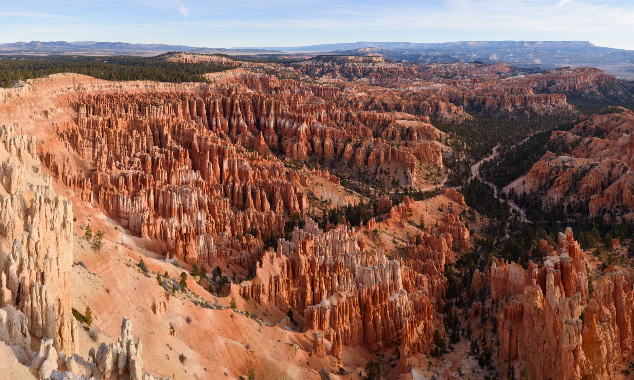
Skip to content
KITAUTHORITY
Panoramic view from Inspiration Point of the Bryce Amphitheater in Bryce Canyon National Park, with thousands of orange and white limestone hoodoos descending into the bowl-shaped canyon under a clear sky

National Park · Utah

Bryce Canyon

A high-elevation rim trail above thousands of glowing orange hoodoos, easy to reach and unreal to walk into.

King of Hearts / Wikimedia Commons (CC BY-SA 4.0)
Switchbacks dropping into the hoodoos on the Navajo Loop and Queens Garden route

Field briefing

Bryce Canyon changes fast with season and elevation.

Before you go

Bryce Canyon is small, high (8,000 to 9,100 feet on the rim), and easy to walk straight into, which is what makes it special.

Come in summer for the warmest, busiest stretch, or aim for September and October when the air is crisp and crowds thin. Winter is a quiet stunner if you bring traction and serious layers. Whatever the month, the rim sits high enough that mornings are cold and the sun is intense, so pack layers, sun protection, and more water than the cool temperatures suggest. The signature move is the Navajo Loop and Queens Garden descent into the hoodoos: do it, but respect the elevation on the climb back out.

Best window
Summer (June through August), with a strong shoulder bump in September and October
Signature routes
Navajo Loop and Queens Garden combo, Sunrise and Sunset Points
Pack focus
Water, weather checks, layers

The landmarks worth the trip. Tap any photo to enlarge.

Location
Utah
Established
September 15, 1928 (national monument in 1923)
Size
36k acres
Visitors
2.5M / year
Best time
Summer (June through August), with a strong shoulder bump in September and October
Entrance
$35 per private vehicle, valid 7 days. No timed-entry reservation required. The park is cashless, so bring a card.
Nearest airport
Cedar City Regional Airport (CDC), about 90 minutes by car. Most visitors fly into Las Vegas (LAS) or Salt Lake City (SLC), each roughly a 4-hour drive.

When to go

Conditions, crowds, and what each season asks you to pack.

Spring

Moderate crowds

Highs in the 40s to 60s F, with snow lingering on the rim into May and muddy or icy trails.

Pack Layers plus traction (microspikes) for shaded, icy switchbacks.

Summer

Peak crowds

Highs in the 70s to low 80s F on the rim, cool nights in the 40s, and afternoon thunderstorms.

Pack Sun protection, a rain shell, and more water than you think for the dry air.

Fall

High crowds

Highs in the 50s to 60s F cooling fast, crisp clear air, and the first snow possible by late October.

Pack Warm layers for cold mornings and a windproof shell on the rim.

Winter

Low crowds

Highs in the 30s to low 40s F, nights well below freezing, and snow on red rock that is the park at its most photogenic.

Pack Insulated boots, traction devices, and serious cold-weather layers.

The Bryce Amphitheater hoodoos glowing below Sunrise Point

Top things to do

Switchbacks dropping into the hoodoos on the Navajo Loop and Queens Garden route

Navajo Loop and Queens Garden combo

3 mi loopModerate

The classic 3-mile descent into the hoodoos through Wall Street, the one hike most people remember.

The Bryce Amphitheater hoodoos glowing below Sunrise Point

Sunrise and Sunset Points

Short rim walksEasy

Short rim walks where the amphitheater lights up; first light is worth the early alarm.

A wide view across the Bryce Amphitheater from Bryce Point

Bryce Point

Easy

The widest view over the main amphitheater and the best perch for sunrise color.

Layered forest and hoodoo country near Rainbow Point in Bryce Canyon

Bryce Canyon Scenic Drive to Rainbow Point

18 mi one wayEasy

An 18-mile drive climbing to 9,100 feet, with overlooks the whole way out and back.

Hoodoos and open trail on the quieter Fairyland Loop

Fairyland Loop

8 mi loopHard

A quieter, longer 8-mile hike for those who want the hoodoos without the crowds.

How long to spend

Anchor the day around Navajo Loop and Queens Garden combo

Put the access rule first: shuttle, parking, timed-entry, or reservation windows should decide the order of the day. For one day in Bryce Canyon, make Navajo Loop and Queens Garden combo the non-negotiable, add Sunrise and Sunset Points only if the first stop runs clean, and keep Bryce Point as the flexible finish.

  1. 1Start with Navajo Loop and Queens Garden combo: The classic 3-mile descent into the hoodoos through Wall Street, the one hike most people remember.
  2. 2Add Sunrise and Sunset Points: Short rim walks where the amphitheater lights up; first light is worth the early alarm.
  3. 3Use Bryce Point as the optional finish, not as a reason to rush the whole day.

Plan your trip

Turn Bryce Canyon's conditions into water, pack, and sleep-system decisions.

A wide view across the Bryce Amphitheater from Bryce Point

Build around conditions

Let season, elevation, and weather set the plan.

Plan your trip

3 quick tools, already seeded for Bryce Canyon. Tune the numbers around temperature swings, footing, layers, and how much margin the route needs.

  1. 01Size your water for a mild day on the trail
  2. 02Find the right daypack size for a day out
  3. 03Check you will sleep warm down to about 30F

What to pack

Start with the gear decisions Bryce Canyon changes: water, footing, weather, and overnight needs. The checklist is there once your route and dates are set.

Pack planning

Decide what Bryce Canyon asks of your kit before you start checking boxes.

Use this as a constraint check while you are still shaping the trip. The active checklist becomes useful once your route, dates, and sleep plan are set.

  • First constraintHydration and exposureWater, hat, sunscreen, sunglasses, Navigationmap, downloaded GPS, or a GPS watch, 3 more
  • Route realityFooting and tractionHiking boots, Hiking socks, Trekking poles
  • Load choicePack and carry systemDaypack
  • Season checkLayers for conditionsMoisture-wicking base layers, Rain jacket, Insulated jacket, 1 more

Checklist mode

15 items, grouped for the trip you are actually taking.

  1. Dates and season are set.
  2. Primary route, campground, or lodge is chosen.
  3. Water, footwear, and overnight needs are sized.

Gear for Bryce Canyon

The buying guides that match what Bryce Canyon asks of your kit. Each one has our current top picks across budget and use case.

Where to stay

The Bryce Amphitheater hoodoos glowing below Sunrise Point

Stay strategy

Sleep where the first morning stays simple.

Stay strategy

Stay by the rim if sunrise, sunset, and easy shuttle days matter.

Bryce is compact, so the lodging decision is about friction more than distance. The Lodge and park campgrounds win for rim access. Bryce Canyon City is the practical near-entrance base. Tropic and Panguitch trade a short drive for lower prices and a quieter evening.

No timed entry
Entrance is first come, first served
Shuttle
Seasonal shuttle serves the amphitheater and Bryce Canyon City
Elevation
Rim sits around 8,000 to 9,100 feet
Inside the park
Lodge and North or Sunset campgrounds put you closest to the rim

Compare base options

Compare each base by the first morning: where you park, what you ride, and how many decisions happen before the trail or viewpoint.

The Bryce Amphitheater hoodoos glowing below Sunrise Point

Closest stay

The Lodge at Bryce Canyon

Lodging details
Best for
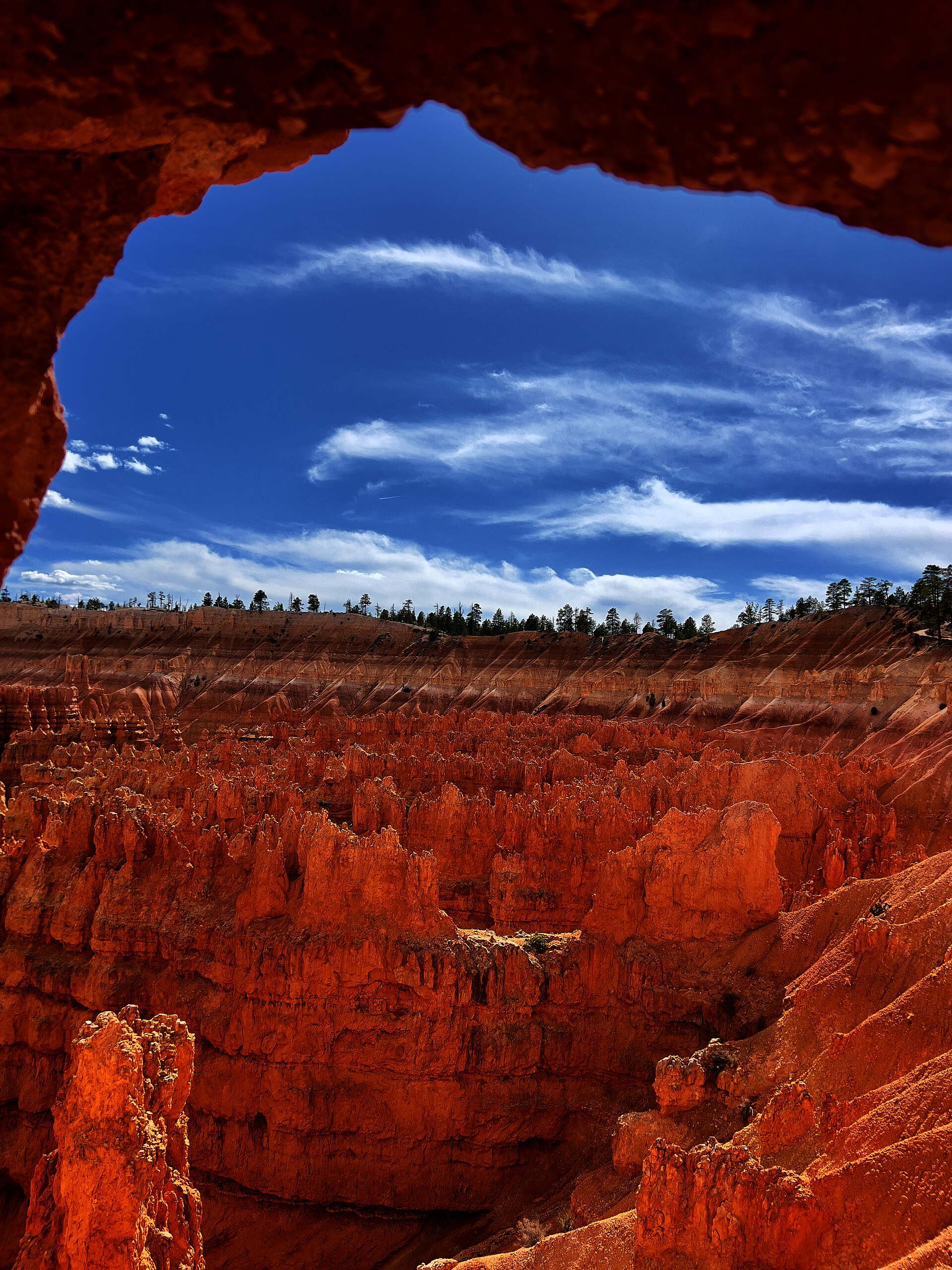
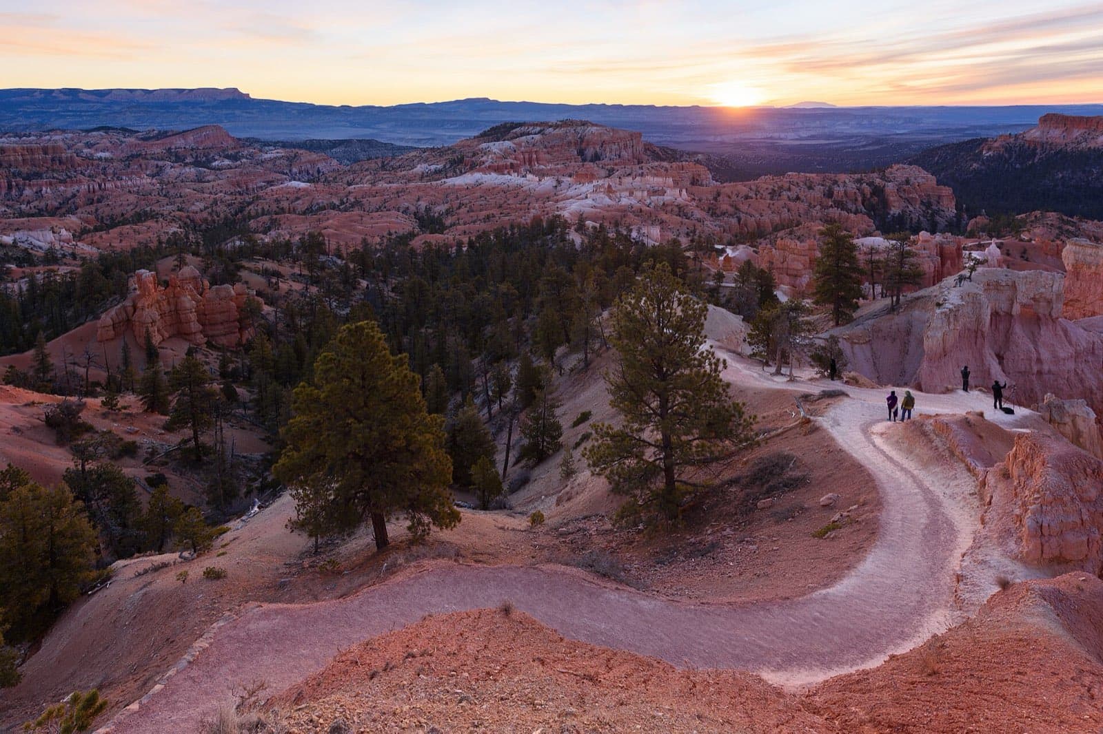
Sunrise starts, sunset walks, and car-light amphitheater days
Tradeoff
Seasonal, limited, and usually priced for the location.
Planning detail

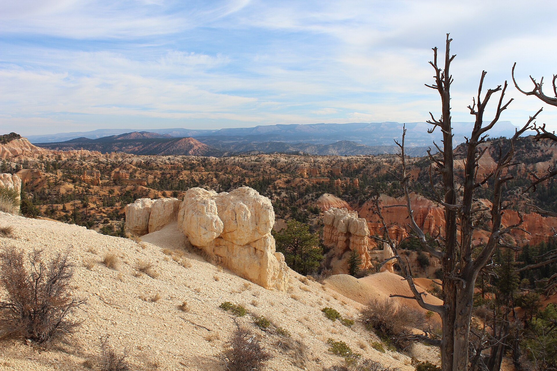
This is the easiest base for a classic Bryce rhythm: walk to rim viewpoints, descend into the hoodoos early, and return for cold clear evenings without solving parking twice.

Switchbacks dropping into the hoodoos on the Navajo Loop and Queens Garden route

Camp by the rim

North or Sunset Campground

Campground details
Best for
Campers who want quick trail access and cold high-elevation nights
Tradeoff
Sites are seasonal or demand planning, and nights can be cold even in summer.
Planning detail

North is closer to the visitor center and amphitheater core. Sunset keeps you near Sunset Point and the Navajo Loop start, which is useful for an early descent.

Hoodoos and open trail on the quieter Fairyland Loop

Gateway value

Bryce Canyon City, Tropic, or Panguitch

Shuttle details
Best for
More rooms, lower prices, and road-trip loops through southern Utah
Tradeoff
You add morning drive time and may still rely on the shuttle for busy overlooks.
Planning detail

Use Bryce Canyon City when convenience matters most outside the gate. Use Tropic or Panguitch when price, small-town quiet, or a broader Highway 12 route matters more.

Morning plan

Sleep close if you want both sunrise color and a cool Navajo and Queens Garden climb.

Winter gear

If snow is in the forecast, bring traction before you commit to hoodoo switchbacks.

Camping reservations

Camping reservations

Camping reservations for Bryce Canyon

Campground systems change by season and sometimes by individual campground. Start with the official park camping page, then confirm open dates, reservation windows, and permit rules before booking.

Reviewed June 6, 2026

Booking window

Check the official park camping page before choosing dates.

  • Use the official park page as the source of truth for campground status, seasonal closures, and first-come rules.
  • Many federal campsite, backcountry, tour, and permit reservations are handled through Recreation.gov, but not every park uses the same system.

Where to book or verify

Official NPS camping page

Use this first for current campground status and park-specific rules.

Search Recreation.gov

Check for federal campground, backcountry, tour, and permit inventory tied to this park.

Permits and reservations

Use this for wilderness permits, timed systems, tours, and other park-specific reservations.

Getting there and practical info

The Bryce Amphitheater hoodoos glowing below Sunrise Point

Plan the handoff from arrival to shuttle.

Parking, pedestrian entrances, and shuttle timing decide how calmly the first morning starts.

Getting there

Get to Bryce Canyon, then remove the first-morning friction.

Nearest airport
Cedar City Regional Airport (CDC), about 90 minutes by car. Most visitors fly into Las Vegas (LAS) or Salt Lake City (SLC), each roughly a 4-hour drive.
Access rhythm
Park once, ride in
Region
Utah
  1. Arrival note

    Bryce Canyon sits in southern Utah off Highway 12, reached via Highway 63 from the junction near Bryce Canyon City.

  2. Fly in

    Most visitors fly into Las Vegas or Salt Lake City and make the roughly 4-hour drive, or use Cedar City Regional Airport about 90 minutes away for the shortest haul.

  3. Shuttle access

    A free seasonal shuttle runs in summer from Ruby's Inn and the visitor center to the main amphitheater viewpoints, which is the easiest way to skip parking headaches at the busy overlooks.

Pair this with lodging: sleep where the park transfer is simple, especially if your route needs an early start.

LocationUtah

Frequently asked questions

Do I need a reservation to enter Bryce Canyon?

No. Unlike some larger parks, Bryce Canyon has no timed-entry reservation system. You just pay the $35 per-vehicle fee at the entrance, which is good for 7 days. The park is cashless, so bring a credit or debit card.

How long do I need to see Bryce Canyon?

You can hit the highlights in a single full day. Walk the Navajo Loop and Queens Garden combo in the morning, drive the scenic road to Rainbow Point, and catch sunset from Bryce or Sunset Point. Two days lets you slow down, add the Fairyland Loop, and stay for the stargazing.

Is Bryce Canyon open in winter?

Yes, the park is open year-round. Winter brings snow on the red hoodoos, which many consider the most beautiful time to visit, plus far fewer people. Trails can be icy, so bring traction devices and warm layers, and check road and trail conditions before you go.

How hard are the hikes at Bryce Canyon?

Most signature trails drop from the rim down into the hoodoos and back, so the descent is easy and the climb out is the real work. The Navajo Loop and Queens Garden combo is about 3 miles with steep switchbacks. Remember the rim sits near 8,000 feet, so the altitude makes any climb feel harder than it looks.

Keep planning